 Cre8Travel
CRE8TRAVEL · NEW YORK PLACES
Dry Brook Ridge Wild Forest
Dry Brook Ridge Wild Forest: A Closer Look
Discover
Dry Brook Ridge Wild Forest offers a mountain route with a clear need to distinguish the forest from the longer trail that carries its name. The public unit covers 8,900 acres in the western Catskill Forest Preserve. Its land is rugged, with mostly moderate to steep grades, and its highest elevation is the 3,460-foot Dry Brook Ridge. Choose a visit for that actual terrain rather than treating a ridge walk as a casual roadside stop.
The blue-marked Dry Brook Ridge Trail is described by the New York State Department of Environmental Conservation (DEC) as 13.6 miles long, but the full route continues beyond the wild forest onto private land and into Balsam Lake Mountain Wild Forest. The route total is therefore not a circuit wholly inside Dry Brook's public unit. Match the planned section to its boundaries and access arrangements before deciding how far to go.
From the northern South Side Road approach near Margaretville, the route begins on an old logging road and climbs. Pakatakan Mountain, at 2,500 feet, is an earlier named high point along the trail, distinct from the higher Dry Brook Ridge. That sequence gives the walk more than one reference on the map. It also makes clear why a destination name, an elevation and a route length should not be combined into one simplified promise.
The German Hollow Trail provides another approach, marked yellow and extending 1.7 miles from Chris Long Road to a junction with the ridge trail. The trailhead parking is on private property under an easement, so use the access respectfully and remain on the permitted route. A formal agreement allowing passage does not turn the surrounding land into an unrestricted extension of the forest.
The red-and-blue Huckleberry Loop offers a longer alternative, connecting with the ridge trail and including a road segment on the return described by DEC. Plan that route from the current map rather than relying on a sequence of distances added from different descriptions. Its name should not obscure the practical arrangement of trail, road and junctions, or the need to choose an outing suited to the mountain setting.
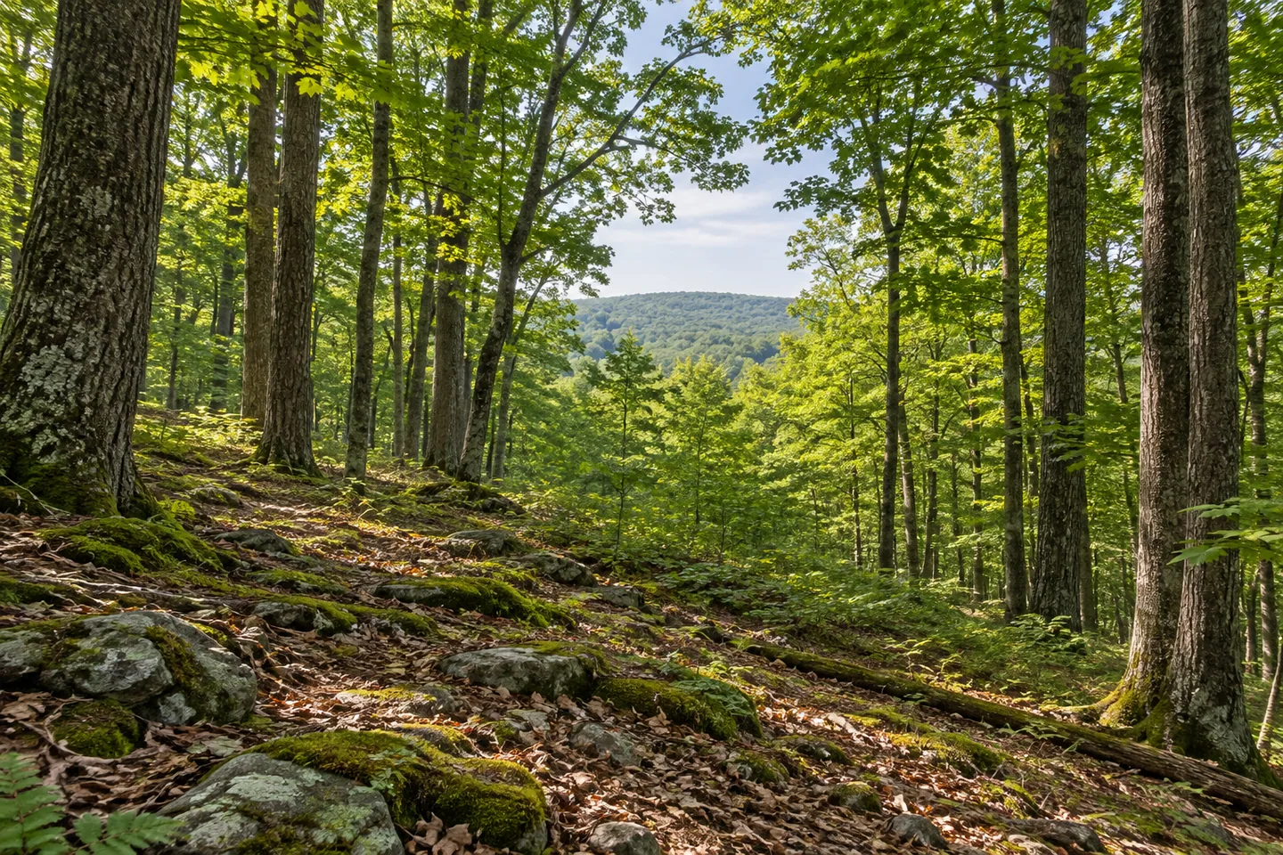
Westward views are part of DEC's description along Dry Brook Ridge. Where an appropriate route position provides one, give the relationship between ridge and surrounding country time to hold attention. A photograph can include ordinary woodland foreground rather than depending on a specific distant mountain being visible. No fire tower needs to be added to the unit's identity; nearby Balsam Lake Mountain is a separate destination.
South Side Road, Millbrook Road, Huckleberry Brook Road and Chris Long Road serve different approach roles. Select the correct parking reference and the route's return before setting out, with private boundaries and neighboring units kept distinct. A large wild forest can support several approaches without all of them making one convenient day walk or returning to the same starting place.
Follow posted conditions and Leave No Trace guidance, using current maps and preparations suited to backcountry mountain travel. Dry Brook Ridge's story is the relationship between a rugged public unit and a larger trail network: separate summits, different colored approaches and boundaries that matter on the ground. Let that real structure shape the visit, without expanding it into an effortless loop or a promised tower panorama.
Fun facts
- Dry Brook Ridge Wild Forest covers 8,900 acres in the western Catskill Forest Preserve.
- The unit's highest elevation is Dry Brook Ridge at 3,460 feet.
- The full 13.6-mile blue-marked trail continues through private land and into a neighboring wild forest.
- The yellow German Hollow Trail is 1.7 miles and joins the ridge route.
- German Hollow parking is on private land under an access easement.
Before you go
- Choose an approach and return for the actual moderate-to-steep mountain terrain.
- Keep the full trail length distinct from the public wild-forest unit.
- Respect private land and the German Hollow parking easement.
- Use current maps for the Huckleberry Loop trail-and-road arrangement.
- Keep Balsam Lake Mountain and its tower distinct from Dry Brook Ridge.
Capture
- Where the route provides a suitable westward view, include woodland foreground without approaching an edge.
- Use ordinary ridge and tree textures without inventing a tower in this unit.
- Let the scene available at your actual position guide the composition rather than promising a specific distant peak.
 Furnace Creek State Forest
 Jackson Hill State Forest
 Mad River State Forest
Social
Dry Brook Ridge Wild Forest covers 8,900 acres of rugged western Catskill Forest Preserve land. #Cre8Travel
Dry Brook Ridge reaches 3,460 feet, the unit's highest elevation. #Cre8Travel
The full 13.6-mile blue trail extends beyond the public unit into private land and a neighboring wild forest. #Cre8Travel
German Hollow provides a 1.7-mile yellow-marked approach to the ridge trail. #Cre8Travel
German Hollow parking is on private property under an easement. Respect the permitted access. #Cre8Travel
Pakatakan Mountain and Dry Brook Ridge are separate high points along the northern approach. #Cre8Travel
Huckleberry Loop includes trail and road arrangements that deserve current-map planning. #Cre8Travel
At Dry Brook Ridge, let the real route and boundaries determine the outing, rather than assuming one easy loop. #Cre8Travel
Hashtags