 Cre8Travel
CRE8TRAVEL · NEW YORK PLACES
Mad River State Forest
Mad River State Forest: A Closer Look
Discover
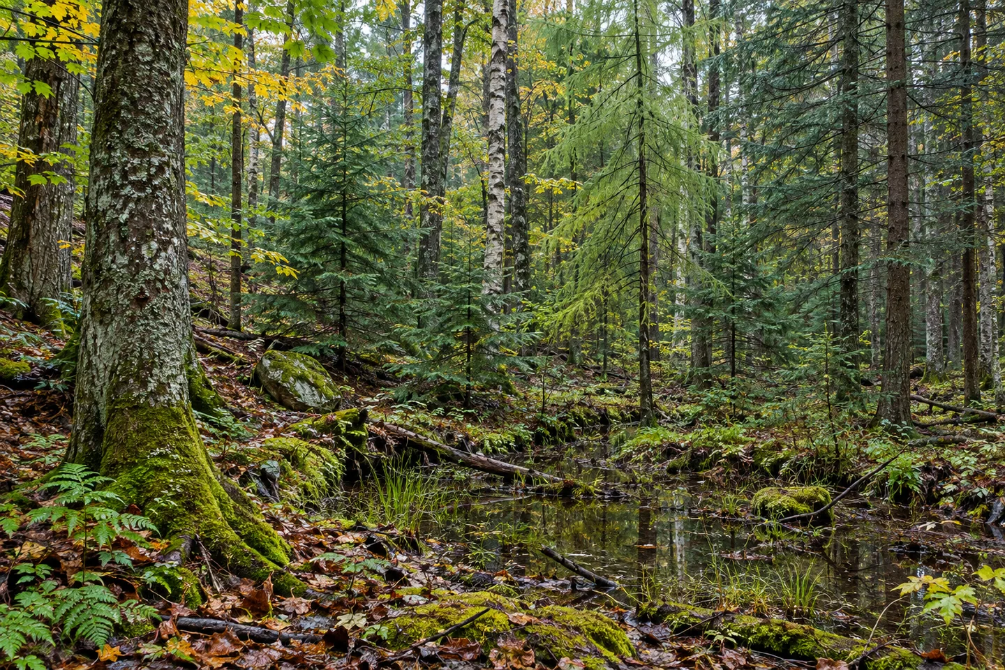
Mad River State Forest carries a history of exhausted farmland with little or no remaining tree cover becoming a planted and naturally wooded landscape. Many of its parcels were acquired in the 1930s and early 1940s, when reforestation, erosion control and reducing wildfire risk were early priorities. Today, the 2,933-acre property in Florence, Oneida County, combines rolling terrain, streams, wetlands and different kinds of forest. That change in land use gives an outing a particular thread.
The New York State Department of Environmental Conservation (DEC) manages the land for water quality, recreation, habitat and timber. Those purposes describe a working forest, rather than a place untouched by human decisions. Looking at the mixture of stands can invite a useful question: which parts of the woodland reflect planting, and which are natural forest? The answer need not be obvious in every view for the question to enrich a walk.
The plantation list includes white, red, Scotch and jack pines, several larches, Norway and white spruce, and Douglas fir. Natural woodland includes eastern hemlock, black cherry, American elm, red and sugar maple, yellow birch, beech and white ash. These are the tree groups in DEC's description, not an instruction to locate each one beside a particular access road. Compare broad forms and textures where they are visible from the route you choose.
Streams give the forest a second set of names. Mad River, Finnegan Brook, Wickwire Brook and tributaries pass through the property, with wetlands among the rolling ground. Think of those watercourses as part of the landscape rather than a prepared stream-to-stream itinerary. A woodland road may provide a useful view, but the presence of water on a map does not establish a continuous bank-side path or a viewpoint at every crossing.
Approximately 7.7 miles of paved and unpaved roads cross the forest and may be used for hiking. Select an appropriate section and return from the property map and current conditions. The combined mileage does not describe one designated loop, and the different road surfaces are a reason to check the actual route rather than judge an outing by distance alone. Give the selected section time to reveal its woodland character.
DEC's approach from Camden uses River Road, and Phelan Road is a parking-area reference. Match the approach to the part of the property you intend to visit before setting out. For photographs, a scene combining forest texture and a stream view available from an appropriate position can connect the planting and water stories. No animal or dramatic cascade is required to make the landscape specific.
Follow posted conditions and Leave No Trace guidance, leaving vegetation and any earlier land-use traces undisturbed. The most useful focus may be the relationship between the forest's beginnings and its present mixture: former farmland, deliberate planting, natural woodland and water moving through rolling ground. Mad River offers those layers at the scale of an actual road-based outing, without an invented viewpoint or a claim that every management goal is already an achieved ecological outcome.
Fun facts
- Mad River State Forest covers 2,933 acres in Florence, Oneida County.
- Many parcels were acquired in the 1930s and early 1940s as farmland with little tree cover.
- Early priorities included reforestation, erosion control and reducing wildfire risk.
- Mad River, Finnegan Brook, Wickwire Brook and tributaries pass through the property.
- About 7.7 miles of paved and unpaved roads may be used for hiking.
Before you go
- Choose a mapped road section and return rather than expecting one 7.7-mile loop.
- Match River Road and Phelan Road access references to the chosen route.
- Do not infer a continuous streamside path from the watercourse names.
- Use forest texture as an observation subject without expecting wildlife.
- Follow posted conditions and Leave No Trace guidance.
Capture
- Compare the broad forms of plantation trees and natural woodland visible from the route.
- Use a stream view only from a suitable actual position, without assuming a bank-side path.
- A composition of rolling ground and trees can carry the land-use story without dramatic scenery.
 Jackson Hill State Forest
 Amy's Park
 Oriskany Flats Wildlife Management Area
Social
Mad River State Forest spans 2,933 acres in Florence, Oneida County. #Cre8Travel
Former farmland acquired in the 1930s and early 1940s is part of Mad River's reforestation story. #Cre8Travel
Replanting, erosion control and reducing wildfire risk were early forest-establishment priorities. #Cre8Travel
Mad River, Finnegan Brook and Wickwire Brook are named streams in the property. #Cre8Travel
Natural woodland and pine, spruce, larch and fir plantations bring different textures to Mad River. #Cre8Travel
About 7.7 miles of paved and unpaved roads may be hiked at Mad River rather than one declared loop. #Cre8Travel
River Road and Phelan Road are approach references for a mapped Mad River outing. #Cre8Travel
At Mad River, how would knowing the farmland history change the way you look at the woods? #Cre8Travel
Hashtags