 Cre8Travel
CRE8TRAVEL · NEW YORK PLACES
Jackson Hill State Forest
Jackson Hill State Forest: A Closer Look
Discover
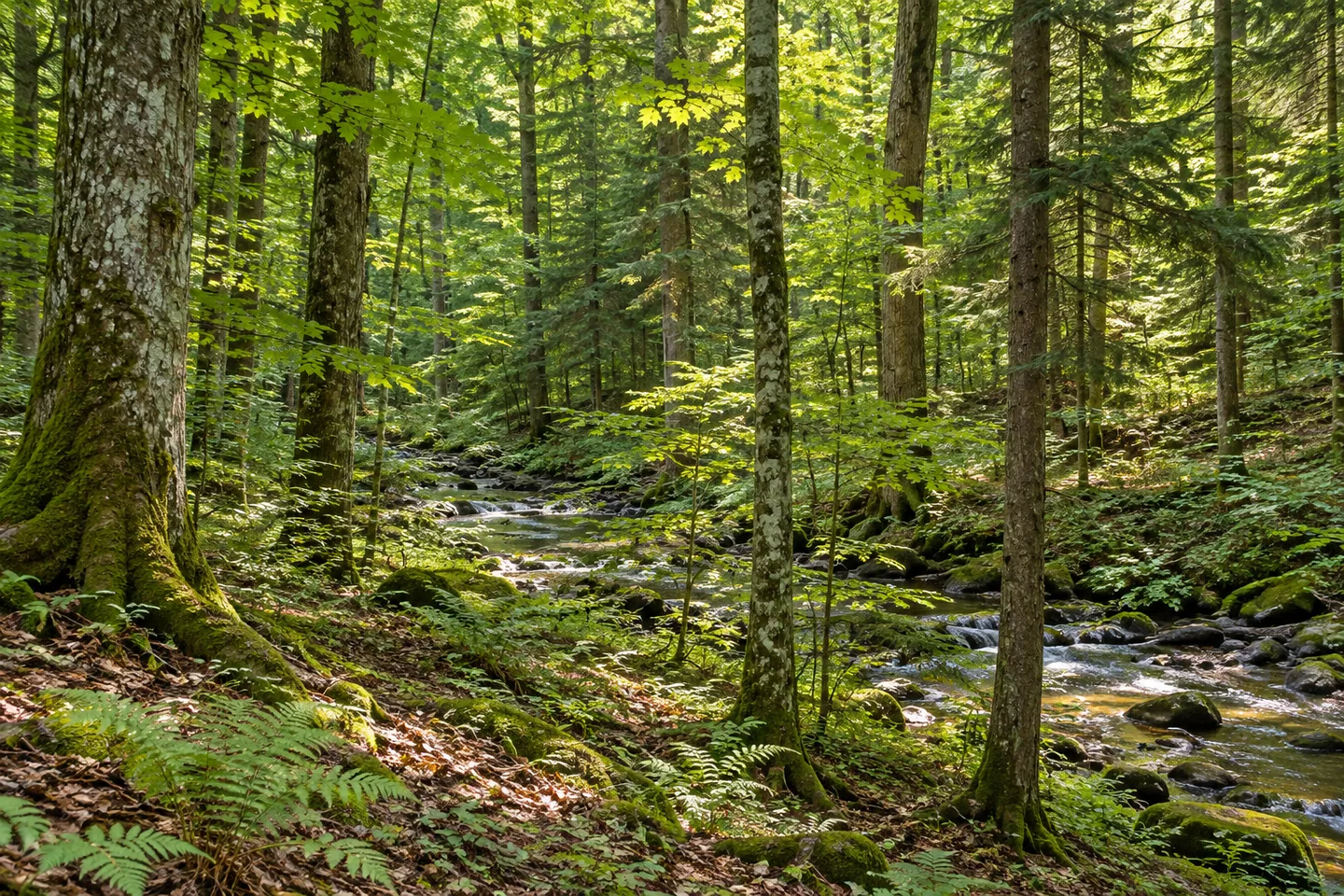
Clark Brook gives Jackson Hill State Forest a western edge with a strong sense of terrain. The brook cuts a gorge along that side of the property, while plantations, natural woodland and brushy fields occupy the wider 1,409 acres in Boonville, Oneida County. It is a setting where landform and forest history can guide the same outing, without making a gorge-edge position the essential goal of a visit.
Most of the forest was purchased in the 1940s. Additional acquisitions in the 1960s and early 2000s extended the public-land story over more than one period. Those dates offer a useful counterpoint to a map showing one property boundary today. The New York State Department of Environmental Conservation (DEC) established the forest for reforestation, wildlife, timber, recreation and watershed protection, purposes that overlap within the current landscape.
Natural woodland includes northern hardwood and hardwood-hemlock communities. Sugar maple, black cherry, red maple, white ash, beech and hemlock are among the principal trees in DEC's account. Planting in the 1940s overlaps the main period of public land acquisition. Plantation work, generally from the 1940s, added white and red pine, white and Norway spruce, and larch. Where the route provides a suitable view, compare forest forms rather than trying to find every listed species beside the same path.
The northwestern portion contains trails belonging to the Black River Environmental Improvement Association network, usually known as BREIA. About 1.15 miles of that system lie within the property and are maintained by the organization. Keep the local part distinct from BREIA's larger network when selecting a route. The presence of a familiar system name is useful orientation, but the property map still matters for understanding where you actually plan to walk.
DEC also lists 1.83 miles of trails and unpaved forest roads for access. Do not simply add that figure to the separately described BREIA mileage as if the two were necessarily independent. Choose an approach, a section and a return with current maps and route designations. A forest can offer several types of access without every figure combining into one convenient loop through its most notable features.
Jackson Hill Road provides the road approach from Boonville, with a Fire Lake forest access road pull-off listed as a reference. Match that point to the chosen route and present conditions before setting out. If the visit includes a gorge view, use only an appropriate established position. Water, woodland and the shape of the ground can be considered without stepping toward an edge for a more dramatic photograph.
The Oneida Hills Unit Management Plan gives the wider management framework. Follow posted conditions and Leave No Trace guidance, leaving vegetation and any earlier land-use traces undisturbed. A close woodland composition can connect with the planting story, while a view available from the actual route can show the brook's landscape setting. Jackson Hill offers a particular mixture of gorge, decades of acquisition and a local share of the BREIA network, with the selected route determining how those elements come into focus.
Fun facts
- Jackson Hill State Forest covers 1,409 acres in Boonville, Oneida County.
- Clark Brook runs along the western edge and cuts a gorge.
- Most land was purchased in the 1940s, with additions in the 1960s and early 2000s.
- About 1.15 miles of the BREIA network lie within the property.
- DEC also describes 1.83 miles of trails and unpaved access roads.
Before you go
- Use current property and BREIA maps to select a route.
- Do not add separately described mileages without checking overlap.
- Match the Jackson Hill Road and Fire Lake pull-off approach to the chosen route.
- View the gorge only from an appropriate established position.
- Follow posted conditions and Leave No Trace guidance.
Capture
- Compare planted conifer forms with natural hardwood-hemlock texture along the chosen route.
- If a gorge view is available from an appropriate established position, frame it without moving toward the edge.
- Woodland detail can carry the planting story without a panoramic viewpoint.
 Dry Brook Ridge Wild Forest
 Mad River State Forest
 Amy's Park
Social
Jackson Hill State Forest covers 1,409 acres in Boonville, Oneida County. #Cre8Travel
Clark Brook forms Jackson Hill's western edge and cuts a gorge along that side of the property. #Cre8Travel
Jackson Hill land acquisition spans the 1940s, 1960s and early 2000s. #Cre8Travel
About 1.15 miles of BREIA trails are within Jackson Hill, distinct from the wider system. #Cre8Travel
DEC also lists 1.83 miles of trails and roads for Jackson Hill access; check overlap before adding figures. #Cre8Travel
Plantations generally date from the 1940s, alongside natural northern hardwood and hemlock woodland. #Cre8Travel
A considered woodland photograph can tell Jackson Hill's story without approaching a gorge edge. #Cre8Travel
At Jackson Hill, would landform, planting history or the BREIA connection shape your route choice? #Cre8Travel
Hashtags