 Cre8Travel
CRE8TRAVEL · NEW YORK PLACES
Decatur State Forest
Decatur State Forest: Planted Spruce and Unmarked Woodland
Discover
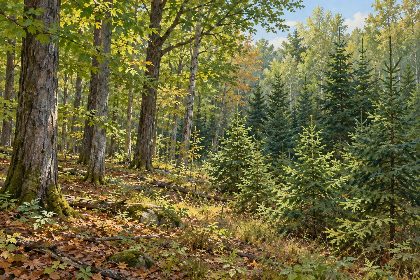
Decatur State Forest occupies 582 acres in the Otsego County towns of Decatur and Worcester. Its mixture of naturally established and planted trees reflects a particular history: the state purchased marginal or abandoned farmland in the 1930s to return it to productive forest use. That origin provides a useful theme for understanding the property today. The setting is not a developed park with one signed circuit, but a public woodland whose tree cover and access patterns require separate attention.
The distinction between natural and planted forest is central to that story. Land acquired for reforestation did not necessarily develop in one uniform way, and the destination description identifies both kinds of woodland here. Where differences in tree arrangement or stand form are visible from appropriate ground, they can offer a starting point for observation. Avoid assigning a precise age or planting history to a particular stand without evidence; the broader 1930s acquisition does not date every tree.
Young spruce plantations give Decatur a more specific habitat detail. DEC describes them as good habitat for rabbits. That relationship can be interesting even when no rabbit appears. Looking at the dense cover supplied by a planted stand may convey more than waiting for an animal to emerge. Keep the observation outside new planting areas rather than entering the trees to search for wildlife, and do not treat habitat value as a promise of a photograph.
For walking, the important fact is the absence of designated or marked trails. Hiking is allowed, and unmaintained herd paths are described in the southwestern part of the property. Such paths differ from a maintained route that supplies clear signs and a dependable circuit for an unfamiliar visitor. Decide on the outing with the current official map and the actual starting position in mind, rather than assuming a visible path must connect with a formal trailhead elsewhere.
Winter routes tell a separate access story. Two snowmobile trails cross the forest north to south along Lum Hill and Skinner Hill roads, while another follows Lease Lot Road near the northwestern boundary. The Sharon Pathfinders Snowmobile Club signs and maintains these routes for that use. Their existence does not contradict the lack of designated hiking trails: different activities can have different infrastructure on the same property. It also does not turn the network into one ready-made summer walking loop.
The published entrance reference is on Duck Farm Road, north of its intersection with West Hill Road. DEC describes roadside parking rather than a dedicated parking area inside the forest. Check the current map and on-site signs before selecting a stopping place, leaving the road and access clear. A road name or a map coordinate is a way to locate the property, not proof that every nearby roadside space is a suitable place to leave a vehicle.
Decatur's interest comes from understanding these distinctions together: former farmland and later forest, natural growth and planted spruce, unmarked walking ground and designated winter corridors. A focused visit can notice those relationships without searching for a major scenic landmark. Let the documented setting determine the experience, and keep expectations consistent with a woodland that has a reforestation history and limited formal infrastructure for a walk.
Fun facts
- Decatur State Forest covers 582 acres in the towns of Decatur and Worcester, Otsego County.
- The state purchased the area in the 1930s to reforest marginal or abandoned farmland.
- Young spruce plantations are identified as habitat for rabbits.
- Signed snowmobile routes use Lum Hill, Skinner Hill and Lease Lot roads; there are no designated hiking trails.
Before you go
- Plan with the current map; southwestern herd paths are unmaintained rather than marked hiking routes.
- Treat winter snowmobile corridors separately from the infrastructure available for a walk.
- The published access uses roadside parking; verify on-site signs and avoid obstructing roads or entrances.
Capture
- Observe visible differences between planted and mixed woodland without assigning an unsupported stand date.
- Photograph habitat from appropriate ground without entering new plantations to seek animals.
- Do not reconstruct a signed hiking circuit, developed trailhead or specific wildlife encounter.
 Daketown State Forest
 Delaware Wild Forest
 Mallet Pond State Forest
Social
Decatur State Forest covers 582 acres across Decatur and Worcester in Otsego County. #Cre8Travel
The state acquired former marginal or abandoned farmland here in the 1930s.
Natural and planted woodland provide different layers in the reforestation landscape.
Young spruce offers rabbit habitat, which can be appreciated without a sighting.
There are no designated hiking trails; southwestern herd paths are unmaintained.
Snowmobile routes along Lum Hill, Skinner Hill and Lease Lot roads are a separate winter system.
Duck Farm Road is the documented entrance reference. Parking is roadside rather than a dedicated interior lot.
Notice the relationship between the forest’s history and its present access. Decatur is a woodland setting rather than a signed scenic circuit.
Hashtags