 Cre8Travel
CRE8TRAVEL · NEW YORK PLACES
Daketown State Forest
Daketown: Woodland Trails, Stone Walls and a Water-Corridor Setting
Discover
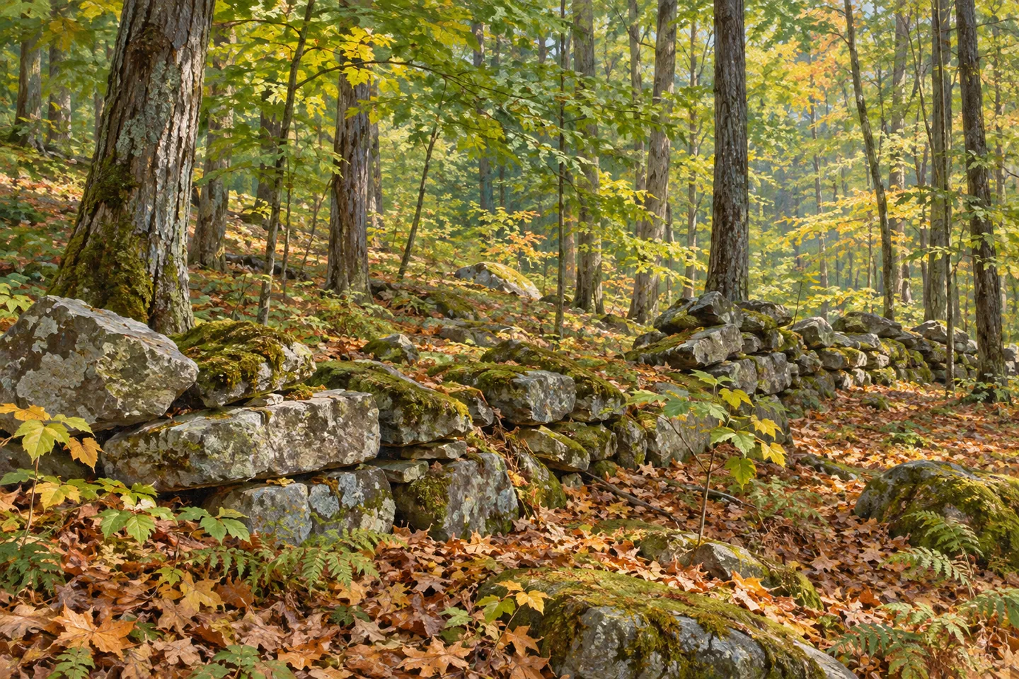
Daketown State Forest offers 506 acres of public woodland in the Town of Greenfield, Saratoga County. Its multiple-use routes pass a setting where large old foundations and property walls are among the documented features. These details give the forest a human history alongside its trees. They invite a walk focused on relationships: between a route and a wall, between the woodland and earlier boundaries, and between the property and the streams draining the surrounding ground.
The state's acquisition took place in 1966,1967 and 1968, according to the April 2002 draft Saratoga and Warren management plan. The document records completed purchases rather than a proposed date for creating the forest. That chronology helps place Daketown within the story of public land assembled in the 1960s. It does not establish the age or original owner of every foundation seen along a route, so keep the acquisition history and the older physical remains separate.
The same plan identifies Gasher Brook and Blue Brook as streams flowing toward Kayaderroseras Creek. This drainage connection is a useful theme for understanding the land, without assuming that a maintained creekside trail follows either brook from end to end. Water on a map can explain where the property fits in the wider landscape even when the chosen walk does not reach a particular stream. The forest is more than an isolated patch of green near a city.
Daketown's recorded elevation range runs from 550 to 770 feet. The 220-foot difference provides context for a small woodland property whose ground is not uniformly level. Those figures describe the terrain, not the climb on a specific route, a summit destination or a trail difficulty rating. Let the actual route and conditions determine the outing rather than converting the property's full elevation range into an assumed walk length or ascent.
Foundations and walls provide a different observation subject. Appreciate them from the route rather than climbing onto masonry or entering a ruined structure for a closer photograph. Their presence shows that the landscape carried earlier uses, but the destination description does not supply a named building or a complete story for each remnant. A careful photograph can record the relationship between stonework and woodland without inventing the missing history.
The published access references include locations on Daketown Road, Kilmer Road, Coy Road and Old Daketown Road. Several choices do not automatically create a single signed loop linking every starting point. Consult the current official map and select the approach serving the intended walk. Hiking and mountain biking share multiple-use routes, while the property's rules do not describe a set of purpose-built specialist facilities for each permitted activity.
Daketown works well as a study of layers within a modest public forest: the documented acquisition years, older walls and foundations, varied ground and a drainage connection to a larger creek. Choose a route that leaves time to notice those elements. A visit need not depend on identifying every tree or reaching every access point. Its interest comes from seeing how the present woodland relates to the shape and history of the place beneath it.
Fun facts
- Daketown State Forest covers 506 acres in Greenfield, Saratoga County.
- The April 2002 draft management plan records completed state purchases in 1966,1967 and 1968.
- Gasher Brook and Blue Brook flow toward Kayaderroseras Creek.
- The same plan records elevations from 550 to 770 feet, a 220-foot range across the property.
Before you go
- Choose an access point with the current map rather than assuming every approach joins one signed loop.
- Observe old masonry from the route without climbing or entering foundations.
- Keep the property’s elevation range separate from a particular route’s climb.
Capture
- Frame documented walls in relation to woodland while remaining on appropriate access.
- Record visible terrain changes without labeling an unsupported summit or exact historical building.
- Keep illustrations conceptual rather than reconstructing a specific ruin, creek route or trail junction.
 Crystal Lake Wild Forest
 Decatur State Forest
 Delaware Wild Forest
Social
Daketown State Forest offers 506 acres of woodland in Greenfield, Saratoga County. #Cre8Travel
An April 2002 draft DEC plan records land purchased in 1966,1967 and 1968.
Older foundations and property walls provide a different historical layer from those acquisition dates.
Gasher Brook and Blue Brook connect the setting with Kayaderroseras Creek.
A recorded 220-foot property elevation range is not a route’s stated ascent or difficulty rating.
Hiking and mountain biking use multiple-use routes, rather than separate specialist parks.
Several roadside access references offer choices; use the current map to select the right starting point.
Observe the relationship among walls, woodland and terrain without inventing a history for every remnant.
Hashtags