 Cre8Travel
CRE8TRAVEL · NEW YORK PLACES
Mallet Pond State Forest
Mallet Pond: A Woodland Lake with a Purpose-Built History
Discover
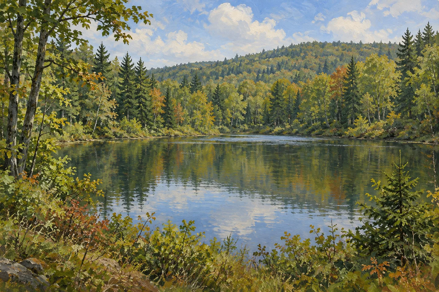
Mallet Pond State Forest takes its name from a waterbody with a specific purpose. Within a 2,584-acre public holding in the Schoharie County towns of Summit and Fulton, the pond represents a 1970s fisheries project connected with the nearby Blenheim-Gilboa hydroelectric development. Rossman Pond supplies another water setting, while rough roads and woodland give the surrounding property a rustic character. The two ponds help make this forest distinct from the neighboring hills across the valley.
Mallet Pond was constructed in 1976 by the New York Power Authority. DEC's Region 4 fisheries staff designed it to provide trout-pond fishing opportunities as mitigation for the hydroelectric project's effects on fisheries. That history puts the waterbody in a different light. Its existence reflects a deliberate effort to provide a particular habitat and recreation resource, rather than simply adding a name to a naturally occurring lake.
The archived Eminence management plan records a pond of 16.5 acres, with a maximum depth of 24 feet. Those design descriptions give the project a useful sense of scale within the much larger forest. A visitor looking at water and wooded margins is also looking at a landscape shaped for a defined purpose. The relationship between construction and continuing care is part of the pond's identity, alongside its present appeal as a place to spend time outdoors.
The same historical account records an artificial spawning device installed in 1977. It also explains why the fishery required management: natural reproduction alone was insufficient to sustain it. This detail adds substance to the story without requiring a fishing trip. The pond can be understood as a managed waterbody, where the original design and later biological care belonged to the same conservation objective. Current angling conditions and regulations are a separate matter for anyone planning to fish.
Rossman Pond, also called Rossman Fly, offers a different comparison. The archived plan describes 32 acres of water, abundant aquatic vegetation and a maximum depth of 16 feet. It also records a largely undeveloped shoreline and watershed. Keep that older physical description in its historical context, and use the current map for the public boundary: the plan distinguished the pond's ownership from the state land reaching its edge. A public forest nearby does not establish unrestricted access around every shore.
Away from the water, the forest has rough dirt roads and no designated or marked hiking trails. That combination suits an outing planned around a specific access point and objective. The current destination information lists separate parking references for Mallet and Rossman ponds, reached through the Summit area via Sawyer Hollow and Rossman Fly roads. Select the appropriate starting point with the official map rather than assuming the two waters form a signed walking circuit.
The neighboring Burnt-Rossman Hills State Forest lies across the valley and remains a separate property. Here, the clearest thread is the contrast between two water settings within the wider woodland landscape: one designed in 1976 for a fisheries purpose, the other described in older records as a larger, shallower pond. A focused visit can connect those histories with what is visible from legitimate access, giving the place more character than a general description of woods and water.
Fun facts
- Mallet Pond was designed by DEC fisheries staff and constructed by the New York Power Authority in 1976.
- The archived Eminence plan records Mallet Pond as 16.5 acres, with a maximum depth of 24 feet.
- An artificial spawning device was installed in 1977 according to the historical plan.
- The surrounding state forest covers 2,584 acres in Summit and Fulton, Schoharie County.
Before you go
- Use the current map to distinguish Mallet Pond and Rossman Pond access.
- Plan for a forest without a designated marked hiking network.
- Respect the mapped public boundary at Rossman rather than assuming the whole shoreline is public.
Capture
- Where visible from legitimate access, photograph water together with its wooded margins.
- Compare the different pond settings only from their actual public approaches.
- An illustration should not reconstruct the dam, spawning device, shoreline or an exact access route.
 Delaware Wild Forest
 Potato Hill State Forest
 Michigan Hill State Forest
Social
Mallet Pond State Forest covers 2,584 acres in Schoharie County. #Cre8Travel
The namesake pond was built in 1976 for a particular fisheries purpose.
DEC designed the pond and the New York Power Authority constructed it as mitigation linked to the Blenheim-Gilboa project.
The archived plan describes 16.5 acres of water and a 24-foot maximum depth.
A 1977 spawning device adds another detail to the pond’s management history.
Rossman Pond has its own setting and access reference. Keep the two waterbodies distinct.
The forest has rough roads and no designated marked hiking trails, so plan a specific objective.
A visit can connect a purpose-built pond’s history with a larger woodland landscape. Use current boundaries for every approach.
Hashtags