 Cre8Travel
CRE8TRAVEL · NEW YORK PLACES
Cold Spring Brook State Forest
Cold Spring Brook: Big Pines and a Landscape Changed by Wind
Discover
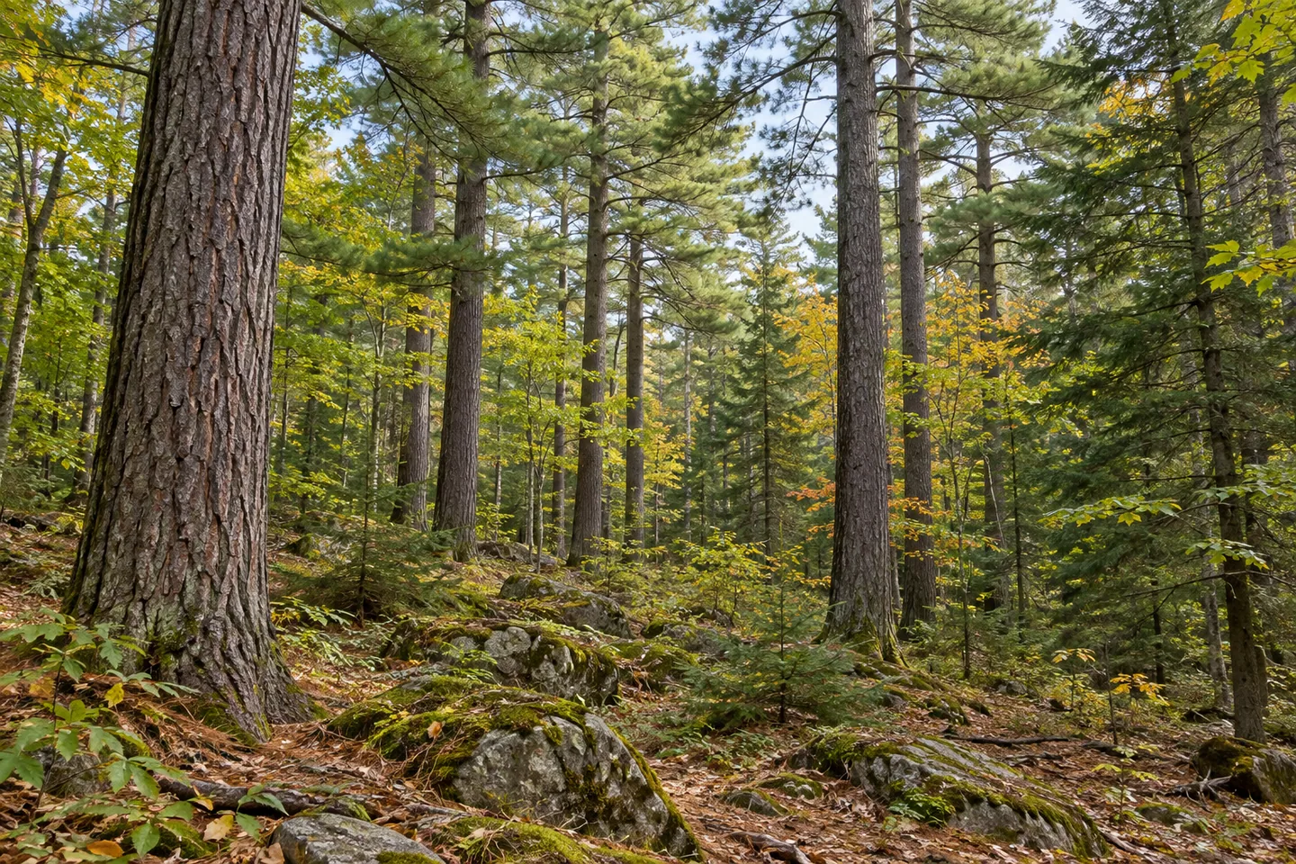
Cold Spring Brook State Forest offers two quite different named walking routes within a landscape of rocky ridges, planted stands and wetter low ground. The Big Pine Trail circles through large white pines, while the Hill and Dale Access Trail leads toward an isolated state-forest parcel. Understanding that difference is a useful starting point for the 1,068-acre property in St. Lawrence County. Neither a single forest name nor a short distance tells the whole story of a route's conditions.
The ground itself provides much of the forest's variety. Hilly uplands have thin soils and exposed rock, with northern hardwoods, hemlock and white pine on better sites. Less productive upland ground supports red oak, eastern hophornbeam and other trees adapted to dry, nutrient-poor conditions. In flatter areas, open wetlands and shrub swamps give way to swamp hardwoods where seasonal flooding occurs. These distinctions offer specific things to notice instead of treating every wooded section as the same habitat.
Pine and spruce plantations add evidence of another land-use chapter. They were established on former farm fields and pastures. Their presence connects today's tree cover with earlier agricultural ground and deliberate planting, while the other woodland types reflect different settings within the property. Comparing a planted stand with a rocky ridge or a wetter hollow can make a walk more attentive to the particular landscape without requiring assumptions about the age or origin of every individual tree.
The Big Pine Trail is a 0.8-mile loop through a stand of large-diameter white pine. Its defined loop and documented subject make it a specific option when choosing an outing. That description should not be stretched into a promise of level ground, accessibility or effortless walking. The Hill and Dale Access Trail is different: DEC describes its 0.4-mile connection from Kansas Road as difficult, reaching an isolated parcel and requiring visitors to stay on the red-marked route beside private land.
Access to the forest is available from Kansas Road, the Cold Spring Brook Public Forest Access Road and County Route 23. The property extends across the towns of Edwards and Pitcairn. Use those references to locate the intended trailhead rather than treating every roadside opening as an equivalent entrance. Respect for adjoining private property is part of the walking plan, particularly on the Hill and Dale route, where a short distance does not remove the need for careful route choice.
The forest also belongs to a wider story of recovery after the July 1995 windstorm known locally as the Microburst. Cold Spring Brook was one of four Pitcairn state forests that suffered heavy damage. Salvage work over the following three years occurred across those forests, and many harvested areas developed dense young hardwood growth. The combined figures recorded for the four properties should not be assigned to Cold Spring Brook alone. Its place in that shared history helps explain another layer of changing woodland structure.
For a visit centered on observation, choose the route first and then look for the differences the forest actually presents: large pines, planted stands, exposed upland ground and wetter vegetation. Primitive camping is allowed without designated campsites, and winter trails are not groomed. Those limits keep expectations in scale with the setting. Cold Spring Brook's interest lies in its contrasts, with each route and woodland type contributing a different part of the story.
Fun facts
- The Big Pine Trail is a 0.8-mile loop through large white pines.
- The 0.4-mile Hill and Dale Access Trail connects Kansas Road with an isolated state-forest parcel.
- Pine and spruce plantations were established on former farm fields and pasture.
- Cold Spring Brook was one of four Pitcairn state forests heavily damaged in the 1995 Microburst.
Before you go
- Keep the Big Pine loop distinct from the more difficult Hill and Dale connection.
- Stay on the red-marked Hill and Dale route and respect adjoining private property.
- Do not expect designated campsites or groomed winter trails.
Capture
- Use the vertical forms of large pines as a subject without inventing an exact trail scene.
- Compare rocky upland vegetation with a planted stand from legitimate routes.
- Photograph changes in woodland structure rather than reconstructing storm damage or promising wildlife encounters.
 Clark Preserve
 College Lodge Forest
 Coon Hollow State Forest
Social
Cold Spring Brook State Forest contains rocky uplands, wetter low ground and planted stands. #Cre8Travel
Its 1,068 acres extend into Edwards and Pitcairn in St. Lawrence County.
The Big Pine Trail is a 0.8-mile loop through large-diameter white pine.
Hill and Dale is a different outing: a difficult 0.4-mile access route from Kansas Road to an isolated parcel.
Stay on its red-marked route and respect neighbouring private land. Short mileage does not make every connection straightforward.
Plantations of pine and spruce occupy former farm fields and pasture.
Cold Spring Brook was one of four Pitcairn forests heavily damaged in 1995. Their combined recovery figures are not figures for this property alone.
Choose the route, then compare the landscape’s layers: rocky ridges, planted trees and wetter ground. Each tells a different part of the forest’s story.
Hashtags