 Cre8Travel
CRE8TRAVEL · NEW YORK PLACES
Clark Hill State Forest
Clark Hill State Forest: A Closer Look
Discover
Clark Hill State Forest was assembled from land owned by 20 different people. Purchases between August 1933 and September 1950 created a 2,819-acre public property in Oneida County, much of it formerly pasture and cropland. That history offers a useful way to approach the forest: one present boundary can hold many earlier parcels, and the woods growing within it have more than one origin.
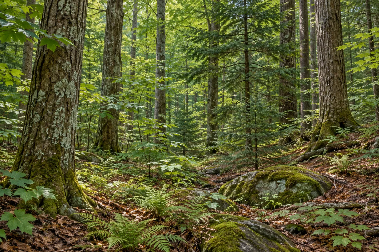
The terrain is hilly and rocky, with streams, small drainages and gorges containing flowing water. Those features give the woodland a particular character without establishing a prepared gorge walk or a signed viewpoint. Choose a route from the map and the access actually available, rather than making an outing depend on reaching the bottom of a gorge. The shape of the landscape can be appreciated without turning every feature into a destination.
There are no marked or maintained foot trails. Instead, 2.6 miles of unpaved roads provide access. The New York State Department of Environmental Conservation (DEC) describes this as a primitive forest setting, which is an important part of deciding whether a visit fits your plans. A road-based approach may offer worthwhile observations, but it should not be presented as an easy loop or a universally suitable walk through the entire property.
Parking is similarly modest: no maintained parking areas are listed. DEC provides northern and southern trailhead references, including the Boody Road and Latteiman Road intersection in the south. Match those locations to the map and check actual stopping arrangements before setting out. A trailhead reference and a maintained visitor lot are different things, particularly in a woodland whose access is not organized around developed facilities.
Winter road conditions differ by approach. Buck Hill Road is plowed through the forest, while Latteiman and Boody Hill roads are generally plowed only to the beginning of state land. Keep that limit separate from the length of a road shown on the map. Checking the chosen approach before traveling is more useful than assuming a network of lines represents a network of winter drives throughout the forest.
Plantations established in the early 1940s and 1950s sit alongside natural woodland. Pine and spruce are part of the planted mixture. Black locust and white cedar are also among planted species. Natural forest including black cherry, red maple, yellow birch, hemlock, hard maple, basswood, aspen and beech. Where visible from your route, compare tree forms and the structure of different stands. Their relationship can suggest a history of land use without claiming that a particular view contains every listed species.
DEC manages Clark Hill within the Oneida Hills Unit Management Plan. Follow posted conditions and Leave No Trace guidance, leaving vegetation and earlier land-use traces undisturbed. For photographs, woodland texture or a water view available from an appropriate position can be enough; no invented overlook is needed. Clark Hill brings former agricultural parcels, later planting and natural forest together in a setting whose limited access should remain part of its honest description, rather than approaching it as a prepared walking circuit.
Fun facts
- Clark Hill State Forest covers 2,819 acres in Oneida County.
- It was purchased from 20 landowners between August 1933 and September 1950.
- There are 2.6 miles of unpaved access roads and no marked or maintained foot trails.
- No maintained parking areas are listed.
- Only Buck Hill Road is plowed through; Latteiman and Boody Hill are generally plowed to state-land boundaries.
Before you go
- Plan around the unpaved roads rather than expecting marked foot trails.
- Resolve parking before visiting; trailhead references do not establish maintained lots.
- Check the specific winter road approach and plowing limit.
- Do not use gorge descriptions as directions for a descent.
- Follow posted conditions and Leave No Trace guidance.
Capture
- Compare natural woodland with planted conifer forms where visible from the appropriate route.
- Use rock and forest texture without seeking a gorge-edge viewpoint.
- If a stream view is available from your actual position, frame it without implying a maintained waterside trail.
 Canada Creek State Forest
 Cobb Brook State Forest
 Fall Brook State Forest
Social
Clark Hill State Forest covers 2,819 acres assembled from 20 landowners between 1933 and 1950. #Cre8Travel
Much of present Clark Hill State Forest was once pasture and cropland. #Cre8Travel
Clark Hill has 2.6 miles of unpaved access roads, without marked or maintained foot trails. #Cre8Travel
DEC lists no maintained parking areas at Clark Hill. Check the actual approach before setting out. #Cre8Travel
Buck Hill Road is plowed through Clark Hill; other approach roads generally stop plowing at state land. #Cre8Travel
Early 1940s and 1950s planting adds another layer to Clark Hill's natural woodland. #Cre8Travel
Hills, rock, streams and gorges shape Clark Hill, without establishing a prepared gorge itinerary. #Cre8Travel
At Clark Hill, what would you notice first: the varied terrain or the different origins of its woodland stands? #Cre8Travel
Hashtags