 Cre8Travel
CRE8TRAVEL · NEW YORK PLACES
Chautauqua Lake Fish And Wildlife Management Area
Chautauqua Lake Wildlife Lands: Three Parcels, Two Shores
Discover
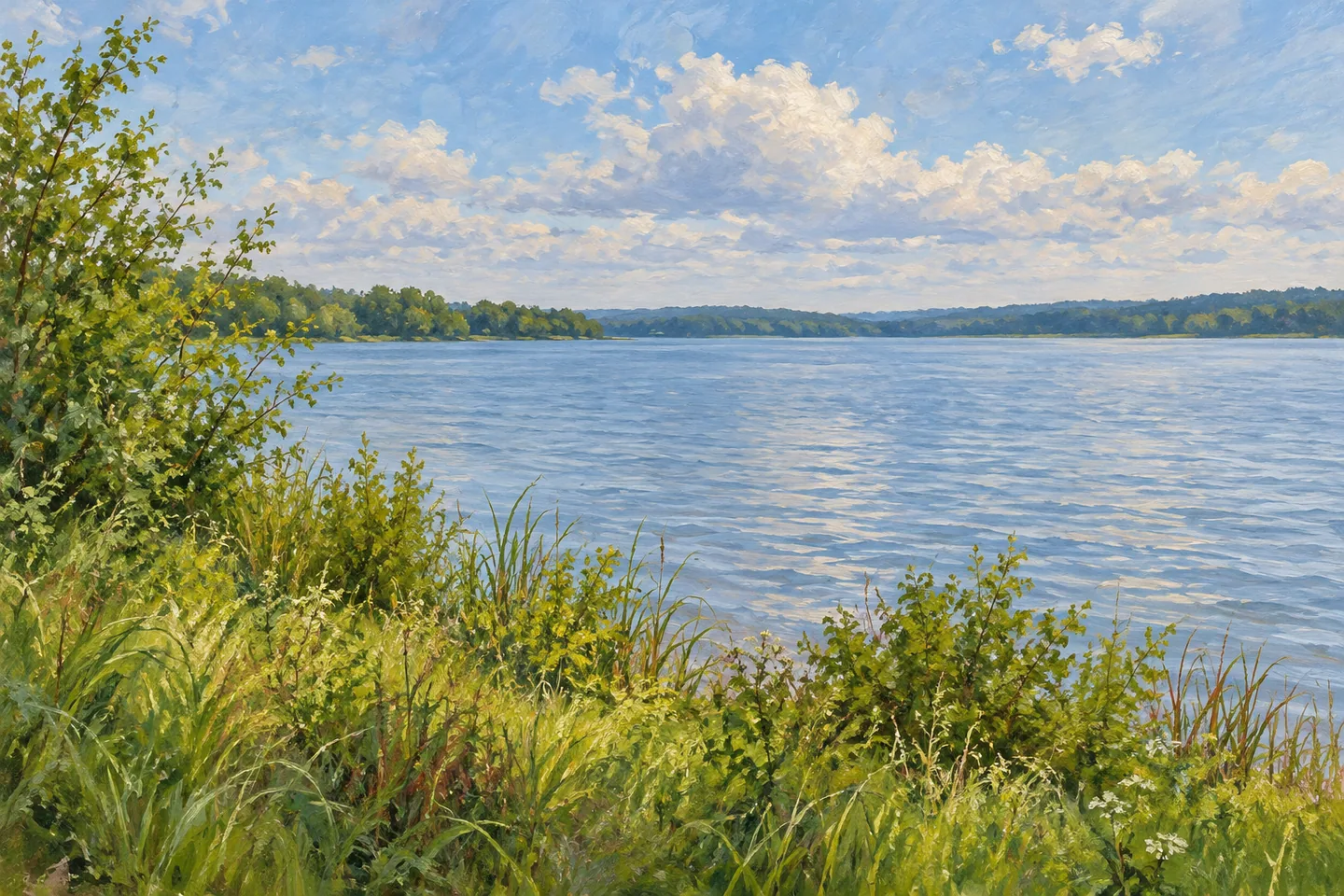
Chautauqua Lake Fish and Wildlife Management Area is a collection of three parcels rather than one continuous lakeside park. Its 123 acres include Tom's Point, Cheney Farm and Stow Farm, located on different sides of Chautauqua Lake. That arrangement gives each visit a specific starting point and setting. The management area's purpose is wildlife habitat and compatible recreation, with public access fitted to particular pieces of shoreline rather than extending automatically around the lake.
The geography helps make the three names meaningful. Cheney Farm lies on the lake's eastern side in the Town of Ellery, south of Bemus Point. Stow Farm and Tom's Point lie on the western side in North Harmony, reached from the Route 394 side of the lake. Choosing a parcel is therefore a real part of planning the outing. The names do not describe successive stops on a single walking loop, and the management-area label should not obscure the water and roads between them.
Stow Farm offers one particularly well-described approach. From its parking area, a trail leads half a mile in one direction to the lake and a viewing blind. DEC describes a firm crushed-stone surface, a minimum three-foot width and a maximum slope of ten percent. Those details are more useful than a blanket claim that every route on every parcel is equally accessible. They allow visitors to consider a specific documented path in relation to their own requirements and the conditions at the time.
The viewing structure provides a place from which to observe the lake, but the experience need not depend on a particular animal appearing. Water, shoreline vegetation and the relationship between open space and the lake can all be subjects. Keep to the designated trails, as DEC requests, to protect the plant communities. A defined approach to one viewing point is not permission to explore all shoreline ground or to treat nearby private land as part of the management area.
The historical setting adds another layer. Early Holland Land Company records describe the wider area around Chautauqua Lake as mostly forested in the early 1800s. Clearing followed, and dairy farming became a major use by the late nineteenth and early twentieth centuries, continuing into the 1960s. That is a history of the surrounding lake landscape, not proof that every parcel followed an identical sequence or retains a particular farm building. The distinction lets the broader story inform a visit without inventing specific remains.
Present management places habitat and wildlife-related public use together. The lake's fisheries and the land's plant communities are parts of a wider ecological setting, while access is provided through particular trails, parking areas and the documented viewing route. It is useful to think of these as related functions rather than competing attractions on a checklist. An observation-focused visit can be modest in distance and still connect the chosen parcel with the lake around it.
Begin with one name: Cheney Farm, Tom's Point or Stow Farm. Identify its approach and the public ground intended for the outing, then give attention to the shoreline setting it actually offers. The management area's distinctive character comes from those separate pieces of land. Understanding their relationship to the two shores makes the visit clearer and more meaningful than treating the entire lake as one interchangeable public destination.
Fun facts
- The 123-acre management area consists of Tom’s Point, Cheney Farm and Stow Farm.
- Cheney Farm is on the eastern side of Chautauqua Lake; Stow Farm and Tom’s Point are on the western side.
- The Stow Farm trail to the lake and viewing blind is 0.5 mile one way.
- DEC describes that trail as crushed stone, with a minimum three-foot width and maximum ten-percent slope.
Before you go
- Choose the particular parcel before selecting an approach or route.
- Use Stow Farm’s documented trail measurements when assessing that route, without generalizing them to all three sites.
- Stay on designated trails and keep the management parcels distinct from surrounding private shoreline.
Capture
- From the documented viewing route or structure, compare open lake water and shoreline vegetation.
- Use a general lakeshore composition without joining different parcels into an invented panorama.
- Let the landscape be the subject instead of requiring a staged or guaranteed wildlife encounter.
 Charleston State Forest
 Armstrong Preserve
 Chestnut Woods State Forest
Social
Chautauqua Lake FWMA contains three separate parcels on two shores, not one continuous lakeside park. #Cre8Travel
The 123 acres include Cheney Farm, Stow Farm and Tom’s Point.
Cheney Farm lies on the eastern side of the lake in Ellery. Stow Farm and Tom’s Point are on the west in North Harmony.
At Stow Farm, a trail reaches the lake and viewing blind in 0.5 mile one way.
DEC gives specific surface, width and slope measurements for that trail. Those details do not describe every route on every parcel.
Stay on designated trails to protect the area’s plant communities.
The wider lakeside landscape has a documented history of forest clearing and dairy farming. That does not establish a surviving farm building on each parcel.
Pick a parcel and understand its ground. A modest observation outing can reveal a specific relationship with Chautauqua Lake.
Hashtags