 Cre8Travel
CRE8TRAVEL · NEW YORK PLACES
Charleston State Forest
Charleston State Forest: Marshes and a Seasonal Trail Landscape
Discover
Charleston State Forest combines an extensive marked trail system with a set of deliberately created wildlife marshes. Its 4,026 acres extend across Montgomery and Schoharie Counties, bringing rolling terrain, woodland and water into one public property. The relationship between trails and wet ground is central to understanding the place. A route designed for winter travel can have very different conditions during warmer months, so the forest's mileage should never be read as a guarantee of the same walking experience throughout the year.
The marked winter trail network totals 22.8 miles, with many routes forming loops across moderately rolling ground. Long, gradual climbs and descents give parts of the system a different rhythm from a direct summit path. The figures describe a network rather than one visitor circuit. Choose the particular route and its complete distance from the intended starting point, keeping any connecting segments separate from the number assigned to an individual loop.
Walking is also allowed on the trails, but DEC specifically warns that many become extremely swampy in the warmer months and may be impassable. This is a defining condition of a possible visit, not a minor inconvenience to disregard. A winter map cannot establish a dry summer route. Keep the outing within actual conditions, and do not turn saturated ground into an excuse to create an informal detour through the surrounding vegetation.
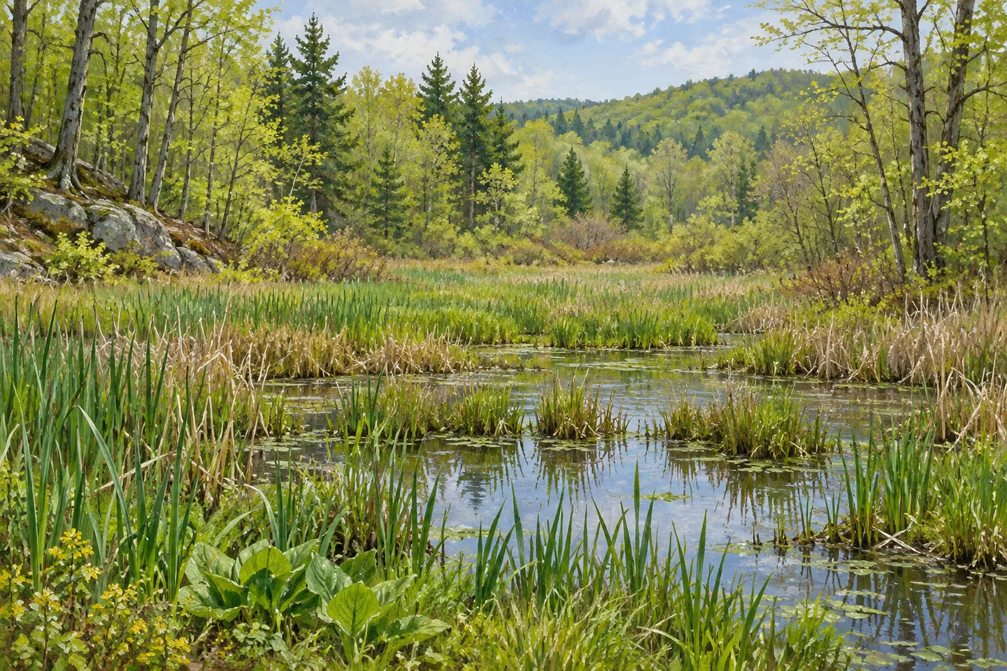
The marshes provide another way to read that water-rich setting. Eleven were constructed during the 1950s through Federal Aid to Wildlife programs, with the aim of providing habitat particularly for waterfowl. Their origin distinguishes them from features simply assumed to have developed without intervention. They are part of the forest's conservation history, linking purposeful habitat work with the woodland and trails that visitors encounter today. Their presence does not guarantee birds at a particular time or place.
This conservation perspective can shape an observation-focused outing. Where a legitimate route offers a view, consider how open wet areas contrast with the more enclosed woodland. The value of a marsh does not depend on it serving as a scenic stop or having a constructed viewing platform. Its documented purpose is habitat. Watching from an appropriate route allows the landscape to remain the subject without needing to approach every shoreline or find a particular animal.
Access references include Hughes Road, Gordon Road, Burtonville Road, Waite Drive and Gidley Road. These serve different positions around the property rather than functioning as interchangeable entrances to a single fixed circuit. The county setting is similarly broader than a single label: parts lie in Montgomery County and the Town of Esperance in Schoharie County. Keeping that extent in mind helps relate a chosen access point to the actual area intended for the visit.
Charleston is most distinctive when its recreation and habitat stories remain connected. The trail network makes purposeful movement through the forest possible under suitable conditions, while the marshes show an earlier effort to support wildlife. A modest outing can focus on either theme without trying to cover the whole system. Let the route, season and actual ground determine the plan, then notice the relationship between planted or managed landscape and the public uses fitted around it.
Fun facts
- The forest covers 4,026 acres across Montgomery and Schoharie Counties.
- The marked winter trail network totals 22.8 miles.
- Eleven wildlife marshes were constructed during the 1950s.
- Those marshes were intended particularly to provide waterfowl habitat.
Before you go
- Account for DEC’s warning that many trails can become swampy or impassable in warmer months.
- Choose a complete route from a particular access point instead of treating network mileage as one loop.
- Observe marsh habitat from legitimate routes without assuming access to every shoreline.
Capture
- Where visible from an appropriate route, contrast open wet habitat with enclosed woodland.
- Use the forest’s rolling terrain as a compositional subject without inventing a summit viewpoint.
- Keep a conceptual scene free of unverified boardwalks, observation platforms and staged birds.
 Carlton Hill Multiple Use Area
 Chautauqua Lake Fish And Wildlife Management Area
 Armstrong Preserve
Social
Charleston State Forest connects marked trails with eleven constructed wildlife marshes. #Cre8Travel
Its 4,026 acres extend across parts of Montgomery and Schoharie Counties.
The winter trail network totals 22.8 miles, with many routes forming loops over rolling terrain.
Walking is allowed, but DEC warns that many trails become swampy and may be impassable during warmer months.
The marshes were constructed in the 1950s, particularly to provide waterfowl habitat.
Habitat value does not depend on a guaranteed bird sighting or a visitor platform.
Choose the access point and actual route together; roads around the property do not all lead to one standard circuit.
Water shapes both the habitat story and the practical visit. Let actual ground conditions determine the outing.
Hashtags