 Cre8Travel
CRE8TRAVEL · NEW YORK PLACES
Catherineville State Forest
Catherineville State Forest: Plantation, Wetland and Community Memory
Discover
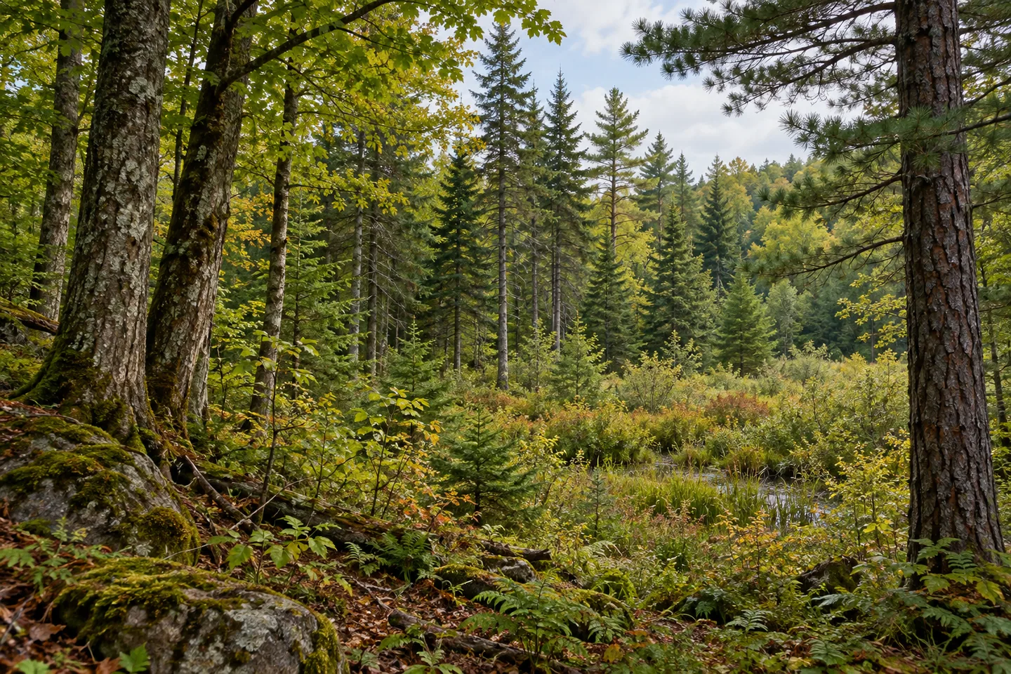
Catherineville State Forest contains more than one kind of woodland and more than one chapter of local history. Across 1,623 acres in Hopkinton, St. Lawrence County, upland forest gives way to wetter ground, while planted trees occupy former agricultural land. The property's name also recalls an earlier community within the area now encompassed by the forest. A visit can bring those different elements together, provided the landscape is approached as a combination of places rather than as a uniform spread of trees.
The state assembled Catherineville from 17 separate parcels purchased between 1933 and 1988. Reforestation, timber production, habitat, water protection and recreation all formed part of its purpose. That long acquisition period helps explain why the forest is better understood through several layers of use than through a single beginning. Its boundary brings together land with earlier histories, subsequently managed within a common public property.
The uplands support northern hardwoods alongside hemlock and white pine. Elsewhere, pine and spruce plantations were established on old farm fields and pastures. Those planted stands belong to the land's agricultural afterlife: a former field can become woodland through deliberate work as well as through changes that happen without planting. Compare the character of the different stands where they are visible from the route, without assuming that every group of trees began in the same way.
The lower, flatter ground introduces another set of habitats. Open wetlands and shrub swamps transition toward red spruce, balsam fir and swamp hardwoods in poorly drained places. These contrasts make drainage an especially useful theme for observation. Notice how a wooded setting can change across the property, while keeping feet and equipment out of sensitive wet ground. The presence of wetland habitat does not establish a boardwalk, a maintained crossing or permission to follow the water wherever it leads.
The Civilian Conservation Corps contributed substantially to the early forest. Between 1935 and 1940, crews from camps in Pierrepont and Brushton planted more than 690,000 trees across 665 acres and constructed six waterholes for fire control. DEC identifies one of those waterholes as still visible along Fletcher Road, within a larger wetland area. The figures describe particular work within Catherineville, giving a more precise history than a general statement that conservation crews once worked somewhere in the region.
Before that planting effort, Catherineville was a community with more than a dozen families living in the area now included in the state forest. A schoolhouse stood near the junction of Fletcher Road and the Circle Public Forest Access Road. Its documented location provides historical context; it does not establish that a building or visitable ruin remains. Looking at today's forest with that distinction in mind leaves room for the earlier community without inventing physical traces of it.
Access is available from Fletcher, Hayden and Santamont Roads and the Circle Public Forest Access Road. Hiking is allowed on the forest's trails, while winter recreation routes are not specifically maintained for skiing or snowshoeing. Choose an outing that reflects those actual conditions. The most distinctive experience here is connecting the different kinds of ground and history: old fields, planted stands, wetland transitions and a former community, all held within one public forest.
Fun facts
- The state purchased 17 parcels between 1933 and 1988 to assemble the forest.
- CCC crews planted more than 690,000 trees on 665 acres between 1935 and 1940.
- The crews also created six waterholes for fire control.
- A former schoolhouse stood near Fletcher Road and the Circle Public Forest Access Road.
Before you go
- Use the documented road access points rather than assuming a route across adjoining land.
- Keep the former schoolhouse as historical context; no surviving building or public ruin is established.
- Expect no specifically maintained skiing or snowshoeing trails.
Capture
- Compare planted conifer stands and mixed woodland from a legitimate route.
- Study vegetation transitions near wet ground without entering sensitive areas.
- Use the texture and spacing of trees to suggest the forest’s changing land-use history without reconstructing the former community.
 Cat & Thomas Mountains Forest Preserve
 Cinnamon Lake State Forest
 Clark Preserve
Social
Catherineville State Forest brings upland woods, plantations and wetlands together in Hopkinton. #Cre8Travel
Its 17 parcels were purchased over more than five decades, from 1933 to 1988.
Pine and spruce plantations occupy land that was once farm fields and pasture.
Between 1935 and 1940, CCC crews planted more than 690,000 trees across 665 acres here.
Six fire-control waterholes were constructed; DEC identifies one along Fletcher Road within a wetland area.
The area now included in the forest once held a community of more than a dozen families.
A former schoolhouse location belongs to the documented history. Do not mistake that record for a promise of a surviving building.
Look for differences between upland woodland and wetter ground. Catherineville’s story becomes more specific when its separate landscape layers remain visible.
Hashtags