 Cre8Travel
CRE8TRAVEL · NEW YORK PLACES
Cat & Thomas Mountains Forest Preserve
Cat and Thomas Mountains: A View into the Lake George Watershed
Discover
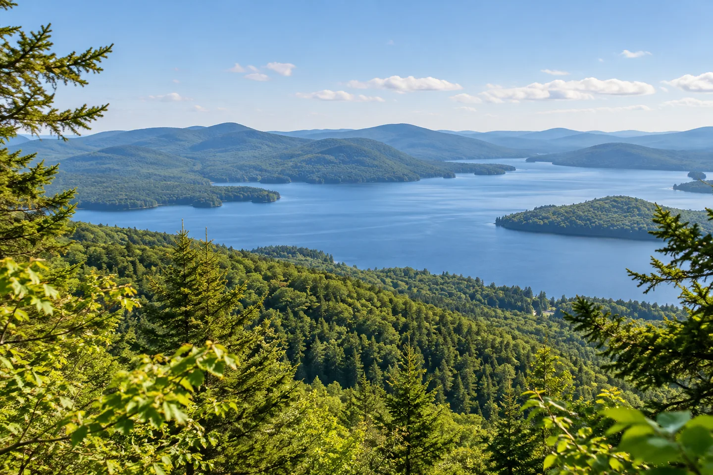
At Cat and Thomas Mountains, the reward of a summit view is connected to a larger conservation story. The preserve in Bolton protects land around Finkle Brook and Edgecomb Pond as well as routes toward two different mountaintops. Looking across Lake George can therefore be more than a finishing moment on a hike. It can also be an opportunity to connect the visible landscape with the water and woodland that the preserve helps protect.
Lake George Land Conservancy acquired the property in 2003 and sold it to New York in 2013. It is now part of the Adirondack Forest Preserve, while the conservancy continues to maintain the trails through a volunteer stewardship agreement. That sequence distinguishes ownership from ongoing care. The public forest and the organization helping look after its routes have related but different roles, both of which matter to understanding the place as it is used today.
The water story gives the acquisition a particularly local purpose. Finkle Brook, one of Lake George's larger tributaries, flows through the preserve and forms Edgecomb Pond, a drinking-water source for Bolton Landing. Protecting this land also preserves a substantial continuous tract within Bolton and the landscape visible around the lake. The ponds, brook, forest and distant views belong to the same setting, though they should not be treated as interchangeable recreation sites or assumed access points.
The two mountain destinations offer different route choices. From the Valley Woods Road parking area, a blue route follows a dirt road to a junction with the yellow route toward Thomas Mountain. The conservancy lists the Thomas summit approach as 1.4 miles one way. Its overlook provides a broad view of Lake George. Reading the mileage as one-way is essential: a distance to an overlook is not automatically the length of the complete outing.
Continuing from Thomas toward Cat Mountain is a separate commitment, described as two additional miles with more difficult footing. Another option follows the blue route from Valley Woods Road toward Cat, first using a logging road and later a more rugged woodland section. The contrast is useful when choosing a destination. Sharing a preserve does not give the two summits identical approaches, and combining them should be a deliberate plan rather than an assumption made at the first junction.
An approach from Edgecomb Pond Road offers another route toward Cat Mountain. It begins on the red route and connects with blue-marked sections; the conservancy gives the summit distance from this trailhead as 1.9 miles one way. Cat's summit offers a wider sweep across Lake George and the Adirondacks. These documented differences allow a visitor to choose between specific routes, rather than relying on a general idea that either mountain is simply a short extension of the other.
For an observation-focused visit, choose the route and turning point first, then let the landscape provide the detail. A summit view can show relationships between water, wooded slopes and the wider region without needing a claim about ideal light or guaranteed visibility. Cat and Thomas are most compelling when the walking plan and conservation story remain connected: the land being crossed helps protect the very watershed that gives those views their meaning.
Fun facts
- Lake George Land Conservancy acquired the property in 2003 and sold it to the state in 2013.
- Finkle Brook flows through the preserve and forms Edgecomb Pond.
- Edgecomb Pond supplies drinking water to Bolton Landing.
- The conservancy maintains the trails through a volunteer stewardship agreement.
Before you go
- Read the conservancy’s listed summit distances as one-way, not complete outing lengths.
- Choose Thomas, Cat or a combined route deliberately; the connecting section has more difficult footing.
- Use the route information to distinguish the Valley Woods Road and Edgecomb Pond Road approaches.
Capture
- At a documented summit viewpoint, relate the lake to its wooded slopes without promising clear weather or an unobstructed seasonal view.
- Use a wide composition to express the watershed setting rather than inventing a recognizable exact panorama.
- Consider vegetation and terrain along the legitimate route as subjects when a distant view is not available.
 Cass Park
 Catherineville State Forest
 Cinnamon Lake State Forest
Social
Cat and Thomas Mountains connect summit views with a Lake George watershed conservation story. #Cre8Travel
Lake George Land Conservancy acquired the property in 2003 and sold it to New York in 2013.
Finkle Brook flows through the preserve and forms Edgecomb Pond, a drinking-water source for Bolton Landing.
The conservancy continues to maintain trails through a volunteer stewardship agreement.
The Thomas Mountain approach from Valley Woods Road is listed as 1.4 miles one way. Remember the return journey.
Continuing from Thomas toward Cat is a separate two-mile section with more difficult footing, not an automatic extra stop.
The Edgecomb Pond Road approach toward Cat is listed as 1.9 miles one way and connects red and blue route sections.
A summit view can reveal the watershed around it. Choose the route first, then notice how lake, brook and forest relate to one another.
Hashtags