 Cre8Travel
CRE8TRAVEL · NEW YORK PLACES
Bessie's Woods
Bessie’s Woods: Graywacke, Orchard Trees and Woodland Paths
Discover
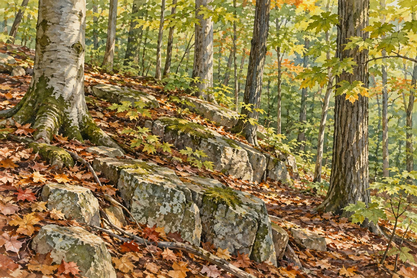
Bessie's Woods brings a rocky ledge, an old orchard and woodland paths together on Taborton Mountain. The 122-acre preserve lies on the Rensselaer Plateau near Little Bowman Pond, with its visitor address on Taborton Road in Sand Lake. Rather than one distant landmark, the interest is in the sequence of smaller features: a change in tree cover, a stone wall or an apple tree remaining from an earlier use of the land.
The preserve also has a family story. Roland LeBarron and his daughter Robbin Dzembo donated family land in memory of Bessie LeBarron. Hudson Taconic Lands recalls Bessie's enjoyment of gardening there and Roland's connection with the wild turkeys. The donation gives the name a particular meaning, joining a public woodland visit with the family's own relationship to the place.
Graywacke Wander provides one route into that landscape. From the parking area, it begins past the kiosk along an old logging road before following yellow markers at a fork. The operator lists the route at 0.96 mile with a gentle to moderate rise, passing a mossy graywacke ledge and a wetland before reaching a four-way junction. Keep the map with you to understand the return rather than assuming the named segment is a complete loop from the car.
Old Wood Road uses red markers and shares the initial approach before taking the other branch. Its 0.59-mile route includes a short, steep rise and reaches the same junction area. The operator describes returning along the approach or using Graywacke Wander. Reading those connections before departure lets you choose a combination appropriate to your time, footing and comfort with the terrain.
The white-marked Orchard Loop adds another theme. It passes through an old apple orchard where some trees still bear fruit, with a picnic table and bench identified by the operator. An orchard scene can reward attention to branching shapes and the relationship between older land use and surrounding woodland. The trees' presence does not establish permission to harvest fruit or a guarantee of blossom or ripe apples on a chosen date.
Hemlock and northern hardwood cover give way to beech and maple at higher elevations. Stone walls appear along the trails as another trace of the landscape's past. For photography, try a wider woodland frame paired with a closer stone or tree detail, keeping plants and historic features undisturbed. The operator lists wildlife including chickadees and downy woodpeckers, but a visit does not need a particular sighting to be interesting.
A snowmobile route crosses the preserve and connects with neighboring land. It uses club markers on the ground even where shown in blue on the map, shares parts of other trails and leaves the conservation property. Respect private boundaries. The operator also notes that summer grass and ferns can make parts difficult to walk. Use current guidance for the intended season and activity rather than assuming every mapped connection is a general public route.
Check the current preserve map and rules before arrival, and pack out your trash. Some terrain is steep and uneven, so let actual conditions shape your plan. At Bessie's Woods, a manageable combination of routes can give the ledge, orchard and family conservation story time to become more than passing details.
Fun facts
- Bessie’s Woods covers 122 acres on Taborton Mountain.
- The preserve was conserved through a family donation in memory of Bessie LeBarron.
- Graywacke Wander is yellow marked and listed at 0.96 mile to its junction endpoint.
- Old Wood Road uses red markers and includes a short steep rise.
- The orchard route passes some fruit-bearing apple trees.
Before you go
- Use the current map to plan route connections and the return to parking.
- Allow for steep and uneven terrain on parts of the preserve.
- Respect private property where the snowmobile corridor leaves the preserve.
- Follow current seasonal guidance rather than assuming every corridor is easy to walk in summer.
- Pack out trash and leave orchard trees, stone walls and other features undisturbed.
Capture
- Compose the documented graywacke ledge as a texture study without disturbing moss or vegetation.
- Use orchard branching forms in relation to surrounding woodland, without promising blossom or fruit on a particular date.
- Pair a wider trail scene with a closer stone-wall detail, keeping historic features intact.
 Downerville State Forest
 Plattekill State Forest
 Wolf Hollow Wildlife Management Area
Social
Bessie’s Woods covers 122 acres on Taborton Mountain, with a rocky ledge, old orchard and woodland paths. #Cre8Travel
Roland LeBarron and Robbin Dzembo donated family land in memory of Bessie LeBarron, giving the preserve’s name a personal conservation story. #Cre8Travel
Graywacke Wander uses yellow markers and passes a mossy stone ledge and wetland before its four-way junction. Plan your return with the map. #Cre8Travel
Old Wood Road shares the beginning of Bessie’s woodland approach, then follows red markers and includes a short steep rise. #Cre8Travel
The orchard route at Bessie’s Woods passes some fruit-bearing apple trees. Their presence does not imply permission to harvest or a guaranteed seasonal display. #Cre8Travel
Hemlock and northern hardwood cover give way to beech and maple higher in Bessie’s Woods. Look for changes in woodland form. #Cre8Travel
The snowmobile corridor at Bessie’s Woods connects with neighboring land. Follow current rules and respect private property where it leaves the preserve. #Cre8Travel
At Bessie’s Woods, which detail would start your photograph: graywacke texture, orchard branches or an old stone wall? #Cre8Travel
Hashtags