 Cre8Travel
CRE8TRAVEL · NEW YORK PLACES
Downerville State Forest
Downerville State Forest: Two Rivers and Changing Woodland
Discover
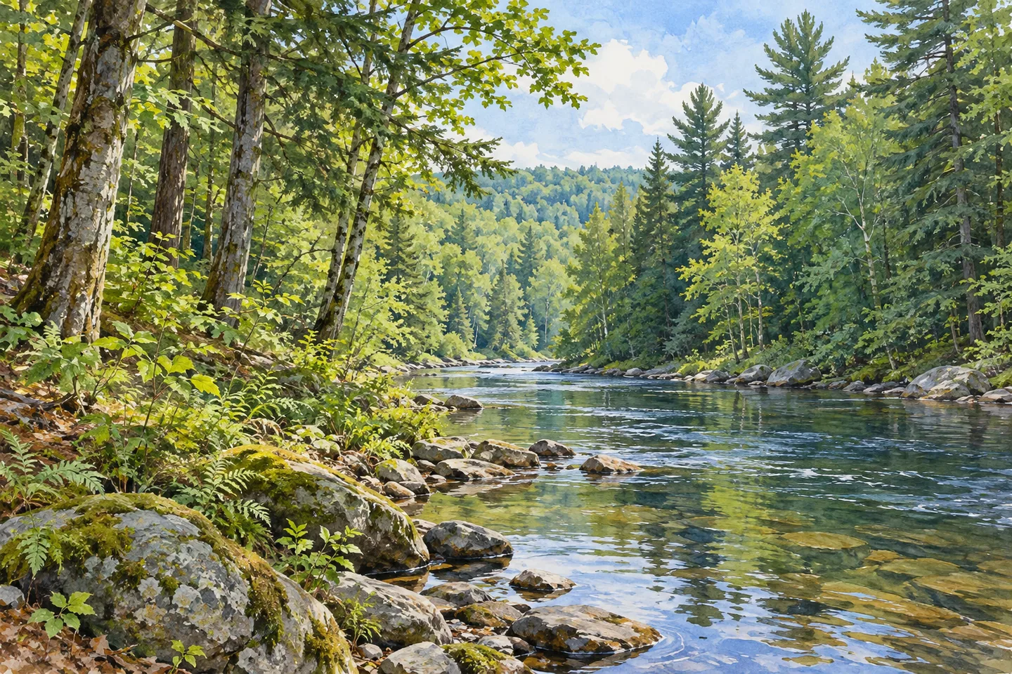
Downerville State Forest brings river frontage and upland woodland together within 1,443 acres in Russell, St. Lawrence County. DEC describes 2.9 miles along the Grass River and another 1.5 miles along its North Branch. Between the higher ground and river bottomlands, the forest changes in both elevation and vegetation. That variety gives a visit a clear theme: looking at how water and the shape of the land relate to the trees.
The uplands support northern hardwoods, hemlock and white pine. Pine and spruce plantations occupy former farm fields and pastures, adding a land-use story to the present cover. Flatter areas contain open wetlands and shrub swamps, with swamp hardwoods in seasonally flooded places. These are different parts of one landscape, not a promise that a single short walk will pass through every habitat type.
Elevations range from about 640 feet near the rivers' confluence to 1,009 feet on Palmer Hill. Those figures describe the ground rather than a marked summit walk or open overlook. For a woodland photograph, compare the actual tree forms, water and vegetation you encounter. A close view of texture can be as revealing as a wider river frame without requiring a distant panorama.
Access needs to be planned before departure. DEC identifies Downerville Road, Backus Road and River Public Forest Access Road as approaches. The ford across the North Branch is closed to motor vehicles. Do not build a driving itinerary around crossing there; the agency describes high water and swift currents, as well as damage to roads south of the crossing. Check current routes and conditions, keeping any river crossing outside an assumed road connection.
Two parking references lie along River Public Forest Access Road: one at an old gravel bed and another near the kiosk and campsite before the North Branch. Use the current map to choose the appropriate arrival point. A road near the river does not establish that its entire length is open, suitable for every vehicle or continuous across the water. The forest's river frontage is a reason to study access carefully rather than skip the planning.
DEC identifies two designated campsites, along Downerville Road and River PFAR. Dispersed primitive camping is also allowed with 150-foot setbacks from roads, trails and water. Stays beyond three nights or groups of ten or more need a ranger permit. Review current guidance before an overnight visit and distinguish designated locations from dispersed-camping rules. Follow Leave No Trace and the agency's guidance against moving firewood.
The eastern boundary adjoins Grass River Wild Forest. That neighboring property has its own management designation and access arrangements, so consult the relevant maps before extending an outing. Downerville's place within the St. Lawrence Foothills management unit is an administrative connection, not evidence of a single continuous trail across every included forest.
Fishing is identified on the Grass River, with current regulations and public access to be checked before an angling visit. Gouverneur and Canton are listed for amenities. For a focused day at Downerville, choose one river-side approach or woodland section and let the change between planted conifers, native trees and wet ground guide your attention. The landscape offers enough detail without relying on a promised animal sighting or an improvised ford crossing.
Fun facts
- Downerville State Forest covers 1,443 acres in Russell.
- DEC describes 2.9 miles of Grass River frontage and 1.5 miles on the North Branch.
- Elevations range from about 640 feet near the confluence to 1,009 feet on Palmer Hill.
- Pine and spruce plantations occupy former fields and pastures.
- The eastern boundary adjoins Grass River Wild Forest.
Before you go
- Plan a route using current official maps before leaving.
- Do not plan to drive across the North Branch ford; it is closed to motor vehicles.
- Check the River PFAR parking references and road conditions for your chosen approach.
- Review designated campsites, dispersed setbacks and ranger-permit thresholds before staying.
- Respect the neighboring property’s separate access arrangements when considering an extension.
Nearby & related places
- Unranked adjacent-land selection: Grass River Wild Forest — adjoining Downerville’s eastern boundary, with separate maps and access guidance.
Capture
- Compare native woodland and planted-conifer forms where visible through appropriate public access.
- Frame river water and surrounding vegetation together without entering a ford for a photograph.
- Use a sequence of wider woodland and close texture images rather than assuming a Palmer Hill panorama.
 Hoxie Gorge State Forest
 Bessie's Woods
 Plattekill State Forest
Social
Downerville State Forest covers 1,443 acres in Russell, St. Lawrence County, between river bottomlands and higher woodland. #Cre8Travel
DEC describes 2.9 miles of Grass River frontage and 1.5 miles along the North Branch at Downerville. Use current maps to understand actual access. #Cre8Travel
Native hardwoods, hemlock and white pine mix with planted pine and spruce at Downerville. Former fields and pastures are part of the story. #Cre8Travel
Downerville’s flatter areas include wetlands and shrub swamps, with swamp hardwoods in seasonally flooded ground. #Cre8Travel
The North Branch ford at Downerville is closed to motor vehicles. Do not assume the road continues as a permitted drive across the river. #Cre8Travel
Two parking references lie along River PFAR at Downerville. Check the current map and road conditions before choosing an approach. #Cre8Travel
Grass River Wild Forest adjoins Downerville’s eastern boundary. Plan any extension with the neighboring property’s own access information. #Cre8Travel
At Downerville, compare tree forms with water and wetland texture. Which detail best shows the connection between land and river? #Cre8Travel
Hashtags