 Cre8Travel
CRE8TRAVEL · NEW YORK PLACES
Beaver Pond State Forest
Beaver Pond State Forest: A Long Woodland with a Pond at Its Edge
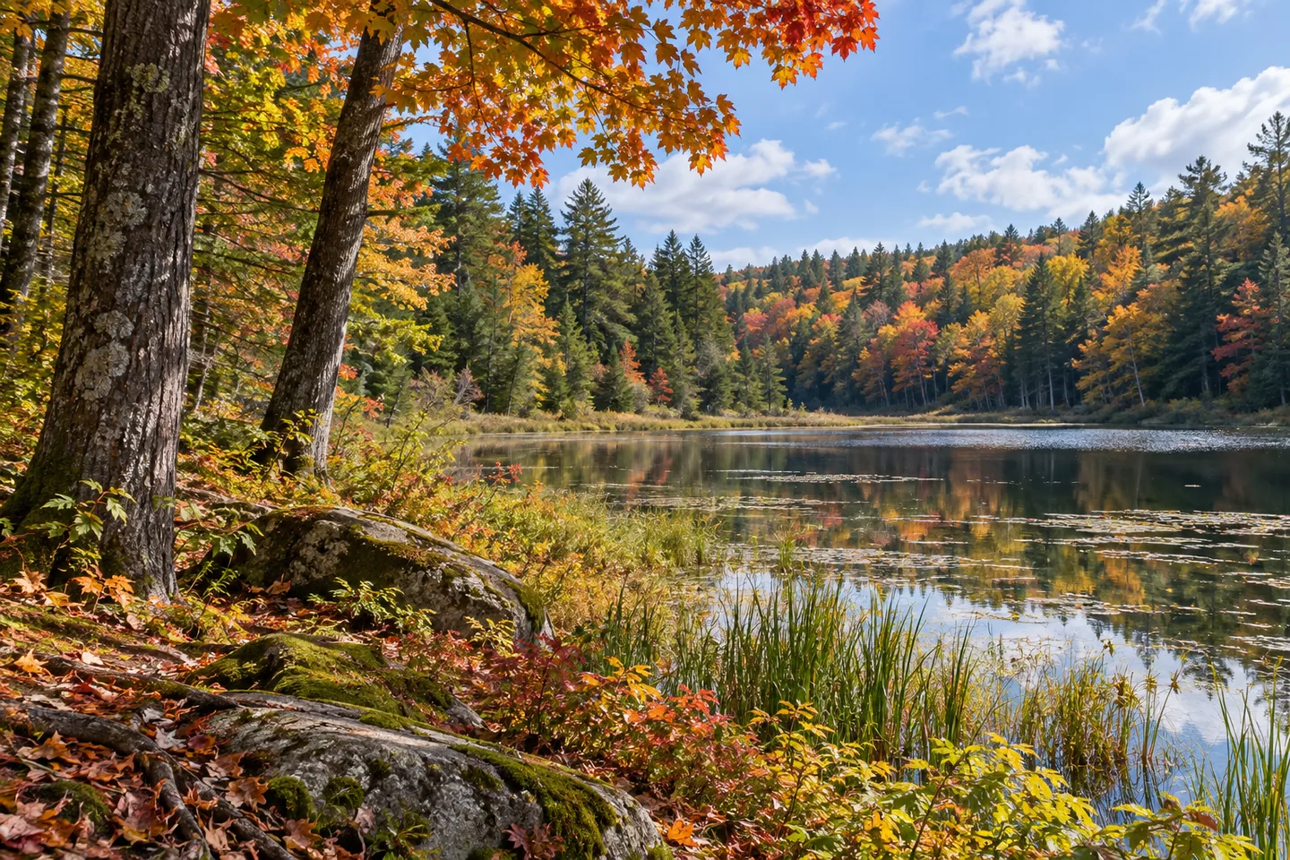
Discover
Beaver Pond State Forest has a name that sounds compact, but its shape tells a different story. The 791-acre property in Sanford, Broome County, stretches roughly three miles from its northern boundary to its southern one. A 17-acre pond lies partly within it. That distinction matters: the pond is one feature of a longer woodland landscape, and its name does not make every shoreline a public access point.
The property was formerly known as Page Pond State Forest. Its first two tracts were acquired in 1940 and 1941, followed by additional purchases in 1981 and 1989. Those dates give the forest a specific public-land history rather than an unspecified story of untouched wilderness. They also help explain why studying the boundary map is useful before treating the area as a single, simple block.
Tree cover supplies much of the interest. Native conifers and northern hardwoods form the principal mix, while only a few acres were planted with red pine or Norway spruce. The largest hemlock block is in the southern section, south of Route 41. Elsewhere, the hardwood list includes red oak, sugar maple, aspen, red maple, white ash, black cherry and beech. Looking for changes in tree form and canopy texture gives a walk a focus without requiring a dramatic overlook.
The ground rises to about 2,010 feet on two peaks in the northern section. These are elevation facts, rather than promises of an open summit view or a marked route to either high point. Keep the distinction between the forest's shape and its recreation route equally clear: the boundary-to-boundary distance is about three miles, but DEC does not give that figure as the length of the trail.
A single multiple-use recreation trail runs north to south through the forest. The closed portion of Huggins Road offers another documented recreation corridor, specifically noted for cross-country skiing. Huggins Road once crossed the property, but that interior section is closed to traffic. The remaining road segments provide the approaches: the northern segment connects through Hawkins Road to Route 41, while the southern segment connects directly with Route 41. Consult the current forest map rather than expecting to drive straight across.
Wildlife adds another reason to look closely. DEC records deer, raccoons, squirrels, porcupines, beavers, chipmunks and opossums, with coyotes and foxes also present. Songbirds and hawks occur here, and the agency connects the abundance of turkeys with the forest's beech and oak cover. These descriptions explain habitat; they cannot tell you which animal will appear during a particular visit. A photograph of woodland structure can work perfectly well without a creature completing the composition.
For an overnight stay, distinguish primitive camping from a serviced campground. DEC's property guidance requires dispersed sites to be at least 150 feet from roads, trails and water; stays beyond three nights or groups of ten or more require a ranger permit. Check current guidance before setting out. Marsh Pond State Forest is listed among the nearby state lands, while Deposit is identified for amenities. Beaver Pond itself rewards an approach built around its actual features: a narrow forest, varied tree cover and a road corridor whose closure is an essential part of understanding access.
Fun facts
- The 791-acre property was formerly known as Page Pond State Forest.
- The 17-acre namesake pond lies only partly within the state forest.
- The forest extends roughly three miles from its northern boundary to its southern boundary; that is not a documented trail length.
- Two northern high points reach about 2,010 feet.
- The largest hemlock block lies south of Route 41.
Before you go
- Use the forest boundary map before choosing an approach; parts of the surrounding land are privately owned.
- Do not plan a through-drive on Huggins Road: its section within the forest is closed to traffic.
- Distinguish the north-to-south recreation trail from the property’s roughly three-mile length.
- Review DEC primitive-camping setbacks and permit requirements before an overnight visit.
Capture
- Compare the forms and textures of documented hemlock and hardwood stands from appropriate public access.
- Use an accessible section of the recreation corridor as a leading line, without implying that every road section permits driving.
- Make a woodland study from wide views and bark or leaf details; an open summit panorama is not documented.
 Beaver Flow State Forest
 Cascade Valley State Forest
 Marsh Pond State Forest
Social
Beaver Pond State Forest covers 791 acres in Sanford, Broome County. Its 17-acre namesake pond lies partly within the forest. #Cre8Travel
Formerly Page Pond State Forest, this public woodland began with acquisitions in 1940 and 1941, followed by additions in 1981 and 1989. #Cre8Travel
A long, narrow shape sets Beaver Pond apart: roughly three miles from north to south. That figure describes the property, not a verified trail length. #Cre8Travel
The largest hemlock block at Beaver Pond State Forest is in the southern section, south of Route 41. Compare its texture with the hardwood cover elsewhere. #Cre8Travel
Two northern high points reach about 2,010 feet. Elevation alone is not a promise of an open viewpoint or a marked summit route. #Cre8Travel
Huggins Road once crossed Beaver Pond State Forest. The interior section is closed to traffic; check the current map for the separate approaches. #Cre8Travel
DEC links Beaver Pond’s turkeys with its beech and oak habitat. Let that guide your attention without expecting a guaranteed sighting. #Cre8Travel
A single recreation trail runs north to south at Beaver Pond. What catches your eye first in a woodland: the shape of the route or the character of the trees? #Cre8Travel
Hashtags