 Cre8Travel
CRE8TRAVEL · NEW YORK PLACES
Beaver Flow State Forest
Beaver Flow State Forest: A Landscape Shaped by Water
Discover
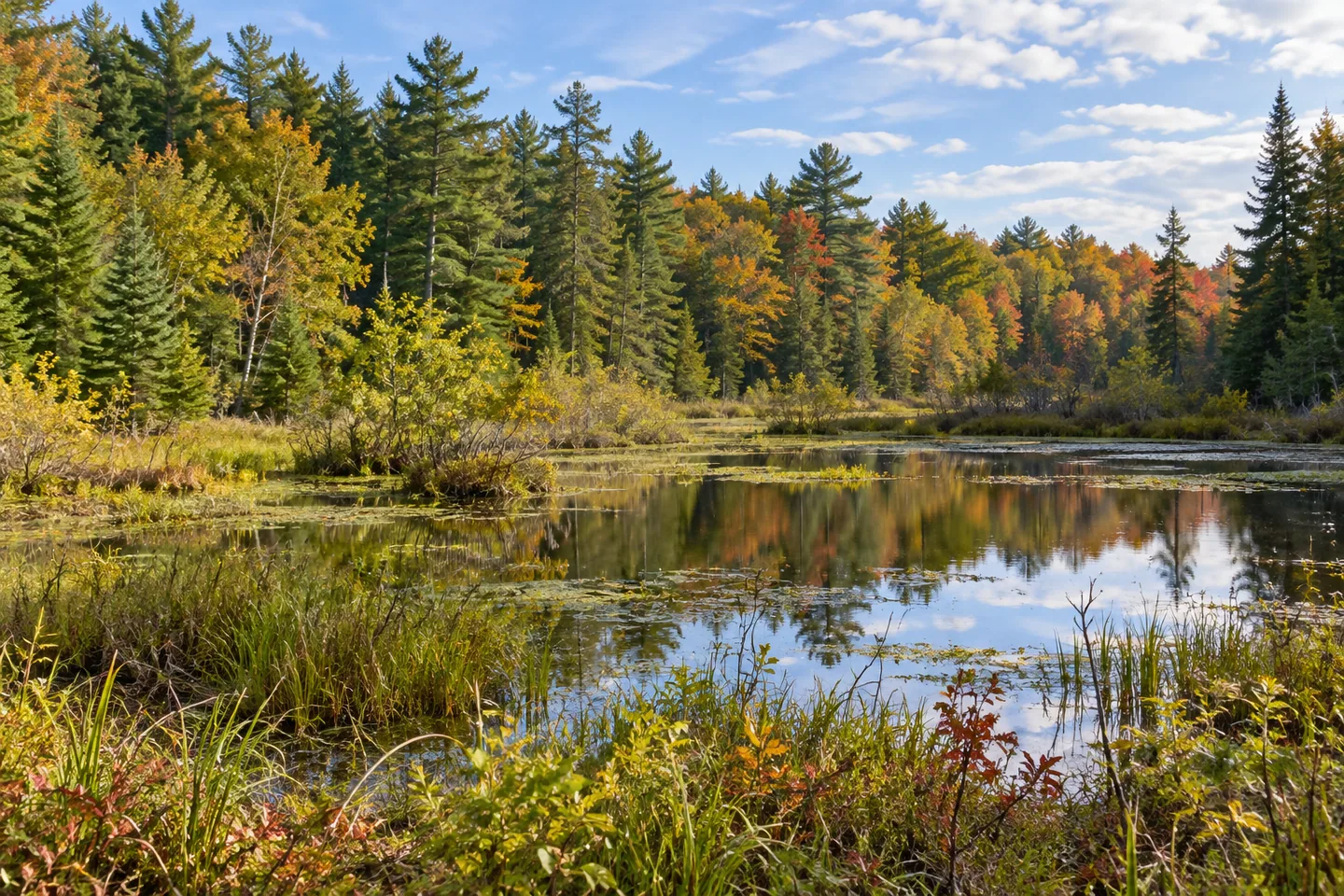
Beaver Flow State Forest crosses a county line and brings together two different accounts of how a landscape changes. Beaver activity alters its wet places, while planted trees and naturally growing woodland reflect earlier agricultural use. The 1,028-acre property lies in Coventry in Chenango County and Colesville in Broome County, New York. Its interest is in those relationships rather than a long list of visitor facilities.
Beavers have influenced habitat in at least three locations within the forest. The resulting water sites are not fixed landscape ornaments: their water levels can vary as beaver activity changes. That makes the forest's name a useful starting point for understanding the place, but a poor basis for assuming that every pond will look the same from one visit to another.
Ponds and meadows add another dimension to the woodland. Ducks, herons, muskrats, raccoons, mink and deer are among the animals documented around the water sites. Treat those names as context for the habitats rather than a sightings checklist. A composition centered on water and its surrounding vegetation can tell the landscape's story without depending on an animal appearing in the frame.
The trees offer a different way to read change. Cultivated stands include red pine, white pine, larch and Norway spruce. Natural forest includes red maple, American beech, sugar maple, black cherry, white ash, white pine and eastern hemlock. White pine appears in both descriptions, a useful reminder that a tree's species alone does not explain whether a particular stand was planted.
Much of this comparatively gentle land was once cleared for agriculture and pasture. The forest is consequently described as middle aged. Looking at the present woodland with that history in mind shifts the emphasis from an imagined untouched landscape to one shaped by successive uses. The planted and naturally growing stands provide two connected strands of that history rather than separate attractions to tick off.
There is a small, specific walking destination: a designated 0.1-mile trail leads east from Glendenning Road to a historic cemetery dating to the early 1800s. Keep the scale of that route in mind when planning. This documented short trail should not be confused with a promised network of marked walking routes throughout the property.
Access deserves more attention than the short trail's distance might suggest. Glendenning Road is described as a poorly maintained dead-end road, and the forest is remote from main roads. Other approaches involve Mendenhall Road and Skellett Road. At the southern tip, the land drops away from Glendenning Road without good pull-offs or parking areas. A road beside the property is therefore not automatically a suitable stopping point.
An abandoned town road heads north from the intersection of Skellett and Glendenning roads and forms a property boundary until just north of a stream. That is a precise boundary detail, not evidence of a wider walking network. Use the official forest map to distinguish public land and documented access from adjoining property before choosing an approach.
The Chenango Trail Unit Management Plan places the forest within a broader management framework. For a visitor, the most useful thread remains local: changing beaver-influenced water, cultivated and natural tree stands, and a landscape that has passed through agricultural use. Let those documented features guide the visit rather than expectations of extensive facilities or guaranteed wildlife encounters.
Fun facts
- The 1,028-acre forest lies in both Chenango and Broome counties.
- Beaver activity has influenced habitat in at least three locations.
- White pine occurs in both the cultivated-stand and natural-forest descriptions.
- A designated 0.1-mile trail leads from Glendenning Road to a historic cemetery.
Before you go
- Use the official forest map to distinguish public land from neighboring property.
- Plan the approach carefully: Glendenning Road is described as poorly maintained.
- Do not assume the southern tip provides parking; good pull-offs are not documented there.
- Treat the documented 0.1-mile walk as a specific short trail, rather than evidence of an extensive trail network.
Capture
- Build a composition around the relationship between water and surrounding vegetation, without relying on wildlife sightings.
- Consider contrasting cultivated and naturally growing tree stands where they can be observed from appropriate public access.
- Use a sequence of wide and close views to explore woodland structure; do not infer a stand's history from species alone.
 Ossian State Forest
 Beaver Pond State Forest
 Cascade Valley State Forest
Social
Beaver Flow State Forest spans 1,028 acres across Chenango and Broome counties in New York. Its water sites and former farmland tell connected stories of landscape change. #Cre8Travel
Beaver activity has shaped habitat in at least three locations at Beaver Flow State Forest. Water levels can vary as that activity changes. #Cre8Travel
Red pine, white pine, larch and Norway spruce occur in cultivated stands at Beaver Flow. Natural woodland adds another strand to its agricultural past. #Cre8Travel
White pine appears in both the cultivated and natural forest descriptions at Beaver Flow: species alone does not explain a stand's history. #Cre8Travel
Beaver Flow's comparatively gentle land was historically cleared for agriculture and pasture. Read today's middle-aged woodland with that earlier use in mind. #Cre8Travel
A designated 0.1-mile trail at Beaver Flow leads east from Glendenning Road to an early-1800s cemetery. A specific short route, rather than a long trail circuit. #Cre8Travel
Plan the approach to Beaver Flow carefully. Glendenning Road is described as poorly maintained, and the southern tip lacks good pull-offs or parking areas. #Cre8Travel
At Beaver Flow, try framing water and vegetation together. The landscape can carry a photograph without a promised wildlife sighting. #Cre8Travel
Hashtags