 Cre8Travel
CRE8TRAVEL · MAINE PLACES
Tyler Pond Wildlife Management Area
Tyler Pond: A Small Waterbody with a Longer Story
Discover
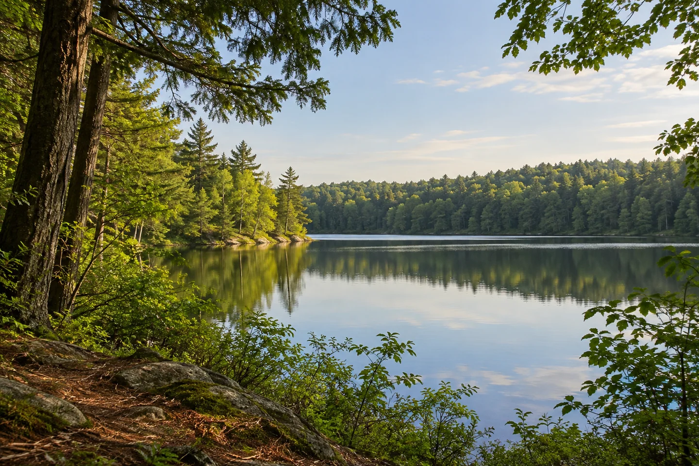
Tyler Pond Wildlife Management Area offers a freshwater outing close to Augusta, with a small pond as its center rather than a developed recreation complex. The state's current property description identifies the approach from Summerhaven Road and an entrance with a small parking area. Check the posted arrangements before bringing a boat, and plan for carrying equipment. A modest walk and time observing the shore can be a complete visit without adding a complicated route.
The pond's shape has a geological explanation. Maine's wildlife agency identifies it as part of a chain of kettle ponds formed when buried blocks of ice melted and the sand and gravel above them subsided. The account also connects the area with an aquifer supplying Governor Hill Hatchery. That gives the view a second dimension: visible water sits within a larger water-bearing landscape. It is a useful background for looking, rather than a reason to enter the water or make assumptions about present drinking-water quality.
The public-land history includes an unrealized plan. Manchester's municipal open-space guide explains that the conservation department acquired the property in the 1970s using federal recreation funds. Plans to make it a state park did not proceed, and a 1992 agreement placed wildlife management with the fisheries and wildlife department. The guide describes a northern hand-carry access and coordinated use of designated motorized trails. Follow current signs and keep walking and carrying plans compatible with other authorized users. An older description is context, not a guarantee about today's road surface or an invitation to drive to the shore.
The fisheries record shows that the water has been actively managed. A state survey revised in 1990 records reclamation in autumn 1989 to remove fish competing with brook trout, followed by a stocking program. Its depth chart portrays a small basin with a much deeper center than its narrow appearance might suggest. These are historical findings, not current fishing regulations or a forecast of what an angler will catch. Consult contemporary rules separately if fishing is part of the visit.
Andrea's original Capital Walks account from October 2009 describes an approach that became less attractive where the road was rutted, followed by a rewarding pond destination. She particularly appreciated a wooded projection at the shore and considered the outing manageable with children. Those are one walker's impressions from that trip. They help explain the appeal of reaching the water without establishing present trail condition, universal family suitability or an exact itinerary to follow years later.
For an outing of your own, choose a small observation task. Compare the enclosed woods with the wider space over the pond, or make a sketch of how the shoreline changes direction. Keep notes on what was actually visible rather than copying a historical account's weather or water clarity. For photographs, make one contextual frame before choosing a closer pattern of branches and water, staying on stable authorized ground. Tyler Pond becomes more distinctive through this combination of water, glacial history and public-land decisions. The reward can be a clearer understanding of a small place rather than a large distance traveled.
Fun facts
- The municipal guide records a wildlife-management agreement beginning in 1992.
- The 1990 fisheries survey records reclamation in autumn 1989.
Before you go
- Check posted access and parking arrangements before carrying equipment.
- Follow designated routes and share authorized trails considerately.
- Verify current fishing rules separately from the historical survey.
Visitor perspectives
- Andrea’s October 2009 Capital Walks account found the rutted approach less attractive than the rewarding wooded pond destination and appreciated the outing with children.
Capture
- Contrast the enclosed woods with the open pond from stable authorized ground.
 Hammond Forest
 Carleton Pond and Watershed Trail
 George Bucknam Wildlife Management Area
Social
A small pond can be the center of a complete outing.
Kettle ponds preserve a connection with the melting of buried glacial ice.
An unrealized park proposal is part of the property’s public-land history.
Historical fisheries surveys describe management decisions, rather than current catch expectations.
A remembered walk can inspire interest without supplying today’s trail conditions.
Try drawing the shoreline’s changing direction before reaching for a camera.
A modest destination rewards a question and time to look.
Would geology or conservation history shape your visit?
Hashtags