 Cre8Travel
CRE8TRAVEL · MAINE PLACES
Carleton Pond and Watershed Trail
Carleton Pond: Walking in a Protected Watershed
Discover
Carleton Pond in Readfield and East Winthrop offers a forest walk with a particular purpose behind the scenery: protecting a drinking-water watershed. Readfield's published trail guide identifies a loop along much of the pond's southern shore. Treat this as a defined walking opportunity within utility-owned land. Confirm the current map and entry arrangements before departure, and keep the visit on the authorized route. A walking trail does not establish permission to launch a boat, swim or wander throughout the wider property.
The town's 2024 guide describes a 3.2-mile loop and calls it Readfield's most challenging trail because of relief and wet ground. It identifies the approach from Route 17 near Gordon Road, with parking between an outer and inner gate. Use the current kiosk and posted instructions rather than assuming the historical parking description remains unchanged. Choose the outing for the people attending, with time to turn back if conditions exceed the group's comfort. This is a woodland walk to prepare for, rather than a level shoreline promenade.
Greater Augusta Utility District explains why the surrounding forest matters. The pond was formerly its principal drinking-water source and remains a source for Winthrop's utility district. The two utilities formed the Central Maine Water Council to protect the supply and its watershed. The owner describes limited sustainable timber harvesting and carefully controlled woodland access. That combination gives the trail a conservation setting: recreation takes place alongside a continuing obligation to protect water, not within land devoted solely to visitor enjoyment.
The forest has also served as a setting for specialist learning. University of Maine advertised a March 2023 field tour here as part of a program on brown ash and emerald ash borer. Its agenda included forestry operations, monitoring, seed collection, basket-quality trees and an ash-pounding demonstration. The associated researchers included the Ash Protection Collaboration Across Wabanakik. These details show how forest management can connect practical research with Wabanaki priorities and knowledge. They describe that particular educational program, rather than demonstrations or interpretive services available during an ordinary walk today.
Readfield's older conservation material records the early twentieth-century acquisition of land around the pond for watershed protection and a further conservation gift in 1996. Access arrangements have changed over the property's history. Reading an older guide alongside the newer trail information is therefore worthwhile: it explains both the long protective purpose and the importance of checking the actual route before arriving. The history is best understood as a series of decisions about water and land, rather than a single moment when conservation was finished.
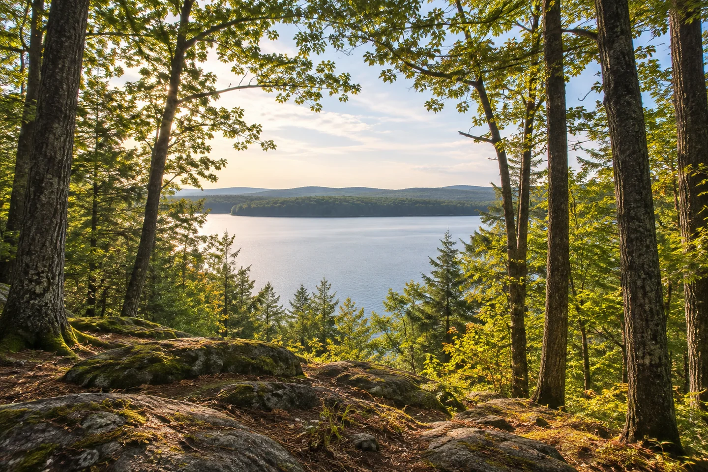
During the walk, give attention to relationships rather than a checklist. Compare a view toward water with the surrounding forest, notice how the ground changes, and keep boots on the intended route through wet sections. A photograph can pair the enclosed trunks with an opening toward the pond without approaching a fragile margin. Leave utility structures and closed areas outside the exploration plan. Carleton rewards a considered visit: a chance to walk beside a protected water source while understanding why the landscape's public use comes with a specific, continuing responsibility.
Fun facts
- The pond has a history as a community drinking-water source.
- A 2023 university field-tour program included brown-ash conservation at Carleton.
Before you go
- Obtain the current town map and confirm entry arrangements.
- Prepare for relief and wet ground on the designated trail.
- Do not infer boating or swimming permission from walking access.
Capture
- Pair the surrounding forest with an opening toward the pond, keeping to the intended walking route.
 Tyler Pond Wildlife Management Area
 George Bucknam Wildlife Management Area
 Hathaway Mill and Creative Center
Social
A watershed walk can make a familiar resource more tangible.
Carleton’s forest has a continuing role in protecting community water.
A defined walking route does not open every part of a utility property.
The town guide describes a challenging loop with relief and wet ground.
An educational field tour connected forest management with brown-ash conservation.
Respect closed areas and the owner’s posted arrangements.
Let the landscape’s purpose shape the pace of the walk.
What would you notice differently beside a community water supply?
Hashtags