 Cre8Travel
CRE8TRAVEL · MAINE PLACES
Shad Pond
Shad Pond: A Small Waterbody with a River-Sized Story
Discover
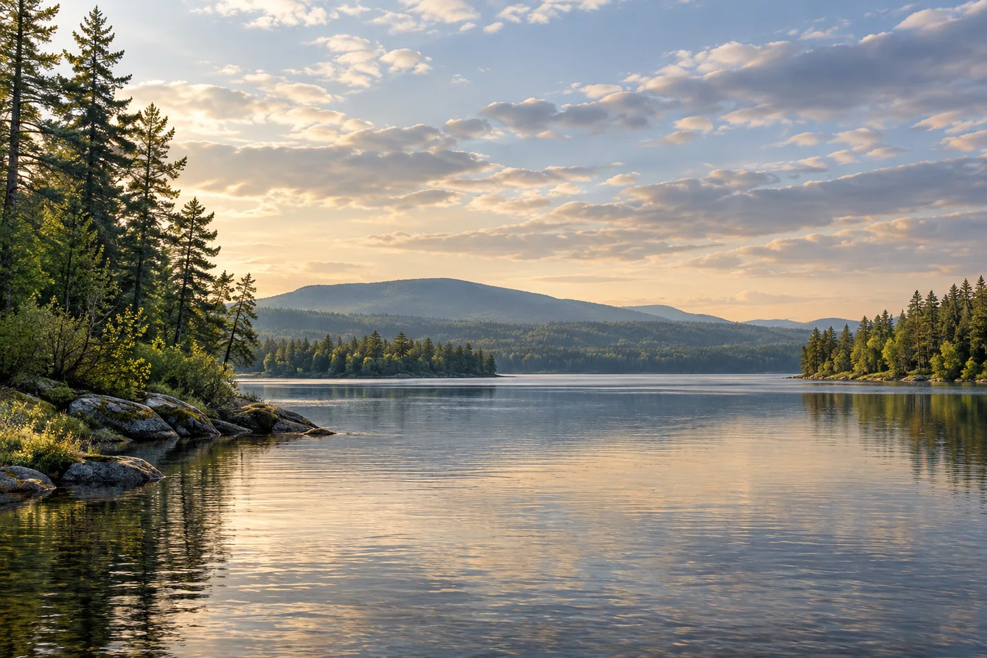
Shad Pond is a widening of the West Branch Penobscot near the mouth of Millinocket Stream, with a name that points beyond the view in front of a boat. It belongs to a connected river landscape rather than an isolated bowl of water. A visit can combine a carefully chosen paddle with an interest in fish migration, old travel routes and the people whose knowledge made journeys through this country possible.
Begin the practical planning in Millinocket. The regional chamber describes a put-in at Crandall Park on Congress Street and a downstream connection toward Shad Pond. The town identifies Crandall among its parks beside Millinocket Stream. Establish the exact route, return plan and present conditions before launching; the wider network contains both flatwater and rapids. A description linking two places is not enough to establish that every intervening reach suits a particular boat or paddler. Use a qualified local outfitter if the river sections are unfamiliar.
The name has ecological significance. Maine Sea Grant's historical account places American shad far up the Penobscot system, including the West Branch at Shad Pond. These fish move between salt and fresh water during their lives. Their presence in historical records makes the pond a useful place to think about the connection between inland waters and the sea. It does not establish a current run or promise a fish sighting during a recreational visit.
The same Sea Grant article explains how dams disrupted shad migration and describes river-restoration work completed by 2016. This is a larger watershed story rather than evidence that every upstream barrier has disappeared. Look at a map of the river network before the outing and trace how the branches join. The exercise changes the scale of a seemingly modest pond: a local stretch of water becomes part of a much longer biological journey, with its future tied to conditions well beyond its banks.
A much earlier visitor left an unusually vivid description. Assistant geologist James T. Hodge's travel report, printed in Maine's 1838 public documents, recalls passing through flowering buckbean on Shad Pond before ascending Millinocket Stream. His party then transported a loaded boat overland on an ox sled. The account preserves both a botanical impression and the considerable labor involved in moving through the river country. Its flowering scene belongs to that historical journey, rather than a seasonal display promised to visitors today.
The modern lake database identifies Shad Pond with Millinocket and the West Branch landscape. Use the exact waterbody when comparing maps: neighboring lakes and river expansions are close enough that an appealing photograph or fishing report can easily describe another place. Let the connected geography guide questions rather than encourage an improvised through trip. A short, well-understood outing offers more room to notice the transition between narrow stream and broader water than a hurried attempt to link every feature on the map.
For photographs, look for that change in scale: a close water edge leading the eye toward a wider opening. Keep the camera packed when navigation needs attention, and avoid treating shorelines as unrestricted landing places. Shad Pond's appeal lies in a combination of water, memory and connection. Its migratory-fish name and the old geologist's flowers can accompany a present-day visit without requiring the landscape to repeat either historical scene.
Fun facts
- Historical records place American shad at Shad Pond on the West Branch.
- An 1838 publication preserves James T. Hodge’s description of flowering buckbean here.
- The pond lies near the meeting of Millinocket Stream and the West Branch.
Before you go
- Research the downstream route and return before using the Crandall Park put-in.
- Seek local outfitter advice when unfamiliar with river sections.
- Keep historic fish records separate from present-day sighting expectations.
- Use exact waterbody names when checking maps and rules.
Visitor perspectives
- James T. Hodge’s historical travel report recalls flowering buckbean on Shad Pond and the labor of moving a loaded boat onward by ox sled.
Capture
- From a stable permitted position, frame the transition from narrow water to a broader opening.
- Put the camera away when river navigation needs attention.
 Dolby Pond
 Vanceboro Historical Society
 Todd Wildlife Sanctuary
Social
Shad Pond’s name opens a story about migratory fish and the Penobscot watershed.
A river-connected pond rewards a look at the wider map before an outing.
Historical fish records do not guarantee a present-day sighting.
An old travel account remembered flowers as well as the labor of carrying boats.
Build a river outing around the group’s knowledge and the day’s conditions.
A planned return is part of choosing a good paddle.
Photograph the transition in water scale from a stable permitted position.
Would you explore this landscape through its fish history, its travel stories or a map?
Hashtags