 Cre8Travel
CRE8TRAVEL · MAINE PLACES
Rainbow Lake
Rainbow Lake: Give the Water Time After the Walk
Discover
Rainbow Lake is a substantial destination within the Debsconeag backcountry, with enough water and ecological character to reward a visit centered on the lake itself. Reaching its shore on foot changes the pace of arrival. Trees, smaller waters and the weight of what has been carried give way to a much broader scene. Plan for that transition as a demanding backcountry outing, with the lake pause given room in the day rather than added as an afterthought.
The Nature Conservancy identifies the Blue Trail from the Golden Road trailhead as a public approach ending at Rainbow. Use the manager's current map to distinguish the lake spur from the surrounding loop routes and allow for substantial terrain and a return journey. Decide whether the purpose is to reach an authorized shore viewpoint or to organize a more involved overnight or paddling visit. Those plans require different equipment and preparation. Carry the information needed to navigate without relying on a phone connection.
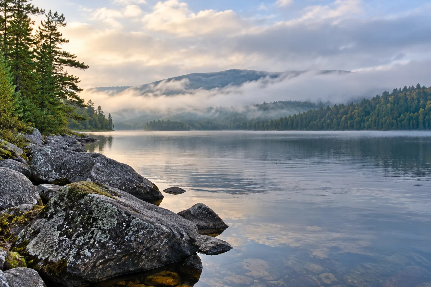
The lake's scale becomes clearer in the compiled Lakes of Maine profile. It reports a basin of more than sixteen hundred acres and a maximum depth of 130 feet. A hiker arriving at one cove is seeing only a part of a large, irregular waterbody. Let that partial view be enough. A foreground rock, a band of water and the wooded distance can convey the lake without requiring an attempt to reach every shoreline feature.
A state fisheries survey from 1959 describes deep, cold water, limited inflow after spring runoff and granite boulders and gravel along the edge. These observations provide a physical explanation for the landscape's distinctive texture. They also connect the visible shore with the basin's low fertility. The account belongs to its historical survey, so clarity or temperature should not be treated as fixed conditions or a water-use clearance for a current visit.
The survey also discusses small tributaries and springs in relation to brook-trout reproduction. Those modest features can matter within a large body of water, giving a small inlet significance beyond its size. Use the ecological context to sharpen attention while leaving habitat undisturbed. Present fishing rules and contemporary species information need separate checking; an old survey's species list and management recommendations cannot establish the full situation today.
Two original accounts show different ways of encountering Rainbow. Carey Kish's 2025 hiking column highlights the Appalachian Trail along its southern shore and the lake's place among the area's long views. Nelson Brown's 2025 packrafting narrative describes returning in fog, with the opposite shore hidden. Read the second account for its changing impressions rather than as a navigation method to copy. Between them, the lake can be appreciated as both a broad landscape and a place whose immediate appearance depends strongly on weather.
For a shore visit, make a little time for deliberate observation before beginning the walk back. Record a line of boulders, the boundary between reflection and open sky, or a change in wind across the water. Keep the camera within the limits of a secure permitted position. Any overnight plan should follow the manager's designated-site guidance, and private camps remain outside the public visit. Rainbow's appeal is more than a distant panorama: it lies in arriving prepared, recognizing the depth behind the visible surface and giving a remote lake enough attention to become a place rather than a name.
Fun facts
- The compiled profile reports a maximum depth of 130 feet.
- The Blue Trail provides a public walking approach to the lake.
- Historical fisheries work connects small inlets and springs with trout reproduction.
Before you go
- Use the current land-manager map for the exact lake approach and return.
- Prepare separately for a shore walk, overnight stay or paddling visit.
- Follow designated-site guidance for any camping.
- Keep private camps and habitat margins outside the landing plan.
Visitor perspectives
- Carey Kish’s 2025 hiking column highlights the Appalachian Trail beside Rainbow Lake and its broad landscape setting.
- Nelson Brown’s 2025 personal packrafting account recalls returning to Rainbow in fog that hid the opposite shore.
Capture
- From secure permitted shore, contrast boulder texture with open water.
- Let the actual weather determine the image instead of depending on a promised panorama.
 Harrington Lake
 Ragged Lake
 First and Second Musquacook Lakes
Social
Rainbow Lake rewards time devoted to the water after the walk.
An arrival at one cove reveals only part of a substantial lake.
A current route map belongs in the plan before setting out.
Granite shore textures connect the visible scene with an older ecological account.
Small habitat features can matter within a large waterbody.
Different weather can make the same lake feel quite different.
Choose a secure viewpoint and make room for a careful shore pause.
Would you record the lake in a photograph, a sketch or a few lines of notes?
Hashtags