 Cre8Travel
CRE8TRAVEL · MAINE PLACES
Harrington Lake
Harrington Lake: Deep Water and a Changing Fishery Story
Discover
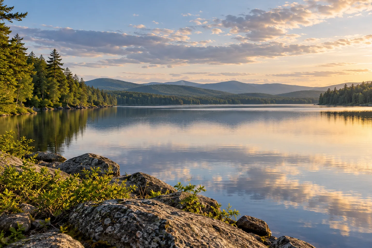
Harrington Lake brings a deep-water landscape to the forest country west of Baxter State Park. It is worth distinguishing from the smaller Harrington Pond nearby and from Canada's better-known lake of the same name. The Maine lake offers a focused water outing with an unusually current fisheries-management story. A visitor can arrive with a camera or a properly researched angling plan, while remaining interested in what happens beneath the surface and at the outlet.
The state's regional fishing guide identifies an improved boat approach from Telos Road. Confirm the actual entrance, road conditions and facility suitability before traveling, then choose an outing that returns to that authorized access. Prepare gear clear of the launching space and leave room for other users. A named approach is the beginning of organizing the day: the craft, weather and experience of everyone aboard still determine how much water it makes sense to cover.
The Lakes of Maine profile gives a useful measure of the basin's scale, reporting a maximum depth of 134 feet. Its classified coldwater fishery has a physical setting quite different from the shallow ponds nearby. A map of depth can enrich the view even for someone who never fishes. Imagine the contrast between a visible shore edge and water extending far below it, without treating a generalized lake profile as a navigation chart or a promise about today's conditions.
The surrounding landscape is also more nuanced than a simple idea of untouched woods. The same compiled profile identifies mostly natural cover in the lake's buffer, alongside a smaller developed component. That combination is familiar to many Maine lakes: valued habitat and human use occupying the same setting. It gives shoreline care an immediate purpose. Keep plants and animals undisturbed, clean equipment between waters and use established access rather than convenient-looking private edges.
At the outlet, recent management has added another chapter. In June 2025, Maine's fisheries advisory-council minutes described a fishway installed at Harrington in 2024, following earlier water-level management associated with a hydropower settlement. Those details show a lake still being actively considered as part of a connected water system. They also make current research worthwhile before an angling visit. Consult the present rules and posted boundaries directly; an account of a proposal or a favorite old fishing pool cannot establish what is permitted now.
An older Tripadvisor forum reply by CountyMounty contributes a personal perspective. The writer recalled staying at the Harrington Lake campground and praised its beautiful setting, while observing that popular periods could bring competition for space. The post is historical, with its operational details belonging to that time. Its lasting value is the impression of a place that invited a return, rather than a current assurance about camping access or availability. Arrange any overnight stay through present authoritative information.
For the day itself, choose one clear purpose and leave space around it. A short stretch of appropriate paddling can be paired with time to watch water patterns from an authorized shore position. Take one broad photograph, then look for a smaller composition that conveys depth through foreground and reflection. A notebook can hold the questions a photograph cannot answer: how fish move, how the lake is managed and how the wooded edge is cared for. Harrington rewards that combination of a straightforward outdoor visit and curiosity about an actively changing water landscape.
Fun facts
- The compiled lake profile reports a maximum depth of 134 feet.
- State meeting records describe a fishway installed in 2024.
- This is Harrington Lake in Piscataquis County, distinct from nearby Harrington Pond.
Before you go
- Confirm the improved Telos Road boat approach before departure.
- Check current fishing rules and outlet boundaries directly.
- Use current authoritative information for any overnight arrangement.
- Keep shoreline plants and private edges outside the landing plan.
Visitor perspectives
- In a historical Tripadvisor forum reply, CountyMounty recalled a stay at Harrington Lake campground, admired its setting and noted competition for space in popular periods.
Capture
- From authorized shore, compare a broad reflection with a close foreground composition.
- Keep a notebook of questions about the lake alongside the photographs.
 Umbazooksus Lake
 Rainbow Lake
 Ragged Lake
Social
Harrington Lake offers a deep-water setting west of Baxter country.
Resolve the correct lake before following a map result.
An authorized launch is the beginning of organizing a good outing.
Depth can add an unseen dimension to an ordinary shoreline view.
Recent fisheries work gives this landscape a continuing story.
Old campground impressions can inspire questions rather than settle present arrangements.
Choose one clear purpose and leave room to observe.
Would you arrive with a camera, a notebook or an independently researched fishing plan?
Hashtags