 Cre8Travel
CRE8TRAVEL · MAINE PLACES
Plymouth Pond
Plymouth Pond: From Roadside Water to Quiet Wetland
Discover
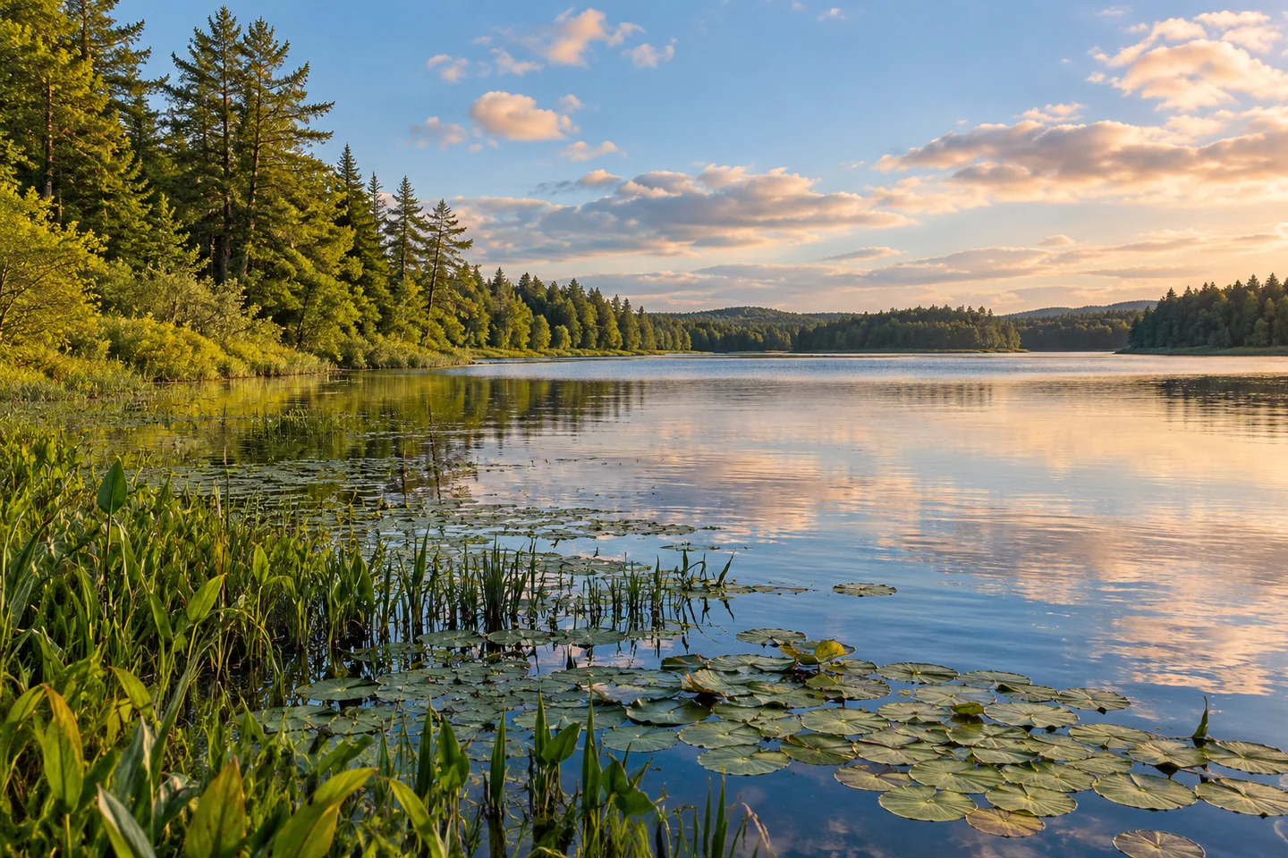
Plymouth Pond makes an interesting transition from a roadside landmark to a watery landscape of marsh and trees. The town’s comprehensive plan describes 480 acres of shallow water, with shrub wetlands along the northern and southern shores and forested wetland toward the east. A visit becomes more rewarding when those edges are the subject of attention. Choose a manageable section, notice how the shoreline changes and let the pond’s modest details set the pace.
The long road crossing has a history of its own. Plymouth’s town history records Parker Eaton’s 1824 floating bridge as the predecessor of the Route 7 crossing. That connection between settlement, travel and water is still a useful way to understand the scene. The public launch makes the pond available for boating, while much of the shore remains privately owned. Keep your land-based preparations at the designated access.
Michael Perry’s published 2010 canoe account illustrates the contrast particularly well. Beginning near the Route 7 causeway, his party followed the northern shoreline eastward, gradually leaving traffic sounds for forest and marsh. He described pickerelweed and lily pads, then a narrower passage lined by cedar, alder and silver maple. The outing offered both open pond views and a much more enclosed perspective from the canoe.
Perry also recorded a lively encounter in which red-winged blackbirds chased a much larger heron. Such a moment helps explain why a short outing can feel eventful. His wildlife observations belong to that particular trip; take them as an invitation to watch patiently rather than a list of animals the pond owes its next visitor.
A more recent perspective comes from Registered Maine Guide Amanda Page, interviewed for a 2025 paddling feature. She recommended Plymouth Pond to beginning kayakers because of its shallow, relatively contained character. Her description distinguishes the pond’s two areas, divided by the causeway, and the marshier water beyond the bridge. That is a useful starting point for discussing an outing with a guide and choosing a scale suited to your experience.
Treat that recommendation as the beginning of planning. Look at the actual wind and water, identify your return point and decide whether exploring one area will be enough. Page’s leisurely outing suggestion leaves time to notice birds and shoreline detail. There is no need to make a short-distance paddle feel like a race, or to regard every possible passage as something that must be attempted.
The pleasures here are cumulative. A broad view from the road, the edge of a wetland and a stand of trees leaning toward the water each reveal a different aspect of the same place. Pause long enough for the initial impression to change. If the most memorable part of the day is something small that would have been missed at a faster pace, the outing has done its work.
Finish with a deliberate return rather than a hurried final crossing. Leave energy and time for loading, check that everyone has their belongings and consider which part of the landscape held your attention longest. A familiar-looking pond can become much less ordinary once you have given it a few unhurried hours.
Fun facts
- The Route 7 crossing traces its history to an 1824 floating bridge.
- A causeway divides the pond into two areas.
Before you go
- Use the public launch and respect the privately owned shoreline.
- Discuss the route and present conditions with a guide if you are new to paddling.
- Leave time for the return and loading.
Visitor perspectives
- Michael Perry described leaving causeway traffic sounds behind for tree-lined water and watching blackbirds chase a heron.
Capture
- Look for the contrast between open pond and the enclosed tree-lined water described by Perry.
 Upper and Lower Mattawamkeag Lakes
 Corundel Lake
 The Octagon House
Social
Plymouth Pond brings wetland edges into a roadside landscape.
Its road crossing has roots in an 1824 floating bridge.
Perry’s canoe account moves from traffic sounds into forest and marsh.
Amanda Page recommends a leisurely approach for beginning paddlers.
The causeway creates two different areas to consider.
Choose one shoreline detail and give it time.
A manageable route can leave more room for observation.
Return with enough energy to enjoy the end of the outing.
Hashtags