 Cre8Travel
CRE8TRAVEL · MAINE PLACES
Pleasant Pond
Pleasant Pond: Deep Water and Community Access
Discover
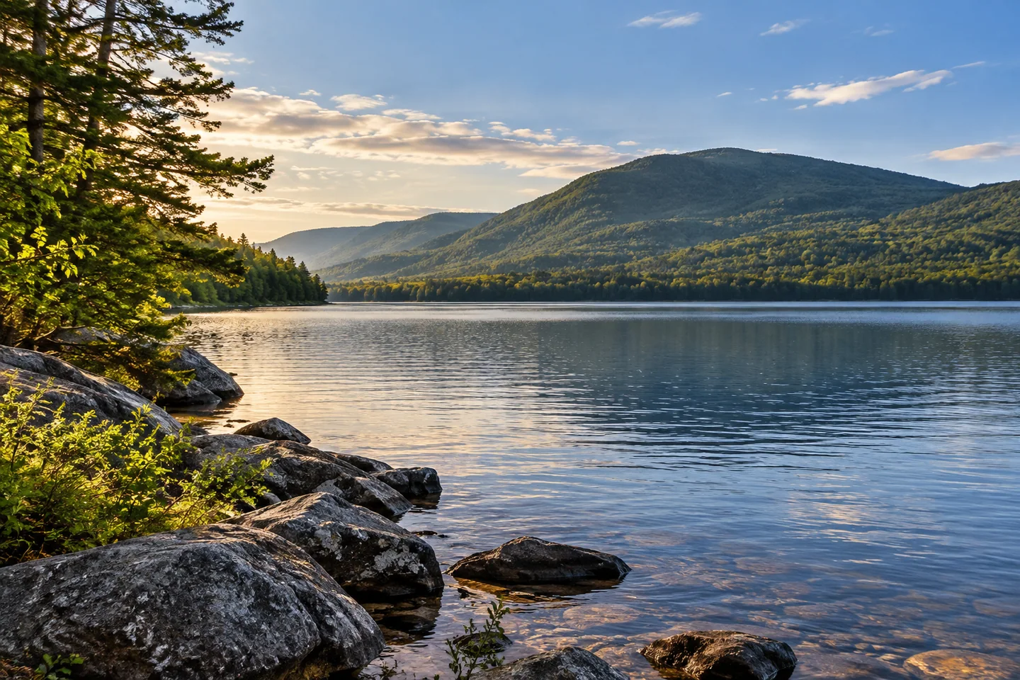
Pleasant Pond near Caratunk offers a lake outing beside Pleasant Pond Mountain, with a surprisingly deep basin beneath its unassuming name. The state’s survey records a maximum depth of 198 feet and describes small inlets entering along its northern and southern shores. Pleasant Pond Stream carries the outlet west toward the Kennebec. For a visitor, that geography provides a useful starting point: a mountain-framed lake is also part of a larger connected watershed.
Access requires an arrangement with the people who operate the boat launch. The Pleasant Pond Protective Association maintains the site through volunteers and asks visitors to call the listed contacts to be admitted and let out. Confirm the seasonal schedule and a workable return time before traveling, because a volunteer-operated entrance cannot be assumed available on arrival. Frequent visitors can ask the association about membership and a key. This is a practical part of the outing, rather than a detail to leave until the boat is loaded.
The association’s Forever Access campaign explains why the entrance deserves attention beyond its immediate convenience. Launched at the 2025 membership meeting, the campaign seeks to buy the existing launch property and secure long-term access for members and the wider community. Its aims connect recreation with conservation management, including preventing invasive plants. Think of the campaign as evidence of the effort required to keep a useful entrance available, and ask the association for the latest arrangements when planning a visit.
Looking beyond access, the association’s mission includes watershed protection, education, water-quality monitoring and management of the outlet dam. Its volunteer organization assigns separate responsibilities for the launch, fisheries, dam and water quality. The structure shows how many different tasks can sit behind a pleasant day on a lake. Some concern a visitor’s immediate arrival; others involve repeated observations and decisions whose effects extend across seasons. A shared water body depends on both kinds of attention.
The historical fisheries survey helps explain what that attention is protecting. It describes coldwater habitat and shoreline areas used by lake trout and brook trout for reproduction, while distinguishing naturally sustained lake trout from supplemented brook trout. These are details of the pond’s fisheries history, not a prediction for an individual fishing trip. They make the shore more than scenery: it forms part of the habitat supporting life beneath the surface, with a different significance from the open water farther out.
A 2021 Appalachian Trail journal published on Lapiz Luz provides a contrasting shore-level impression. The writer paused at Pleasant Pond with fellow hikers and noticed boats, houses and people enjoying a lively Saturday, after quieter and more remote ponds earlier in the journey. That night brought memorable loon calls. The account captures two moods of the same place and encourages realistic expectations: a lake can belong to an active local community while still offering moments that feel personal and unhurried.
Choose a water outing that suits your group, and let the lake set its own pace once the access arrangements are settled. A satisfying visit can combine enjoyment of the setting with an appreciation of the people who keep that relationship between public recreation and private shoreline working.
Fun facts
- The state survey records a maximum depth of 198 feet.
Before you go
- Contact launch volunteers in advance and confirm both entry and return arrangements.
- Check current fishing regulations before planning to fish.
Visitor perspectives
- The trail journal contrasts Pleasant Pond’s lively boats and shores with quieter remote ponds, and remembers loon calls during the night.
Capture
- Compose a shoreline photograph that leaves neighboring camps and visitors their privacy.
 Brassua Lake
 Lower Wilson Pond
 Pemadumcook Chain of Lakes
Social
Pleasant Pond’s outlet flows toward the Kennebec River.
Public boat access depends on arrangements with launch volunteers.
The Forever Access campaign seeks to secure the existing launch property.
The association’s volunteers divide responsibilities for fisheries, water quality and the dam.
A 2021 hiking journal recalls a lively Saturday at Pleasant Pond.
The same journal remembers loon calls during the night.
A lake visit starts with a clear plan for returning.
Leave time for the shore to become more than a departure point.
Hashtags