 Cre8Travel
CRE8TRAVEL · MAINE PLACES
Mill Island Park
Mill Island Park: A River Walk through an Industrial Past
Discover
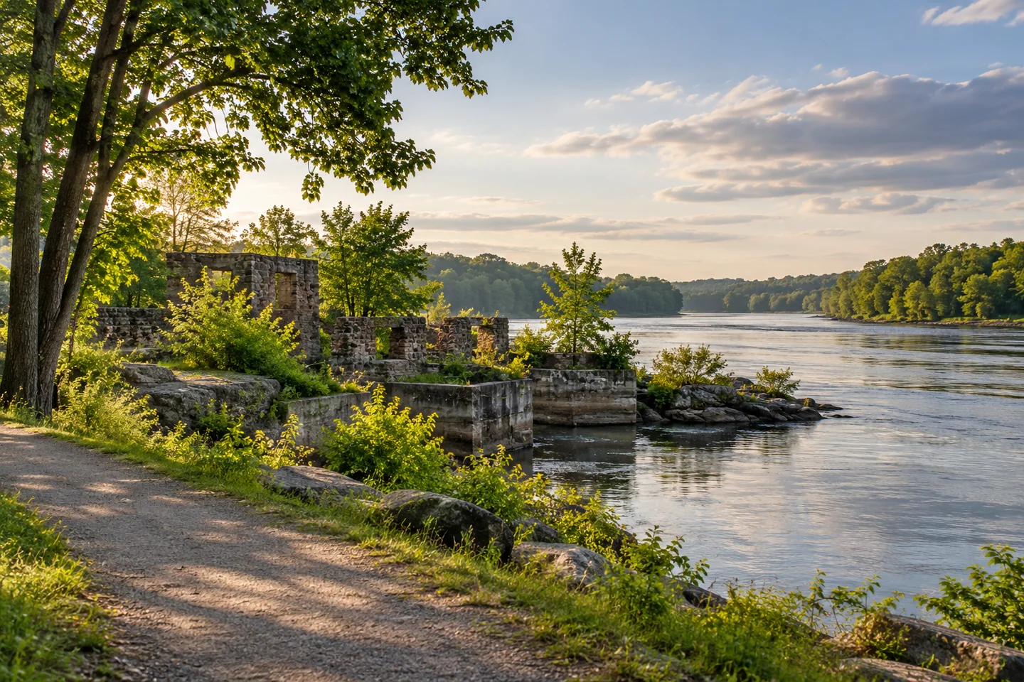
Mill Island Park in Fairfield turns a former industrial island into a place for a short walk beside the Kennebec River. Kennebec Messalonskee Trails describes a perimeter route with river views and glimpses of factory ruins, alongside play and picnic space. Arrive from Bridge Street onto Island Avenue, then choose a walk that suits the group.
Rebecca Goldfine's original account finds the short outing particularly absorbing because its industrial history remains visible. She describes passing through a meadow and woods before reaching the island point and a wider river view. That sequence gives the destination more than one scale: open ground near the beginning, a closer wooded passage, and the movement of the river beyond. A half-mile walk need not feel slight when each part changes what you can see.
Enock Glidden's July 2024 visit offers a more detailed account of moving through that landscape in a wheelchair. Crossing the lawn brought his group to the paved section, followed by broader hard-packed ground. Near the river viewpoint, however, the grade and softer surface made pushing more difficult. He continued with assistance, finding a narrower section beyond the outlook challenging enough to require help backing through it.
The manager-provided trail description also distinguishes easier initial surfaces from steeper, sandier ground around the point. Use its access map to choose an appropriate section, and check current conditions before relying on a particular surface. The same listing credits local dentist Steve Kierstead with the trail idea, Fairfield public works crews with construction, and donated materials with helping make it possible. Today's short recreational walk is itself a product of community effort.
Glidden enjoys the possibility of exploring farther, while also recognizing the viewpoint as a sensible place to turn around for a less demanding outing. His account makes that choice feel purposeful rather than incomplete. A visitor can experience the park through a selected section and still appreciate its river setting, with distance adjusted to the day and the support available.
The Central Maine Growth Council's account of a development plan approved in December 2023 shows the park continuing to evolve. Public meetings and community exercises considered recreation, historical features, education, maintenance, and connections with downtown. These were strategies for phased implementation, not a catalogue of finished additions. They help explain how a small island park can become part of a town's wider discussion about its waterfront.
For an organized occasion, the town directs people to contact its office about reserving the gazebo or other space in the park. A casual walk and a planned gathering therefore involve different arrangements. Leave room for other users and any scheduled activity, allowing a picnic, a river view, and a historical interest to coexist without each needing a separate destination.
For photographs, place a visible industrial remnant within the wider setting before focusing on a detail from the public path. Avoid climbing into ruins to improve the angle. A caption explaining what prompted your attention can carry the history more clearly than an image alone, particularly when the day's most striking contrast is between an old foundation and the living river beside it.
Fun facts
- The trail description credits public works crews and donated materials with helping create the walk.
Before you go
- Use the access map to distinguish easier surfaces from the steeper ground near the point.
- Contact the town before planning an organized gathering.
Visitor perspectives
- Goldfine finds the short walk absorbing, with a meadow, woods, mill ruins, and wide views from the island point.
- Glidden enjoys exploring the park but encounters softer, steeper ground near the viewpoint and needs help on a narrower section beyond it.
Capture
- Frame industrial traces from the public path without entering or climbing ruins.
 Fort St. Georges Historic Site
 Mill Park, Augusta
 Readfield Fairgrounds Community Park
Social
Mill Island’s public paths look toward the Kennebec River and an industrial past.
Goldfine enjoys the sequence from meadow to woods to the river point.
Glidden’s wheelchair visit finds changing surfaces and a challenging slope near the viewpoint.
A local idea, public work, and donated materials helped establish the trail.
Community planning considers the park’s links with downtown Fairfield.
A chosen section can make a complete outing.
Let the setting explain why a small remnant caught your eye.
Compare the river’s movement with the structures left beside it.
Hashtags