 Cre8Travel
CRE8TRAVEL · MAINE PLACES
Readfield Fairgrounds Community Park
Readfield Fairgrounds: Follow a Loop through Fields and History
Discover
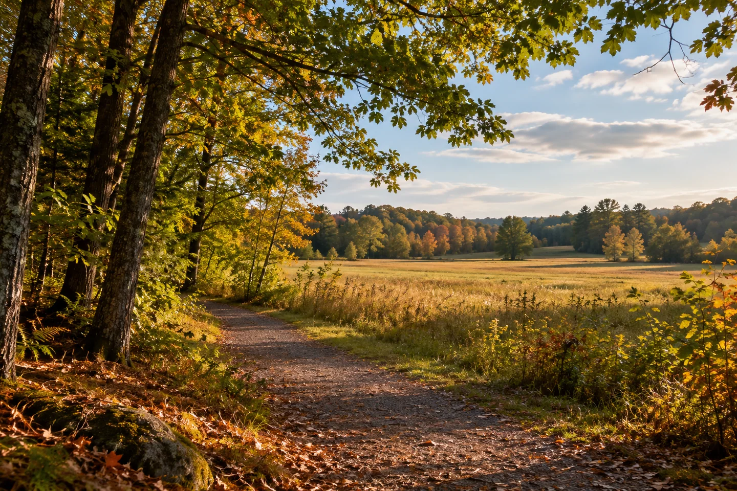
Readfield Fairgrounds offers a network through fields and woods where the history of a former agricultural fair meets everyday recreation. The town-provided trail description names the McDougald, Upper Fairgrounds, and Lower Fairgrounds routes, with connections allowing a choice of loops. Begin from the designated Church Road entrance and choose the walk that suits the group. Consult current notices before setting out, particularly where recreation improvements or nearby activities affect the usual approach.
Dale Potter-Clark's account of an October 2012 history walk shows how much a familiar route can hold. The group followed the sidewalk from the town office into the fairgrounds, where trail stewards discussed the paths' development. Participants also shared stories and pictures of the earlier agricultural and Grange fairs. One walker brought childhood blue ribbons, giving a broad institutional history a small, tangible keepsake.
The town's community park page places that walking landscape within continuing civic decisions. Its account describes an initial baseball field and trails, an expanded parking area, and substantial volunteer contributions. A later proposal sought to balance recreation with keeping most of the property natural. Read proposed courts, utilities, and other additions as planning history unless their current completion is separately confirmed. Existing routes can provide the purpose of a visit without depending on future facilities.
Rebecca Goldfine's original trail account enjoys the transition between forest and fields. She notes the mixture of paved and gravel surfaces and the possibility of connecting with trails around Maranacook Community School. The appeal is partly that variety within a compact setting. A visitor can choose a manageable circuit, allowing a stretch of open ground to change the pace after a more enclosed passage among trees.
A separate original user account on Maine Trail Finder, posted by steveh in April 2026, appreciates the improved gravel walks and Church Road parking. The writer notices families with children and older walkers using the area, while distinguishing the more conventional woodland trails behind the school from the smoother fairgrounds routes. Keep that distinction in mind when choosing an extension; a connected network need not have uniform surfaces throughout.
Potter-Clark's history walk ended along Church Road, once part of the Memorial Day parade route. Participants remembered people who had lived there as well as the events associated with the fairgrounds. That approach suggests a way to deepen an independent outing: think about movement through the place, not only the view at a stopping point. A path can carry personal memories of celebration, work, or ordinary journeys between neighboring parts of town.
The community park proposal also makes cooperation visible. The town describes volunteers giving time and resources to the earlier work, with later planning bringing recreation and conservation interests into the same discussion. Those contributions help explain why a modest loop can feel like an important public resource. Enjoy the established walking space while leaving playing areas and any organized activity room to function.
For a record of the visit, compare a view across the fields with one from the wooded path. Then write down a question about the former fair or a detail that changed as you walked. A short circuit becomes easier to remember when its open and enclosed sections belong to one experience, rather than a list of distances completed.
Fun facts
- A participant in the 2012 history walk brought blue ribbons won at the fair as a child.
Before you go
- Check current notices and choose only the open route that fits your group.
- Distinguish the smoother fairgrounds paths from woodland extensions when planning.
Visitor perspectives
- Potter-Clark recalls stewards explaining the trails and participants sharing fair memories, including childhood blue ribbons.
- Goldfine enjoys the town route through forest and fields and notes its connection with the school’s trail network.
- steveh appreciates the improved gravel walks and Church Road parking, while distinguishing the rougher school woodland extensions.
Capture
- Compare an open field view with a more enclosed woodland frame.
 Mill Park, Augusta
 Whittier Woods
 Tim Pond and Wilderness Camps
Social
Named fairgrounds trails provide several ways to shape a town walk.
A history group shared fair memories and photographs during a 2012 visit.
Volunteer work helped establish recreation on the former fairgrounds.
Goldfine enjoys the changes between fields and woodland.
A connected path does not require every extension to be walked.
What does an ordinary route help you remember?
Let a small historical detail give shape to the day.
A short circuit can hold more than its distance suggests.
Hashtags