 Cre8Travel
CRE8TRAVEL · MAINE PLACES
Long, Caribou and Egg Ponds, Lincoln
Lincoln’s Connected Ponds: Water, Work and Shoreline Life
Discover
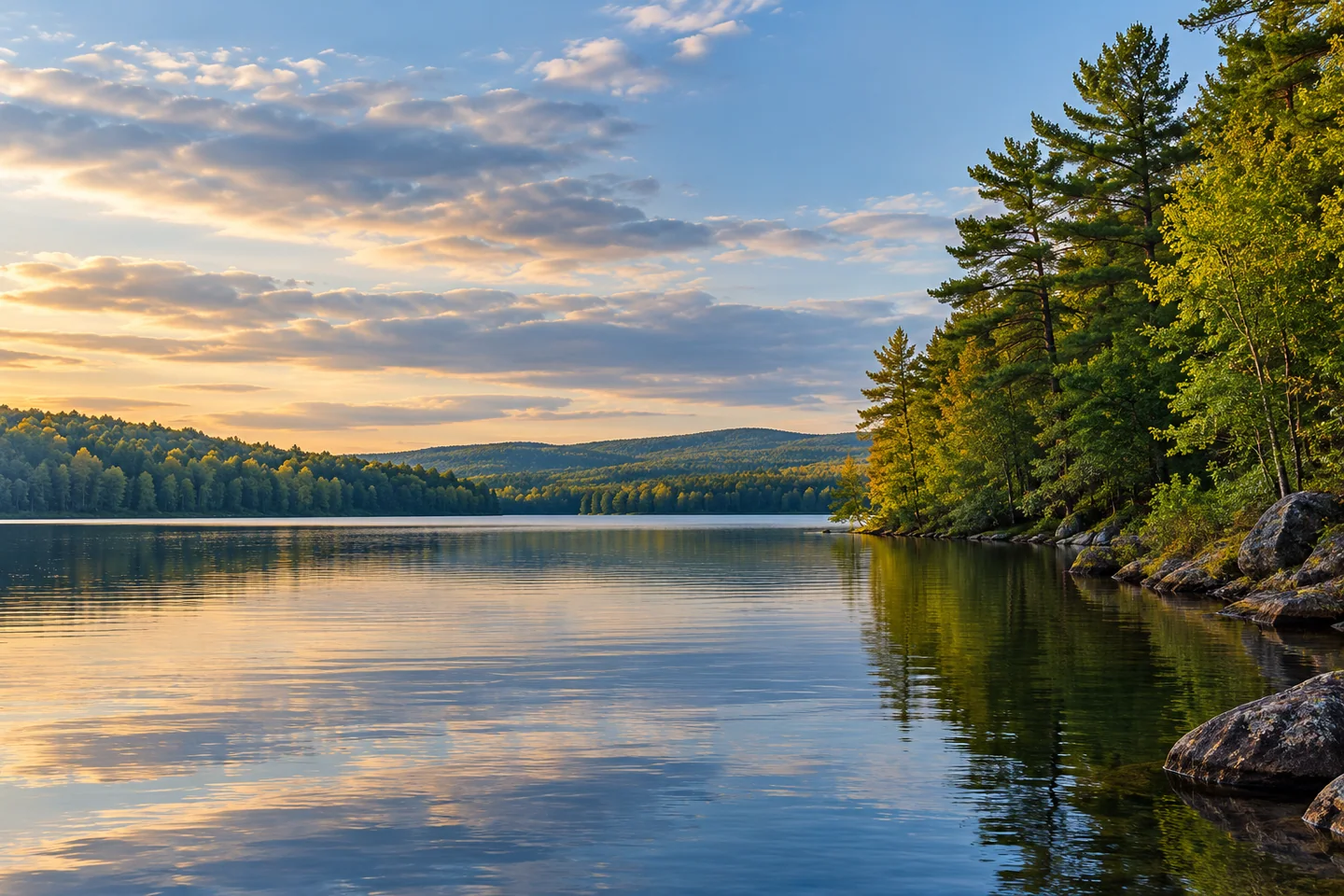
Long, Caribou and Egg ponds can be approached as one connected Lincoln lake outing. The town identifies a public launch at 360 Sweet Road. Choose the extent of the trip before setting out, leaving time and energy for the return rather than treating three names as a requirement to visit every shore. A connected system offers choices, but each additional reach is also water to cover again. Make the relationship between the ponds part of the interest, not a challenge to finish a circuit.
The town's 1928 history gives that relationship a distinctive shape. It places Caribou at the upper end of a chain, receiving Tobin Brook from the east and water from Egg Pond through a northwestern bay. Long Pond continues from Caribou but turns west. Those directions make the names easier to understand as parts of a flowing landscape. The historical account also records early sawmills at Long Pond's foot. A waterway used for recreation belonged to a working geography before it became the subject of today's lakefront photographs.
A later planning document follows the water farther. Lincoln's January 2012 draft comprehensive plan describes the chain draining through a dam at Long Pond's outlet toward Cambolasse and Snag ponds, then onward to the Penobscot River. It also identifies a largely forested watershed with shore homes, camps and some farmland, extending in small parts into Winn and Lee. This is dated planning evidence rather than a current dam-operation guide or a water-quality clearance. Its useful lesson is the connection between what appears beside the boat and a much wider drainage area. The lake's edges are inhabited and managed, not simply an unbroken forest backdrop.
Nick Sambides Jr.'s original September 2009 reporting gives that relationship a human-scale scene. He followed code-enforcement officer Jerry Davis inspecting the three ponds by boat, using a marked lot map, photographs and earlier images for comparison. The officer looked for shoreline changes such as erosion and removal of vegetation. Seeing from the water let him examine places that would have been much harder to reach one property at a time on land. The account is not a present inspection schedule or an invitation to investigate other people's camps. It shows how a familiar boating view can also provide evidence for caring for a shoreline.
That distinction is worth carrying into a recreational visit. A dock, clearing or pleasant bank can be noticed without being treated as a landing invitation. Remain within the permissions associated with the chosen public access and any separately arranged stop. Keep curiosity about shoreline history directed toward the landscape rather than close photographs of occupied homes. The same wooded margin can be part of someone's daily surroundings, a record of changing land use and the subject of a visitor's picture.
For a photograph, compare two scales from a stable position: a broad reach of water and a nearer bend where trees meet the bank. Let changing orientation reveal how a connected lake can feel enclosed in one place and more open in another. Do not make handling the camera compete with boat control. A rewarding day here can remain deliberately limited while bringing several layers into focus: the shape described by an old town history, the flow traced by planners and the continuing work of looking after a lived-in shore.
Fun facts
- An old town history describes Long Pond turning west from Caribou.
- The lake chain drains toward the Penobscot River.
Before you go
- Use the designated public entry and confirm present site conditions.
- Treat private docks and banks as separately permitted destinations.
- Choose a turning point that allows an unhurried return.
Capture
- From a stable position, compare a broad reach with a nearer wooded bend; leave occupied homes outside close compositions.
 Orrington Town Pound
 Fighting Black Bear Statue, Orono
 Big Lake
Social
Three connected pond names can belong to one considered Lincoln outing.
The public launch is on Sweet Road.
An old town history records sawmills at Long Pond’s foot.
A planning document follows the water toward the Penobscot.
Forest, camps and farmland share the wider watershed.
A 2009 boat inspection used photographs to understand shoreline change.
A view of a private dock does not provide permission to land.
Would you photograph the open reach or the point where trees meet water?
Hashtags