 Cre8Travel
CRE8TRAVEL · MAINE PLACES
Jordan Pond
Jordan Pond: Ice, Water and a Lasting Tradition
Discover
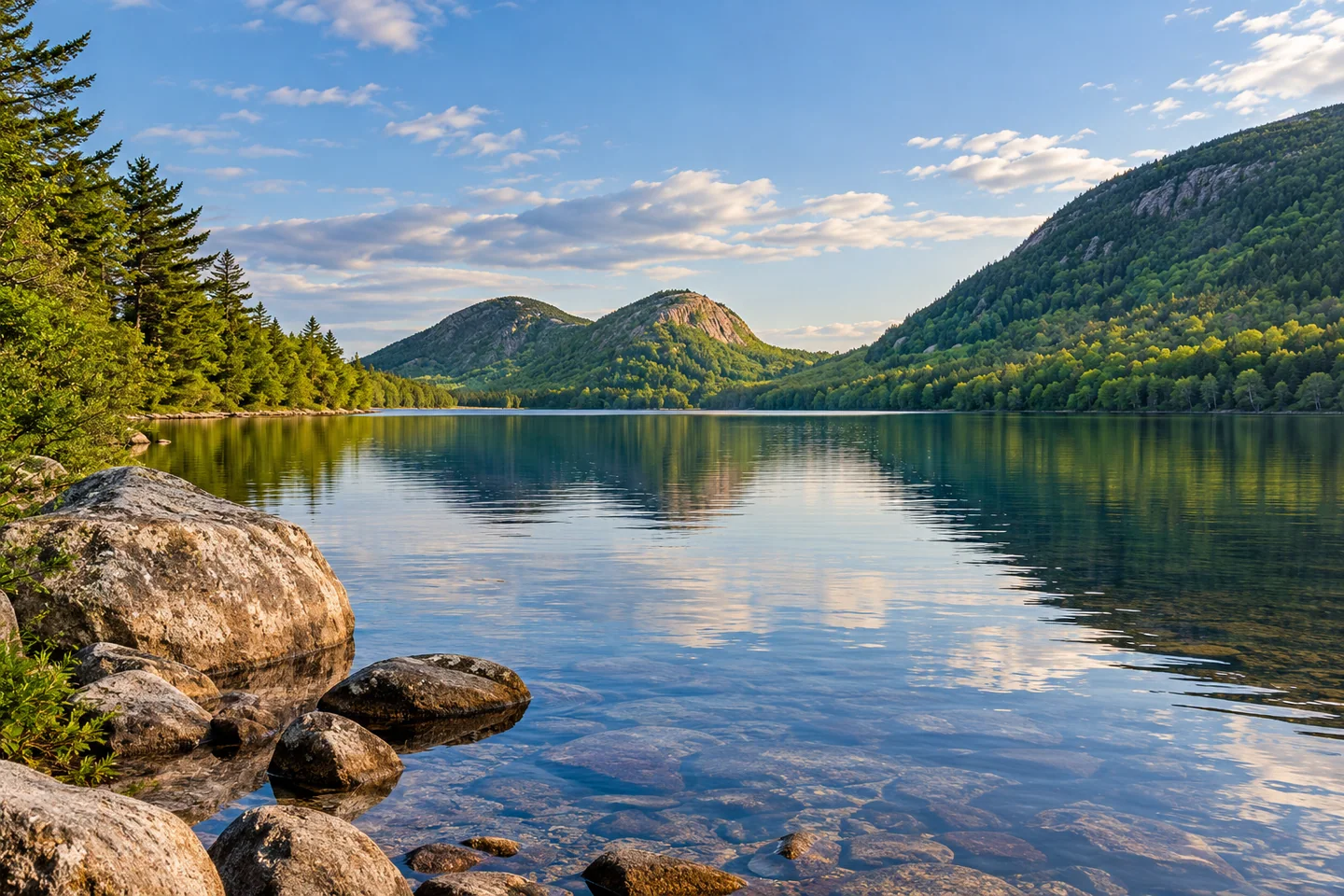
Jordan Pond's view toward North and South Bubble is only the beginning of what makes this Acadia lake distinctive. The National Park Service identifies a basin a hundred and fifty feet deep, the deepest lake in the park. It also supplies Seal Harbor's drinking water, so swimming is prohibited. An outing can be a considered shore visit rather than a full circuit or a boat trip. Use designated paths to protect vegetation, and consult the current watercraft restrictions before launching. The famous view and the practical water-supply role occupy the same place: scenic clarity should never be mistaken for permission to enter the water.
The shape of the scene has a geological explanation. In its geology-and-art activity, the park asks visitors to look for the U-shaped valley between Penobscot Mountain on the west and Pemetic Mountain on the east. Moving ice carved that broad form. As the glacier retreated, it left accumulations of rock, gravel and sand at its edge, forming a moraine. The Jordan Pond House lawn occupies that deposited material. Looking from the southern end therefore brings two linked processes into view: erosion that excavated the valley and deposition that helped hold water within it. The lake is more legible when the surrounding slopes and the ground underfoot are considered together, rather than treating the mountains as a decorative background.
Human history adds another sequence of changes along the southern shore. The restaurant operator traces the pond house's origins to an 1847 logging operation and a small mill. The Jordan family's farmhouse gave the pond and house their name. Thomas and Nellie McIntire helped establish the tea-and-popover tradition in the late nineteenth century. John D. Rockefeller Jr. purchased the property in 1928 and donated it to the National Park Service in 1940, while the McIntires continued operating the restaurant until retirement in 1945. A fire destroyed the earlier building in 1979; local nonprofit fundraising supported the replacement that reopened in 1982. The tradition has continuity, while the present building tells a story of reconstruction.
Natalie Ockey's original Utah's Adventure Family account, updated in September 2024, follows the shore with her children. She recalls the boys spotting frogs in June and enjoying bridges near the northern end. The changing footing became part of the family's experience: a broader eastern path gave way to rockier ground and a narrow raised log walkway on the western return. Her account particularly appreciated an outing that did not climb a mountain, but that preference is not a universal ease rating. Rocks and narrow walking surfaces deserve their own assessment. The family's attention also suggests a useful way to vary the visit: a small waterside observation can be as memorable as the familiar long view toward the Bubbles.
For a photograph from a designated viewpoint, give the nearer water a deliberate share of the frame and watch how the mountain outlines overlap. A second composition can concentrate on the meeting of shore texture and reflection. Keep the walkway free while making either image, particularly where other visitors need room to pass.
Fun facts
- The pond house lawn occupies a glacial moraine.
- The present pond house reopened in 1982 after the earlier building burned.
Before you go
- Do not swim in this drinking-water source.
- Assess rocks and narrow raised surfaces before committing to a full shore circuit.
Visitor perspectives
- Natalie Ockey recalled her boys spotting frogs, enjoying bridges and experiencing the contrast between a broad path, rocks and a narrow log walkway.
Capture
- From a designated shore viewpoint, compare a broad mountain-and-water composition with a tighter reflection study.
 Echo Lake on Mount Desert Island
 Bubble Pond
 Wabassus Lake
Social
Jordan Pond is Acadia’s deepest lake.
Swimming is prohibited because the pond supplies drinking water.
Its U-shaped valley records glacial erosion.
The pond house lawn rests on a glacial moraine.
The present building reopened in 1982.
A family account remembers frogs as well as mountain views.
Walking surfaces vary around the shore.
A near-water foreground can change a familiar mountain photograph. #Cre8Travel
Hashtags