 Cre8Travel
CRE8TRAVEL · MAINE PLACES
Bubble Pond
Bubble Pond: A Small Lake with Layered History
Discover
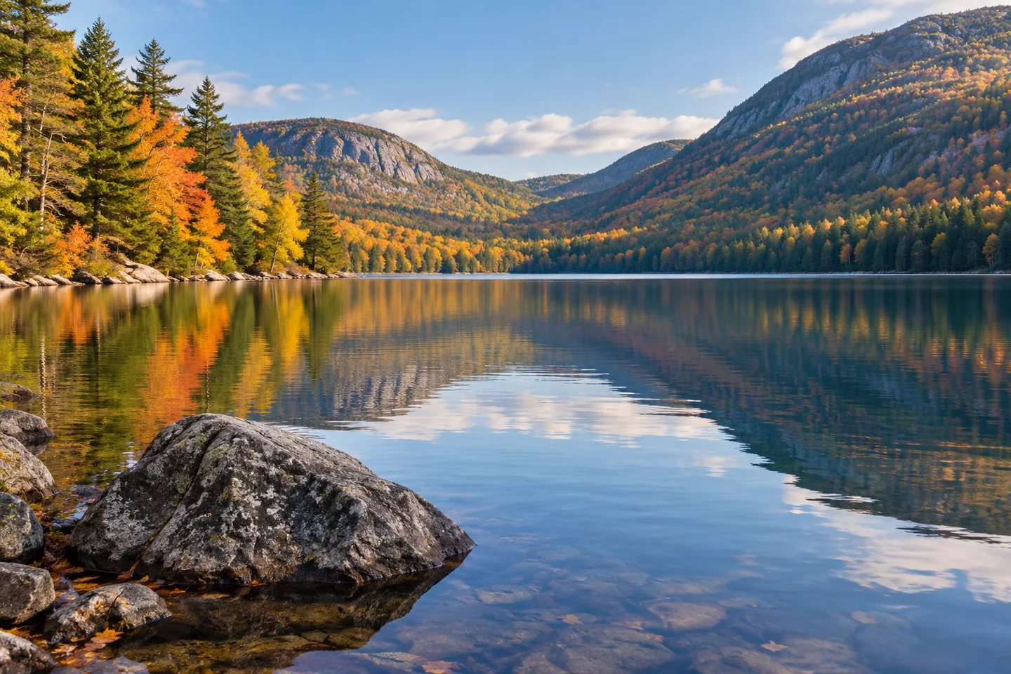
Bubble Pond can be approached as a shore visit in Acadia rather than another mountain ascent. The park's current carriage-road guidance identifies the pond beside Park Loop Road and describes a carriage road following its shore. Pedestrians share that road system with bicycles and horse-drawn carriages, so a lakeside pause should leave the traveled surface clear. Follow current signs at the access and choose a turning point suited to the outing. The water is the subject here; there is no need to convert the stop into a circuit of adjoining mountains.
The nearby Bubble Pond Bridge makes the approach more than a convenient place to leave a road. The National Park Service dates the bridge to 1928 and explains that it originally crossed part of the Jordan Pond–Eagle Lake motor road. That road section was abandoned after a realignment in the early 1960s. The bridge's design also involved disagreement. Architect William Welles Bosworth proposed a formal arch for John D. Rockefeller Jr., but park official Arno Cammerer objected that it looked too urban for the setting. A simpler rustic treatment prevailed. Engineer Paul D. Simpson prepared working drawings, and mason Pringle Borthwick built it. The resulting stone-faced arch records negotiation over how constructed infrastructure should belong within a protected landscape.
The park's historical Guide's Guide places the pond in a small glacial valley between Cadillac and Pemetic mountains. It notes that wind funneled between the slopes could complicate a paddle, despite the basin's apparently sheltered shape. The guide also describes an important alteration in the 1980s: lakeside parking was moved about two hundred feet away from the water to reduce runoff carrying oil and other vehicle pollutants. That history connects the visitor approach with the pond's role as a reservoir. It is an example of a less visible conservation decision, in which moving an everyday facility changed how people reached the shore while helping protect the water.
Current park boating guidance prohibits swimming and pets in Bubble Pond's water, as well as paddleboarding and internal-combustion engines. A shore photograph provides a way to enjoy the scene without entering this protected supply.
A Tripadvisor member writing as directorfantasies described two visits during October 2020 in a review published the following year. Fog gave one view a veiled quality; bright orange leaves and reflections drew attention on the return. The visitor also remembered a painter at work and a canoe near the shore, making the pond a place of several kinds of looking. Those details belong to that individual's visits. The account's pandemic-era parking arrangements are historical and should not guide present arrival plans. What remains useful is its interest in returning to the same small body of water under different light, rather than assuming one quick photograph exhausts the subject.
From the public shore route, try a composition with a small foreground rock and a generous area of reflected slope. Then remove the foreground from the frame and compare the quieter pattern of water and color. Make both photographs without blocking passing road users or stepping into the water.
Fun facts
- The neighboring bridge was built in 1928.
- Historical park guidance describes moving parking away from the shore in the 1980s.
Before you go
- Keep the shared carriage-road route clear when stopping.
- Do not swim or let pets enter Bubble Pond’s water.
Visitor perspectives
- The reviewer recalled fog on one October 2020 visit, then orange foliage, reflections, a painter and a canoe on another.
Capture
- From the public shore route, compare a foreground-rock composition with an uncluttered frame of water and reflected slope.
 Jordan Pond
 Wabassus Lake
 Pocumcus Lake
Social
Bubble Pond’s carriage road follows the shore.
The nearby bridge dates to 1928.
Its design reflects debate over a rustic park appearance.
The old motor-road alignment beneath the bridge was later abandoned.
Moving parking away from the water helped address runoff.
Swimming and pets in the water are prohibited.
One visitor remembered both fog and bright autumn reflections.
Two framings from the same shore can reveal different water patterns. #Cre8Travel
Hashtags