 Cre8Travel
CRE8TRAVEL · MAINE PLACES
Clear Lake, T10 R11
Clear Lake and a Changing Underwater Community
Discover
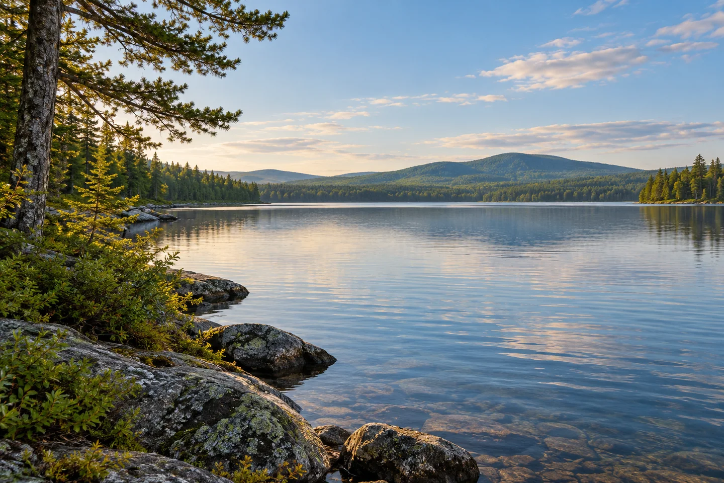
Clear Lake deserves a careful identity check before it deserves a place in an itinerary. This is the lake in T10 R11, Piscataquis County, within the North Maine Woods, rather than one of the many waters sharing its name. Its appeal combines a substantial coldwater basin with a particularly revealing scientific story. A shore-focused visit can make that story tangible: a forested setting above water whose fish community has changed within living memory.
North Maine Woods' 2026 brochure lists a designated Clear Lake camping area with vehicle access. Organize the road approach and camping arrangements directly with the manager before traveling. That listing establishes an authorized way to stay beside the lake; it does not advertise a public boat launch. Keep the visit centered on the permitted campsite and shoreline, and resolve any proposed boating access separately. Give the shore time after the arrival, rather than treating the camp merely as somewhere to sleep between other destinations.
The modern state lake map reports a maximum depth of eighty-six feet and identifies brook trout and lake trout among the principal fish species. It also maps contours that make the basin more interesting than an unbroken patch of blue. For someone looking from land, the chart offers a way to imagine the relief beneath the surface. Follow the shape with a finger, then return to the visible water. The map provides biological background and should not be used alone for navigation.
An August 1957 fisheries survey describes extensive rocky shoals and a large volume of cold water. It also records late-summer oxygen limitations in the deepest layer. Such observations reveal why depth and temperature cannot be interpreted in isolation. A lake may retain cold water while some of that water becomes less useful to fish. The report is a historical inspection, so its measurements and description of an abundant whitefish population belong to that period rather than a promise about the present.
The later whitefish story is more complicated. A state research report published in 2021 describes rainbow smelt becoming established during the 1990s, followed by a major decline in Clear Lake's whitefish fishery. The lake became an important study site, including an experimental hatchery effort using locally collected eggs. This conservation history gives the visible water an unexpectedly complex background.
That research also assessed spawning habitat. Small shoals could offer suitable material, while sediment reduced the value of other apparently promising places. Researchers examined eggs and young fish to understand reproduction rather than relying only on the presence of adults. The work gives a shore visitor a useful change of scale: modest patches of bottom can matter within an entire lake. Leave those places undisturbed and appreciate the investigation without turning its locations into a checklist to visit.
For the outing itself, bring a map and a notebook alongside the camera. From the authorized shore, try one broad view and one smaller composition of water and forest, keeping the position secure. Write down a question the scene raises, then compare it with the dated studies after returning. Contemporary fishing decisions require current information of their own. Clear Lake rewards this slower attention, allowing an ordinary lakeside pause to become an encounter with ecological change and the patient work of understanding it.
Fun facts
- The modern state map records a maximum depth of 86 feet.
- Clear Lake was included in a major state whitefish investigation published in 2021.
- The manager’s 2026 brochure lists a vehicle-access camping area.
Before you go
- Confirm the designated camping approach and registration with North Maine Woods.
- Treat the campsite listing as shore access; arrange any boating permission separately.
- Read older surveys as dated ecological observations.
- Leave shallow shoals and other sensitive habitat undisturbed.
Capture
- Frame water and forest from the authorized campsite shore.
- Use a secure position for a close composition of surface patterns.
 Bear Pond
 Coffeelos Pond
 Governor Brann Schoolhouse
Social
Clear Lake in T10 R11 is a distinct North Maine Woods destination.
A lakeside pause can reveal questions that a surface view cannot answer.
The modern state map records an 86-foot maximum depth.
A 2021 state study follows changes in the lake’s whitefish community.
Arrange the designated camping approach before the journey.
A campsite listing does not establish a public boat launch.
Pair a shore photograph with a notebook question about what lies beneath it.
How would learning a lake’s ecological history change the way you look at it?
Hashtags