 Cre8Travel
CRE8TRAVEL · MAINE PLACES
Bear Pond
Bear Pond in Waterford: A Mountain View at Water Level
Discover
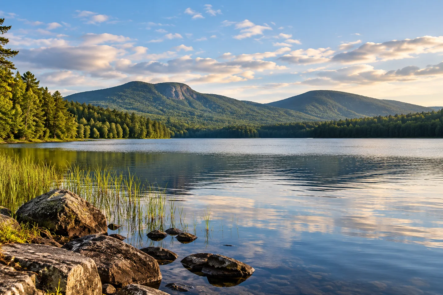
Bear Pond in Waterford places a mountain-framed lake view close to an established roadside arrival. The Lakes Environmental Association identifies the paved access on Route 35 along the eastern shore, noting its steep slope and limited roadside parking. Inspect the approach before unloading and keep the road and landing clear. This is the Waterford pond in Oxford County, separate from other Maine waters sharing the name. A manageable outing here can focus on how the surrounding heights change the feeling of a relatively small lake.
Michael Perry's September 2012 canoeing account describes Bear Mountain's cliffs rising beside the pond and Mount Tire'm presenting a different profile from the water than from neighboring Keoka Lake. He remembers a surprisingly serene outing despite nearby cottages and the road, with marsh plants, ducks, and turtles adding detail. Those are observations from his visit rather than a forecast of what you will encounter. The enduring idea is to look upward as well as across: the land above the water can be as important to the composition as the surface itself.
The older state fisheries description gives the lake another dimension. Revised in 1996, it records a deep basin and describes salmon and brook-trout reproduction in Mutiny Brook alongside the continuing role of stocking. Habitat and competition, rather than scenery alone, shaped those management decisions. Read that material as historical ecology, not today's stocking schedule or catch prediction. It is a reminder that a modest lake can hold different environments below its surface, with the water's depth and incoming streams influencing the life a visitor may never see.
A 2013 watershed survey makes the surrounding land part of the story too. Bear Pond drains to the Bear River, Long Lake, and eventually Sebago Lake. Surveyors documented sixty-eight erosion sites, including problems associated with roads, driveways, residential land, and access areas. The point is not to look for every old survey location during a visit, but to recognize the connection between a pleasing water view and less visible maintenance uphill. Staying on durable approaches and leaving vegetation intact are small decisions within that larger relationship.
There is also a history of making room for public enjoyment. Waterford's parks committee describes work at Bear Pond Park on Route 37 in 2013, including a shore-side walking loop, planting, and a roadside fence. These are recorded improvements from that period, not a promise about every current fixture. They show how a lake can offer more than one kind of encounter: a boating departure and a separate town shore place, each deserving its own access check. A shore visit can be worthwhile without requiring a complete paddle around the pond.
Choose the part of Bear Pond that suits your craft, companions, and conditions, leaving room to shorten the outing if wind or traffic changes. Keep private camp beaches and docks outside your landing plan, and stay clear of outlet structures. For a photograph, give the mountain profile enough space above the water; for a second, look at near-shore texture from a stable, lawful position. A view can become richer when it holds both the physical landscape and the human work behind it. Bear Pond offers an inviting setting for that kind of attention.
Fun facts
- Bear Pond in Waterford drains toward Long Lake and eventually Sebago Lake.
- A 2013 watershed survey recorded sixty-eight erosion sites.
- The state fisheries history describes natural reproduction in Mutiny Brook alongside stocking.
Before you go
- Inspect the steep Route 35 launch and use only permitted parking without blocking the road.
- Keep private camp shores outside the landing plan and stay clear of outlet structures.
- Use durable approaches and leave shoreline vegetation intact.
Visitor perspectives
- Michael Perry’s September 2012 canoeing account values Bear Pond’s mountain backdrop and a serene feeling despite the nearby road and cottages. He describes noticing marsh vegetation, ducks, and basking turtles during the outing.
Capture
- Give the mountain profile room above the water in a broad composition from a safe, lawful position.
- Balance a wider lake view with near-shore texture without landing on private property.
 Cushman Pond
 Coastal Maine Botanical Gardens
 Worthley Pond
Social
Bear Pond in Waterford offers a mountain-framed view at water level.
The Route 35 landing requires attention to a steep slope and limited parking.
Michael Perry’s 2012 canoeing account noticed both cliffs and smaller shoreline details.
Below the surface, depth and incoming streams add another layer to the lake story.
A 2013 watershed survey looked at erosion across the land draining toward Bear Pond.
The water continues toward Long Lake and Sebago Lake.
A town shore stop can be a complete visit of its own.
Would your photograph begin with the mountain profile or a quieter water-edge detail?
Hashtags