 Cre8Travel
CRE8TRAVEL · MAINE PLACES
Coffeelos Pond
A Shallow Pond with a Long Northern Memory
Discover
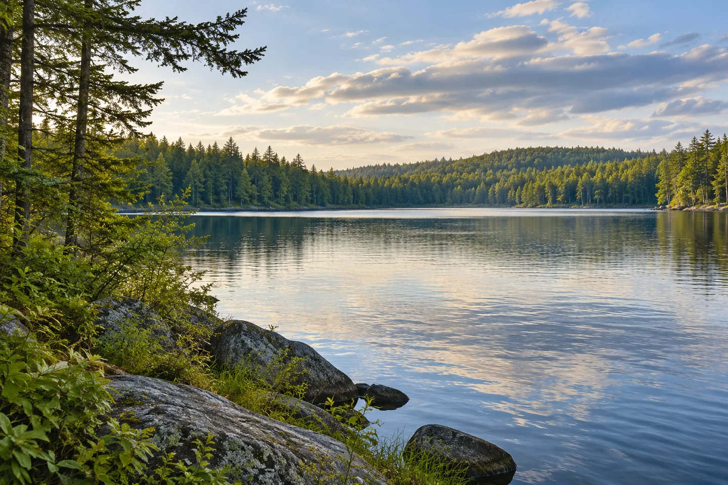
Coffeelos Pond offers an interesting reversal of the usual northern-lake expectation. Its attraction is a comparatively shallow basin with a long brook-trout history, rather than an enormous depth hidden beneath a small surface. A visit can revolve around a carefully arranged camp and time beside the water, with the pond's changing accessibility adding a human story. This is the T6 R11 water also recorded as Coffalos, a spelling worth recognizing when comparing maps and lake information.
North Maine Woods' 2026 brochure lists camping areas on the north and south sides. Confirm the selected site and present road approach before traveling, and plan the short shore approach separately from vehicle access. Older state planning notes describe informal paths from the roadside camps and a carry-in point on the southwestern shore. Have the manager confirm the current arrangement for any boat. The distinction matters when packing: a tent beside a road and a canoe at the water are different stages of the outing.
The compiled Lakes of Maine profile records a maximum depth of twenty-four feet but a mean depth of only seven feet. That difference offers a useful way to interpret the scene. Much of the basin is shallower than its deepest sounding suggests. Its mapped surrounding buffer is classified as natural land cover, reinforcing the sense of a pond framed by woods. The classification describes a landscape pattern; it does not establish that every piece of shoreline is an authorized place to land or camp.
The original August 1962 fisheries survey explains a physical consequence of that shape. Wind mixed the pond extensively, and the biologists measured the same temperature at the surface and at their deepest observation. They also considered cooler spring areas important places for trout during warmer conditions. The pond therefore tells a different habitat story from a deep lake with strongly separated water layers. These observations belong to the survey date, rather than a modern water-temperature forecast.
That survey also describes trout reproducing along gravelly shores, with no permanent inlet streams. It is an especially good reason to regard a modest shore edge as habitat instead of spare ground for equipment. Keep launching and resting within the established approach, and leave submerged gravel and vegetation alone. The account reflects the fish community observed then; present fishing rules and contemporary assessments must guide any angling visit. An old reputation for large fish cannot promise the outcome of a new outing.
A personal recollection gives that passage of time a vivid form. In a July 2024 Maine Fly Fish forum reply, Woody gulliford remembered walking over from Telos more than sixty years earlier, before roads reached the area, and making later fishing visits by aircraft. He hoped to return by a closer vehicle approach. His memory captures the importance of a place retained over decades. It supplies a historical perspective on arriving, while the current manager supplies the practical directions.
Give the visit a purpose small enough to enjoy fully: a permitted camp, a shore pause or an appropriately organized fishing outing. Take a broad photograph of water enclosed by trees, then look for surface texture from a secure position. A notebook can connect the view with the old account of wind mixing and the visitor's changing journeys. Coffeelos becomes more distinctive through those connections, bringing shallow-water ecology and a remembered northern landscape into the same day beside the pond.
Fun facts
- The compiled profile gives a maximum depth of 24 feet and a mean of seven.
- The 1962 survey described trout spawning on gravelly shores.
- Coffalos is an alternate spelling used in the lake profile.
Before you go
- Confirm north or south camping arrangements and the present shore approach with the manager.
- Arrange any boat access separately from vehicle camping.
- Keep equipment away from sensitive shoreline habitat.
- Use contemporary fishing information for an angling visit.
Visitor perspectives
- In a July 2024 forum reply, Woody gulliford recalled walking to Coffeelos from Telos more than sixty years earlier and later visiting by aircraft.
Capture
- Frame the pond within its wooded setting from authorized ground.
- Photograph water texture from a secure shore position.
 Clear Lake, T10 R11
 Governor Brann Schoolhouse
 Togue Pond, Deboullie
Social
Coffeelos Pond combines shallow-water ecology with a long angling memory.
Maximum depth and average depth tell different stories: the compiled profile reports 24 feet and seven feet.
Wind mixing shaped the pond’s historical fisheries account.
The 1962 survey linked gravelly shores with trout reproduction.
Confirm camping and the actual shore approach before traveling.
A remembered walk and later aircraft visits connect one angler with decades of Coffeelos history.
Leave shore habitat undisturbed while finding a simple wooded-water composition.
Which matters more in a return visit: the place itself or the journey remembered?
Hashtags