 Cre8Travel
CRE8TRAVEL · NEW YORK PLACES
Cicero Swamp Wildlife Management Area
Cicero Swamp Wildlife Management Area: A Closer Look

Discover
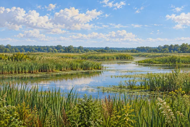
Upland islands interrupt the low, wet landscape at Cicero Swamp Wildlife Management Area. Most of its 4,991 acres belong to a wetland complex, with sphagnum moss, black spruce, tamarack and stunted white pine among the distinctive elements in the New York State Department of Environmental Conservation's description. That mixture gives the WMA a particular character, quite different from a generic open marsh or an evenly wooded park.
The property occupies part of northeastern Onondaga County and extends into Sullivan in Madison County. DEC manages it for wildlife, habitat and wildlife-dependent recreation. Its scale is useful context, but not a visitor-route length: thousands of acres of low ground do not establish a long prepared circuit through the swamp. Choose an approach from current access information rather than assuming every upland island is connected for a walk.
The contrast between wetland and higher ground is a useful subject for observation. From an appropriate public position, consider the relation between tree forms, low vegetation and the ground around them. The moss and conifers are worth noticing without needing a panoramic view. A close composition can suggest something of the place's character, while leaving plants and wet ground undisturbed rather than entering them for a better angle.
Open habitat also belongs to the management story. DEC describes work on some upland fields to retain those open areas as part of the wider habitat mixture. That is a specific management purpose, not proof that the whole swamp is being cleared or that a particular field will look newly worked during a visit. A varied wildlife landscape can include both wooded wet ground and deliberately retained openings.
The habitat supports a variety of wildlife, and DEC provides bird and vertebrate checklists as references. The operator also identifies short-eared owl among species associated with the area. Treat such information as habitat context rather than a sighting promise or a reason to approach wildlife. A wetland outing can remain worthwhile when the visible subjects are trees, vegetation and changing light instead of an animal.
Several roads provide approach references: Route 298 from the east, Route 31 along the north, Taft Road from the south and Island Road from the west. DEC also provides an Eastwood Road location. Match the chosen point to the current WMA map and posted conditions before traveling. Different approaches do not automatically join into a continuous route across the wetland or an easy circuit through all its habitats.
The habitat plan identifies target species and management goals for the WMA. Let the actual access arrangement shape the visit, keeping public boundaries and low, wet terrain in mind. Do not infer a boardwalk, viewing tower or dry walking surface from the presence of a wildlife-management designation. For photographs, use the scene actually available from an appropriate position rather than making a route depend on a particular species or feature.
Follow posted rules, Leave No Trace guidance and DEC's tick precautions. Cicero Swamp offers a grounded way to think about a large wetland: moss and conifers, scattered higher ground, managed openings and wildlife habitat within the same property. The outing should fit that real landscape and its current access, without enlarging the description into facilities or connections that have not been established.
Fun facts
- Cicero Swamp WMA covers 4,991 acres with low wet ground and scattered upland islands.
- It lies in Cicero, Onondaga County, and Sullivan, Madison County.
- DEC identifies sphagnum moss, black spruce, tamarack and stunted white pine in the wetland complex.
- Management includes retaining some open upland-field habitat.
- Road approaches are provided around different sides of the property, without establishing a connected wetland circuit.
Before you go
- Plan using the current WMA map and actual public access.
- Do not infer boardwalks, towers or a dry loop from the WMA designation.
- Observe wetland plants without entering sensitive vegetation for a photograph.
- Treat species associations as habitat information rather than guaranteed sightings.
- Follow posted rules, Leave No Trace guidance and DEC tick precautions.
Capture
- Use conifer forms and low vegetation visible from an appropriate public position.
- A close habitat composition can work without a panoramic marsh view.
- Photograph wildlife only if present without approaching or disturbing it.
 Woodhull State Forest
 Cameron Mills State Forest
 Stanley J. Hamlin Marsh Wildlife Management Area
Social
Cicero Swamp WMA covers 4,991 acres of low wet ground with scattered upland islands. #Cre8Travel
Sphagnum moss, black spruce, tamarack and stunted white pine help give Cicero Swamp its particular character. #Cre8Travel
The WMA extends across Cicero in Onondaga County and Sullivan in Madison County. #Cre8Travel
Some upland fields are managed to retain open habitat within the wider wetland setting. #Cre8Travel
A wildlife-management designation does not establish a boardwalk or a dry circuit through the swamp. #Cre8Travel
Road approaches on different sides of Cicero Swamp should be matched to the current public-access map. #Cre8Travel
Species lists describe habitat value without promising a sighting during every visit. #Cre8Travel
At Cicero Swamp, what would catch your eye first: conifer forms, moss or the contrast with higher ground? #Cre8Travel
Hashtags