 Cre8Travel
CRE8TRAVEL · NEW YORK PLACES
Raymondville State Forest
Raymondville: Seven Parcels and a Woodland–Wetland Mosaic
Discover
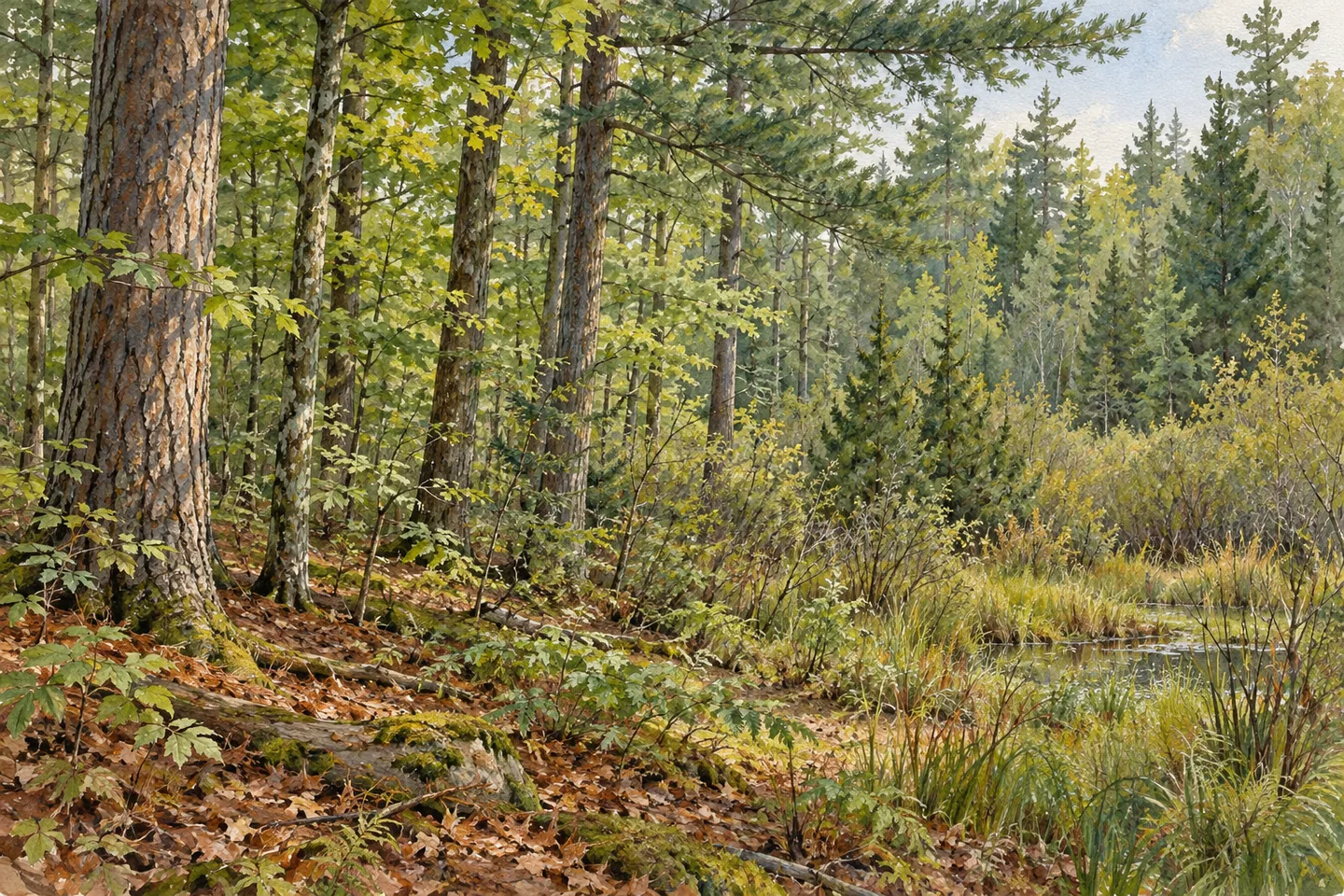
Raymondville State Forest is a collection of seven parcels whose varied vegetation gives a 641-acre public holding several different characters. The St. Lawrence County property includes former agricultural ground, planted trees, wetland communities and drier woodland. A yellow-marked route from Grantville Road offers one defined way into the setting. Its interest grows when those different elements are understood together, rather than assuming that every part of the forest has developed in the same way.
The parcels entered state ownership between 1951 and 1990. That nearly four-decade span gives the forest a history of assembly, with reforestation, wildlife habitat, timber production, recreation and watershed protection among its purposes. The dates describe land acquisition rather than the age of every stand. They help explain how the name Raymondville can refer to several pieces of land with a shared management identity, while each parcel retains its own position and physical setting.
Much of the land had an agricultural past before returning to tree cover. Open fields were planted with red, Scotch and white pines, as well as white spruce. Those choices added planted conifers to a forest that also contains naturally established trees. A visitor can consider the differences in stand form and species composition where they are visible from appropriate access, connecting the present woodland with the earlier use of the ground beneath it.
The wetter areas provide another pattern. DEC describes very flat terrain with extensive wetlands, where open wet ground and shrub swamps grade into swamp hardwoods and white cedar in places that flood seasonally. The sequence offers a useful way to think about the landscape: the degree of wetness helps distinguish one vegetation setting from another. It is a theme for observation from suitable ground, rather than an invitation to cross wetland vegetation to investigate it closely.
Drier upland sites support northern hardwoods and white pine. Secluded parts of the forest also contain native balsam fir stands and large scattered white pines. These details add a different dimension to the planting history. Conifers here belong to more than one story, including both trees established on former fields and naturally occurring woodland. Keeping those possibilities separate makes the forest more interesting than a simple label of pine plantation.
The documented one-mile trail starts on Grantville Road and heads south through mixed white pine and northern hardwoods. Yellow markers identify this multi-use route, which is open for walking and cross-country skiing. Its length and direction describe one particular trail within the seven-parcel property. Use the current map to plan the intended outing and return travel, without extending the route in imagination to every wetland or secluded stand mentioned in the forest's description.
Development is limited across Raymondville, and that modest infrastructure leaves the woodland itself as the principal subject. A visit can focus on the marked route while considering the wider pattern around it: separate parcels assembled over time, old fields planted with conifers, native stands, dry uplands and wetter communities. The differences give this small public forest its particular identity. Paying attention to them adds substance to a short walk without requiring a single spectacular landmark.
Fun facts
- Raymondville’s 641 acres comprise seven parcels purchased between 1951 and 1990.
- A one-mile yellow-marked route heads south from Grantville Road through white pine and northern hardwoods.
- Former fields were planted with several pines and white spruce.
- Wet areas include shrub swamps, swamp hardwoods and white cedar, while drier uplands support hardwoods and white pine.
Before you go
- Use the current map to understand the one-mile route within the seven-parcel forest.
- Observe wetland transitions from suitable ground rather than entering sensitive vegetation.
- Keep native conifer stands distinct from the forest’s documented agricultural planting history.
Capture
- Compare visible woodland structure along legitimate access without assigning a date to individual stands.
- Use changes between drier trees and wetter vegetation as a subject where both are visible.
- Avoid illustrating an exact route, wetland boardwalk or a particular large tree as a verified landmark.
 R. Milton Hick Memorial State Forest
 Lonesome Bay State Forest
 Pleasant Lake State Forest
Social
Raymondville State Forest brings seven parcels under one public forest name. #Cre8Travel
Its 641 acres entered state ownership between 1951 and 1990.
Former farm fields were planted with pines and white spruce.
Other conifer stands have a different story, including native balsam fir.
Wetland vegetation grades through shrub swamp, swamp hardwoods and white cedar.
Drier sites support northern hardwoods and white pine.
A one-mile yellow-marked route heads south from Grantville Road.
Notice how different woodland histories and ground conditions fit together. A short route can introduce a varied forest setting.
Hashtags