 Cre8Travel
CRE8TRAVEL · NEW YORK PLACES
Pleasant Lake State Forest
Pleasant Lake State Forest: A Woodland Visit Focused on Mud Lake
Discover
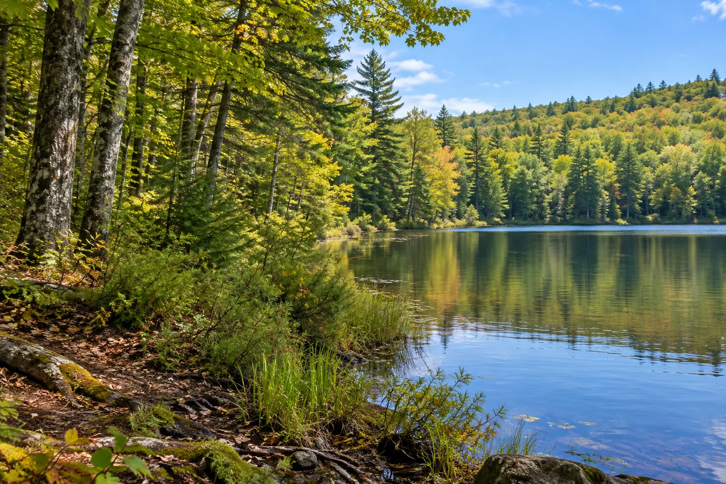
Pleasant Lake State Forest has an important geographical distinction built into a visit: the public water access described here leads to Mud Lake. The 963-acre St. Lawrence County forest has no frontage on nearby Pleasant Lake itself. Once that difference is clear, the property becomes easier to understand as a varied woodland setting, with a short lake-access trail, former agricultural plantings and vegetation that changes between upland and wetter ground.
The Mud Lake Hiking Trail is 0.3 mile long and provides the documented route to the water. Williams Road supplies a parking reference for that approach, while Lockie Road offers another access to the forest. Choose the relevant starting point with the current official map rather than treating every road approach as equivalent. The short named trail gives a particular outing a clear focus within a much larger holding.
Mud Lake's place in the forest adds an open-water setting to the surrounding trees. DEC describes its fishing interest, while the broader woodland offers walking and nature observation. A visit can appreciate the relationship between water and vegetation without depending on an activity on the lake. Keep the view and the access actually available as the starting point, and respect neighboring private property around the differently named Pleasant Lake.
The woodland has a land-use history of its own. Pine and spruce plantations occupy former farm fields and pastures, linking present conifer stands with the earlier use of the ground. These planted areas form one part of a wider mixture rather than defining the whole forest. Where stand form and tree cover can be observed from appropriate access, they provide a way to think about how former open land has become woodland.
Upland ground supports northern hardwoods, oak-hickory forest and white pine. This variety offers several woodland subjects within the same public property. A route does not need to pass every named community to give a sense of that mixture. Study what is visible, noticing differences among the tree cover while avoiding unsupported conclusions about the age or planting history of a particular stand.
Flatter areas supply a different pattern. Open wetlands and shrub swamps grade into swamp hardwoods and white cedar where the ground floods seasonally. The contrast between these wetter communities and the upland forest is one of Pleasant Lake State Forest's clearest physical themes. It helps explain why a visit here can involve several vegetation settings even when the selected walk remains modest in length. Observe wet ground from suitable access rather than crossing sensitive plants to inspect it.
Several trails and roads are available for hiking, and the published description also permits winter use without promising groomed ski tracks. Let the current route information and conditions determine the outing. The most coherent introduction combines a specific Mud Lake objective with the surrounding forest's different histories and habitats: planted conifers on former fields, varied upland trees and wetter communities below. Keeping those elements distinct gives the property its character and keeps the lake named in the forest title separate from the public access actually described.
Fun facts
- Pleasant Lake State Forest covers 963 acres in St. Lawrence County.
- The property has no frontage on nearby Pleasant Lake.
- The 0.3-mile Mud Lake Hiking Trail provides documented access to Mud Lake.
- Pine and spruce plantations occupy former fields and pastures, alongside upland and wetland woodland.
Before you go
- Use the current map to select the Mud Lake approach from Williams Road.
- Keep Pleasant Lake’s private shore separate from the forest’s documented Mud Lake access.
- Winter route use does not mean the trails are groomed for skiing.
Capture
- Where legitimate access provides a view, frame Mud Lake with surrounding vegetation.
- Compare visible planted stands, mixed uplands or wetland margins without inventing a route linking all of them.
- Avoid recreating an exact shoreline, boardwalk, marked circuit or identifiable plantation.
 Lonesome Bay State Forest
 Lincoln Mountain State Forest
 Mendon Ponds Park
Social
Pleasant Lake State Forest’s documented water approach leads to Mud Lake. #Cre8Travel
The 963-acre public holding has no frontage on nearby Pleasant Lake itself.
A 0.3-mile hiking trail provides the Mud Lake access described by DEC.
Pine and spruce plantings recall former farm fields and pastures.
Uplands support hardwoods, oak-hickory woodland and white pine.
Wetter ground grades through shrub swamp, swamp hardwoods and white cedar.
Use the current map to distinguish Williams Road and Lockie Road access choices.
A short lake-focused outing can introduce several woodland histories, while keeping public and private shores clear.
Hashtags