 Cre8Travel
CRE8TRAVEL · NEW YORK PLACES
Pugsley Creek Park
Pugsley Creek Park: Reading a Bronx Landscape Between Trees and Marsh
Discover
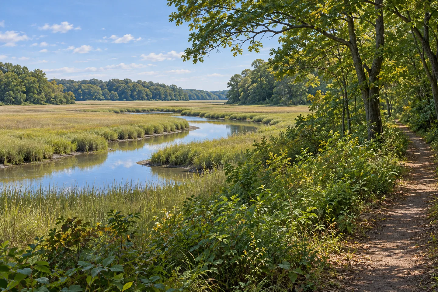
Pugsley Creek Park offers a different kind of Bronx green space, with a creek-edge landscape shaped by woodland, open vegetation and tidal marsh. Its interest is in the transitions between those elements. A visit can become an exercise in looking closely: where the taller canopy ends, how lower plants occupy the ground and how the character of the landscape changes toward the water.
The park has a long history of altered ground. A Natural Resources Group survey carried out in September 2006 describes an area where extensive filling had changed earlier salt marsh. Its introduction records a mixture of trees, open fields and remaining creek-edge vegetation. That dated account provides a historical lens for understanding the park’s patchwork character, showing how an urban natural area can hold traces of several different periods of use.
The survey’s detailed mapping reveals how closely those patches could sit together. One intertidal unit was dominated by salt marsh cordgrass, with sea lavender, glasswort and other grasses also recorded. A neighboring slope carried box elder woodland and cottonwood. Another small unit lay between marsh grass below and trees above, with marsh elder forming part of the transition. These descriptions make the boundary between woodland and marsh a subject worth noticing in its own right.
The value of the old inventory is the way it teaches attention to structure. A tall, shaded area and a low, open strip of vegetation respond to different conditions, even when they are near each other. Look at changes in height, density and exposure from established paths. The specific plant records belong to the 2006 survey; the broader habit of comparing landscape layers remains useful on a walk today.
Restoration added another chapter. The city’s 2014 progress report marked Pugsley Creek Park’s restoration as completed. Earlier planning and assessment records describe the creek within a wider network of wetland restoration work. Read together, those sources show a landscape that has received active management as well as protection, with the recovery of tidal habitat forming part of its modern history.
Care continues at the scale of the paths and plants. Natural Areas Conservancy listed a May 2026 Pathkeeper training session at Pugsley Creek Park, with a meeting point at Stephens Avenue and O’Brien Avenue. Its programme covered assessing trail conditions, identifying plants, managing invasive growth and caring for native vegetation. Those subjects connect the experience of walking through a natural area with the practical work needed to maintain it.
Neighborhood stewardship provides another connection. Marina’s Heart names Pugsley Creek among the waterfront spaces where it organizes cleanup and community activity. Such work gives a quieter background to a visitor’s experience: a path and an outlook depend on repeated care, while ecological restoration develops over years. Check current organizer information if you want to learn through a scheduled activity.
For an independent visit, use posted public paths and choose your own pace of observation. Leave shoreline vegetation undisturbed and appreciate the creek from established ground. Photographs can compare the texture of tree trunks with the more open form of marsh planting, or show how vegetation frames the water. The most rewarding approach is to notice relationships rather than collect sightings, giving the park’s different landscape layers time to come into focus.
Fun facts
- A detailed Natural Resources Group survey was carried out in September 2006.
- The historical survey mapped closely adjoining woodland, intertidal vegetation and transition areas.
- The city’s 2014 progress report marked the park’s restoration as completed.
- A May 2026 Pathkeeper training listing focused on trail and vegetation care.
Before you go
- Use posted public paths when observing the creek-edge landscape.
- Look at changes in vegetation height and density without disturbing plants.
- Check current organizer information for stewardship or learning activities.
Capture
- Compare woodland textures with lower marsh vegetation from established public ground.
- Frame the creek through vegetation without entering the shoreline planting.
 Willowbrook Park
 Watson's East Triangle Wild Forest
 Long Pond Park
Social
Pugsley Creek Park offers a Bronx landscape between woodland and tidal marsh. #Cre8Travel
A September 2006 survey provides a detailed historical picture of its vegetation.
The survey mapped small transition areas between marsh grass and trees.
The city marked restoration work completed in its 2014 progress report.
A 2026 training listing connected trail care with plant identification.
Notice changes in vegetation height and exposure from public paths.
Leave shoreline planting undisturbed during your visit.
Which landscape boundary would you stop to look at more closely?
Hashtags