 Cre8Travel
CRE8TRAVEL · NEW YORK PLACES
Nine Mile State Forest
Nine Mile State Forest: Roads, Trees and a Working Woodland Past
Discover
Nine Mile State Forest covers 3,162 acres in Allegany and Great Valley, Cattaraugus County. Its woodland carries a history of timber production, farming and later conservation work, with old road lines providing a way to understand how the landscape was used. A walking visit can follow that theme through the forest, giving attention to the trees and the routes between them. The strongest interest is the connection between present woodland and the working landscape that came before it.
Much of the land belonged to a timber company before becoming state forest. Sawmills operated both within what is now public land and on neighboring private property. DEC identifies dam remains along Bowers Hollow beside Phearsdorf Forest Road, near its turnaround, and traces of another mill beside Nine Mile Creek off Nine Mile Forest Road. These documented features place the watercourses within an industrial story, adding context to a forest that today draws walkers and cyclists.
Farming supplied another layer. A former farm occupied ground along the present Phearsdorf Forest Road, where DEC also records remains of structures. Trees associated with former house locations help connect the planted and built elements of that earlier landscape. Appreciate whatever is visible from legitimate access, leaving historic traces undisturbed. The story is useful even when a particular remnant is difficult to recognize: it explains how open ground, roads and later woodland came to share the same setting.
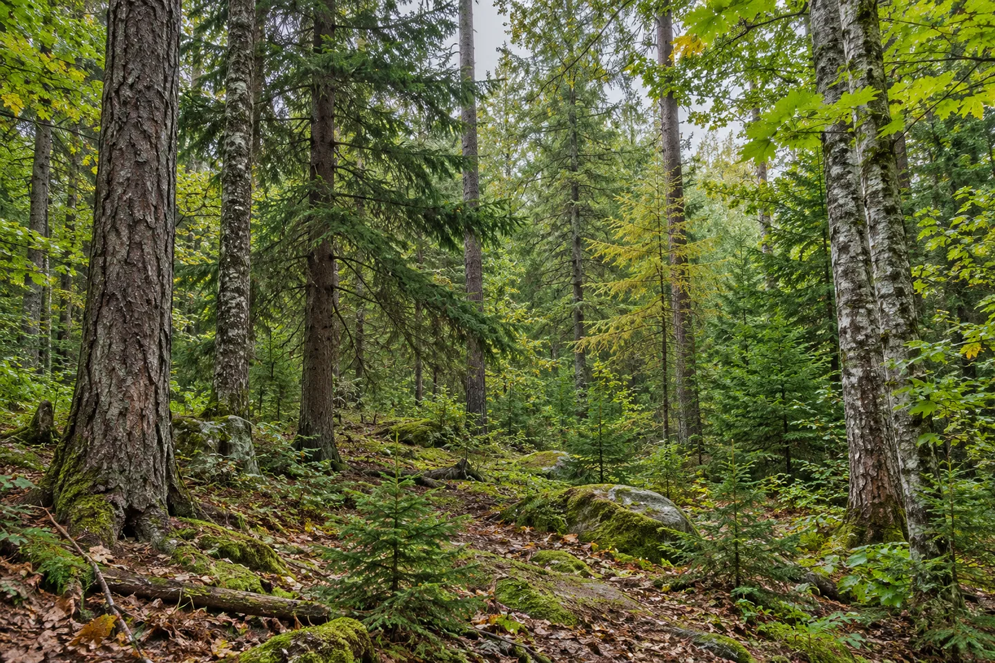
The 1930s brought substantial Civilian Conservation Corps work. Crews constructed roads and planted thousands of pine, larch and spruce trees in open areas. That effort added deliberate reforestation to land previously shaped by other uses. A present-day walk can therefore look at the forest in several ways: as tree cover, as habitat and as the result of decisions about how former working land should develop. The surviving pattern is best observed through the forms actually visible along the chosen route.
For walking, the old logging-road system provides access through the woodland. DEC also identifies developed bicycle trails that may be used by hikers, with cyclists receiving priority on those routes. Choose the intended line using the current official map and follow the applicable shared-use arrangements. The forest's terrain can be rugged in places, so a road or trail's relationship to the ground matters as well as its place on the map.
Access reflects the history of the road system too. Earlier public roads approached from Townsend Hollow to the south and Snow Brook Road to the north, while the present vehicle approach is from North Nine Mile Road. Townsend Hollow provides foot access without a designated parking area. Those differences make the current approach worth planning carefully, particularly for visitors looking at an older map or a route connected with the forest's past.
Before travelling, check the current access notices and map for the selected outing. Give the walk a manageable scope and leave time to observe the woodland itself: the shape of conifers among other trees, a change in stand density, or the way an old route follows the ground. Nine Mile rewards a close reading of those details. Timber-company history, former farming and CCC planting all contribute to a forest whose present character grew through several different kinds of work.
Fun facts
- Nine Mile State Forest covers 3,162 acres in Cattaraugus County.
- Timber-company ownership and local sawmills preceded state-forest use.
- CCC crews built roads and planted pine, larch and spruce during the 1930s.
- Old logging roads form part of the present walking access.
Before you go
- Use the current North Nine Mile Road access information when planning a vehicle approach.
- Select a mapped walking line and follow the shared-use arrangements on bicycle trails.
- Observe historical traces from legitimate access and leave them undisturbed.
Capture
- Use layers of tree trunks to show depth along the selected woodland route.
- Compare conifer forms with surrounding broadleaf woodland where visible from suitable public access.
- Use soft light to retain texture in bark, branches and shaded ground while remaining on the chosen route.
 Wilcox Lake Wild Forest
 Saranac Lakes Wild Forest
 Debar Mountain Wild Forest
Social
Nine Mile State Forest carries a working woodland history across 3,162 acres. #Cre8Travel
Timber-company ownership and sawmills preceded the state forest.
Former farming adds another chapter along Phearsdorf Forest Road.
CCC crews planted thousands of conifers in the 1930s.
Old logging roads remain part of the walking access.
Some bicycle trails also allow hikers under shared-use arrangements.
Plan the current approach and a manageable mapped outing.
Would the tree forms or the forest’s earlier working life catch your attention?
Hashtags