 Cre8Travel
CRE8TRAVEL · NEW YORK PLACES
Clay Pond Wildlife Management Area
Clay Pond: A Wetland Where Three Valleys Meet
Discover
Clay Pond Wildlife Management Area occupies a meeting place in the Town of Poland, Chautauqua County. Here the Chautauqua, Cassadaga and Conewango valleys converge. That description refers to the surrounding valleys, rather than a junction of three rivers inside the property. It provides a useful starting point for understanding a landscape whose interest lies in the relationship among wetlands, open water and the brushier ground around them.
DEC acquired the area in 1989 using funds from the 1986 Environmental Quality Bond Act. The purpose was to preserve a diverse natural wetland permanently. That specific history distinguishes Clay Pond from a former farm purchased primarily for timber production or a reservoir built to supply a city. Its public identity begins with protecting the habitat already present and maintaining a place for compatible wildlife-related recreation.
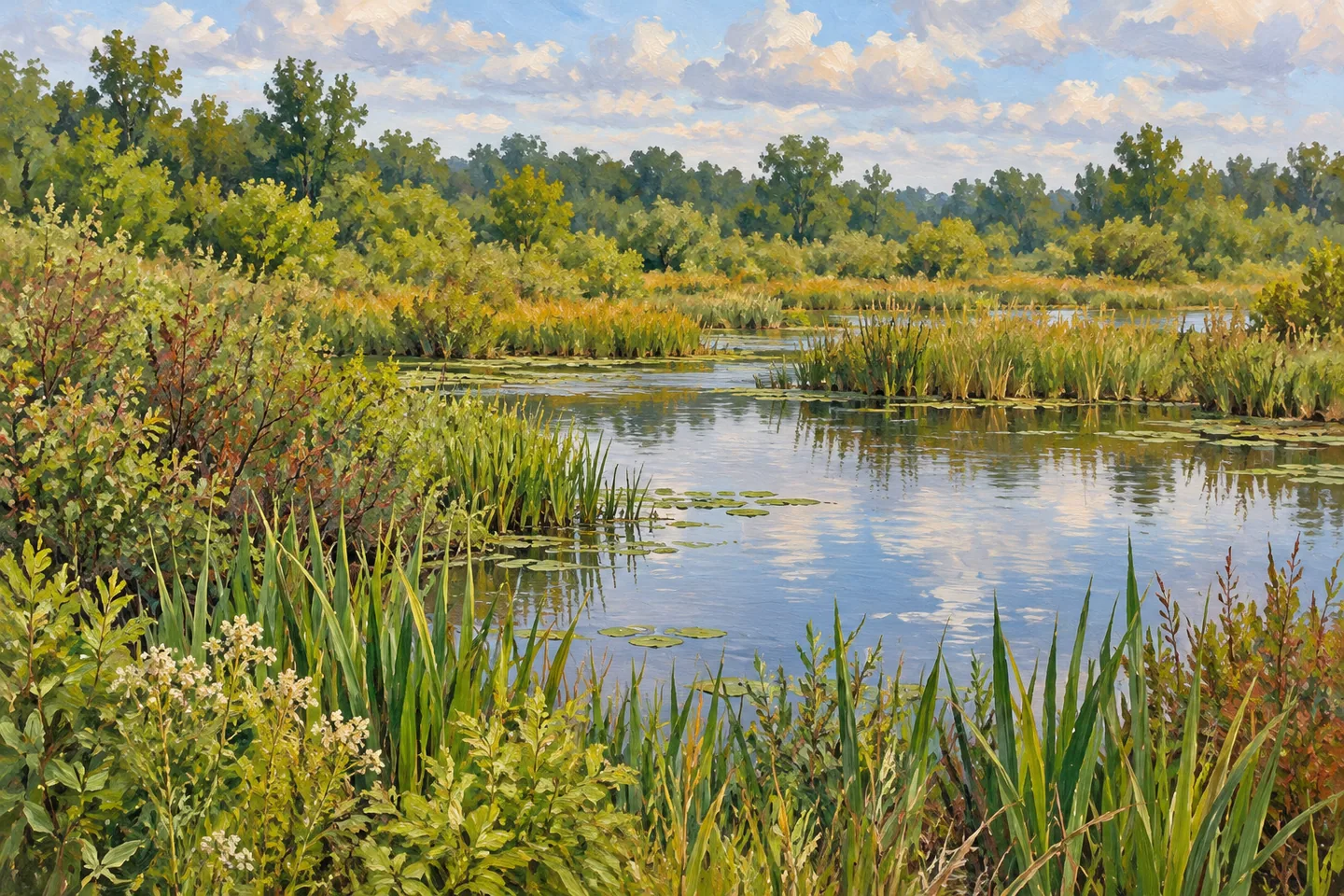
The wetland component covers nearly 140 acres. It includes shrub swamp, emergent marsh and open water, three descriptions that make the site more varied than the simple word pond might suggest. Where they are visible from an appropriate position, pay attention to the different forms: woody growth in one part of the wetland, upright marsh vegetation in another and an open surface elsewhere. These are subjects for observation, rather than instructions to enter wet ground or follow an assumed waterside path.
Approximately 25 additional acres consist of brush and grassland. This second group of habitats gives the surrounding land a role in the story, too. A photograph that includes some of the vegetation around the water may communicate more about Clay Pond than a tightly cropped view of open water alone. The comparison can remain simple: different kinds of plant cover occupy the same protected property, without every patch needing a precise ecological label from the visitor.
DEC's management objectives include providing habitat for resident and migratory species. Wildlife viewing and photography belong among the compatible uses identified for the area. The distinction between habitat and encounter matters here. A visit can reveal something about the places animals use even when no animal is visible. Songbirds and other wildlife are described in the property's information, but neither a particular species nor a successful photograph should become the measure of whether the outing has worked.
Two parking locations are documented on Clay Pond Road. Use the current official map to relate the chosen starting point to the property, rather than assuming that the two places are connected by a maintained walking circuit. The published description does not establish a boardwalk, viewing tower or formal trail network. Planning around those absent assumptions keeps attention on the actual wetland setting instead of facilities the visitor may expect from a more developed park.
Clay Pond rewards a small number of careful comparisons: water and vegetation, marsh and brushland, a protected wetland and its place among three valleys. Let what can be observed from legitimate access determine the scale of the visit. Its appeal does not depend on reaching a named lookout or completing a set distance. The more useful goal is to leave with a clearer sense of how several habitats fit together within one relatively compact conservation property.
Fun facts
- DEC purchased Clay Pond in 1989 using funds from the 1986 Environmental Quality Bond Act.
- Nearly 140 acres comprise shrub swamp, emergent marsh and open-water wetlands.
- Approximately 25 acres of brush and grassland add another habitat component.
- The property lies where the Chautauqua, Cassadaga and Conewango valleys converge.
Before you go
- Use the current official map to distinguish the two Clay Pond Road parking locations.
- Do not assume a boardwalk or maintained walking circuit connects the access points.
- Treat resident and migratory habitat as an observation theme rather than a wildlife-sighting guarantee.
Capture
- From legitimate access, frame visible open water together with surrounding vegetation.
- Compare woody wetland growth, marsh plants and brushland only where those features are actually visible.
- Avoid entering marsh habitat to recreate a composition or photograph wildlife.
 Clapper Hollow State Forest
 Cliffside State Forest
 Cold Brook Wildlife Management Area
Social
Clay Pond WMA protects a varied wetland in the Town of Poland, Chautauqua County. #Cre8Travel
DEC acquired the property in 1989 to preserve its natural wetland.
Nearly 140 acres include shrub swamp, emergent marsh and open water.
Brush and grassland add approximately 25 acres of different habitat.
The meeting of three valleys provides geographical context; it is not a claim that three rivers join inside the WMA.
Two parking points are listed on Clay Pond Road. Use the current map rather than assuming a connecting trail.
Resident and migratory wildlife habitat can be interesting even without a sighting.
Compare the different vegetation and water settings from legitimate access. Clay Pond is a conservation landscape, not a promised boardwalk attraction.
Hashtags