 Cre8Travel
CRE8TRAVEL · NEW YORK PLACES
Cliffside State Forest
Cliffside State Forest: Steep Ground and a Railroad Legacy
Discover
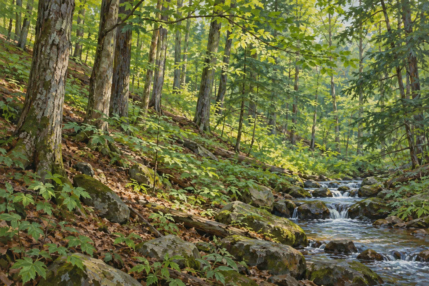
Cliffside State Forest takes its name from terrain that gives this 977-acre property a distinct character. Much of it lies along a fairly steep cliff, within the towns of Newfield and Cayuta. Those towns place it in both Tompkins and Schuyler counties. A visit is best understood through that combination of slope, woodland and the Cayuta Creek corridor, rather than through expectations of a developed park with a standard loop around its main features.
The forest belongs to a much larger block of DEC-managed public open space, approaching 14,000 acres. Cornell University manages about 4,000 additional acres nearby. These figures describe the wider setting; they are not the area of Cliffside itself or permission to continue freely onto every adjoining property. Keeping the boundaries clear helps explain how a relatively small named forest can also contribute to a broader expanse of woodland.
Cliffside's ownership history has two particularly useful dates. About 891 acres transferred from the federal government to New York in January 1956. Another 86 acres were acquired from the Lehigh Railroad in 1985. Together they account for the 977-acre property described today. Earlier clearing and farming form part of the land's history, while the later railroad purchase gives the surviving transport corridor a direct connection to how the public forest took its present shape.
Cayuta Creek runs along the western edge. Public fishing access is associated with an abandoned railroad bed crossing State Route 224. Elsewhere in the forest, a section of abandoned railbed is maintained by a club for snowmobiling. The railway legacy therefore provides more than a historical footnote, but it should not be turned into a claim that every section forms a signed hiking circuit or that a visitor can follow the creek without considering boundaries.
There is no formal trail network within Cliffside. Hiking is allowed where signs do not prohibit it, which is different from having a maintained route that guides an unfamiliar walker around the slopes. Let that distinction shape the intended outing. The steep terrain is part of the forest's identity, but a cliff in the property's name does not establish a maintained overlook, an accessible summit or a designated edge where visitors should gather for photographs.
Access deserves particular attention. DEC's documented approach uses Johnson Road only to make an immediate turn onto Railroad Haul Road, where parking is described farther along. There is no public access directly from Johnson Road into the forest. Respecting that distinction protects neighboring land and prevents a mapped road from being mistaken for an entrance. Consult the current property map before choosing a route from the authorized starting area.
Cliffside also forms part of the Connecticut Hill Important Bird Area. Its habitat contributes to the large blocks of tree cover used by woodland birds. An observation-focused visit can consider the continuity of that cover without requiring a particular species to appear. Between the steep ground, creek, railway history and larger forest setting, there is enough to distinguish Cliffside clearly. The most informative visit connects those features while keeping their scale, access and individual histories separate.
Fun facts
- Cliffside covers 977 acres across Newfield in Tompkins County and Cayuta in Schuyler County.
- About 891 acres transferred from the federal government to New York in January 1956.
- Another 86 acres were acquired from the Lehigh Railroad in 1985.
- Cliffside forms part of the Connecticut Hill Important Bird Area.
Before you go
- Use the current official map; the forest has no formal trail network.
- Public access uses Railroad Haul Road; there is no direct public forest access from Johnson Road.
- Keep Cliffside’s 977 acres separate from the larger DEC block and neighboring Cornell lands.
Capture
- Photograph the relationship between woodland and slope from a suitable legitimate position, without approaching a cliff edge for a composition.
- Where visible from authorized access, use the creek corridor as a landscape subject.
- Do not reconstruct a maintained overlook, trail circuit or guaranteed bird encounter in an illustrative image.
 Clay Pond Wildlife Management Area
 Cold Brook Wildlife Management Area
 Colgate Lake Wild Forest
Social
Cliffside State Forest spans 977 acres in Tompkins and Schuyler counties. #Cre8Travel
Much of this forest occupies fairly steep cliffside terrain. A named cliff does not imply a maintained overlook.
An 891-acre federal transfer in 1956 and 86-acre railroad acquisition in 1985 shaped the current property.
Cayuta Creek follows the western edge, with public fishing access associated with an abandoned railbed.
A section of former railroad is club-maintained for snowmobiling; that does not establish a hiking circuit.
There is no formal trail network at Cliffside. Consult the property map before planning a walk.
Railroad Haul Road provides the documented approach. Johnson Road itself offers no direct public forest access.
The forest contributes habitat within the Connecticut Hill Important Bird Area, linking its local slopes to a larger woodland setting.
Hashtags