 Cre8Travel
CRE8TRAVEL · NEW YORK PLACES
California Road State Forest
California Road State Forest: A Closer Look
Discover
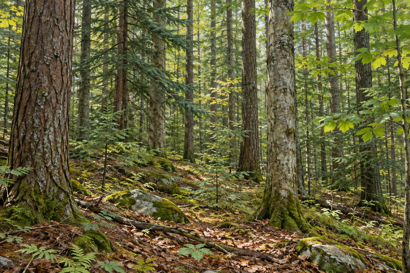
California Road State Forest is a landscape of contrasts between ridge and wet ground. Across 1,410 acres in Pitcairn and Fowler, St. Lawrence County, thin soils and exposed rocky tops characterize much of the hilly terrain. Flatter areas support open wetland and shrub swamp, with swamp hardwoods in places flooded seasonally. The difference between those settings is a useful theme for a visit, rather than expecting one uniform woodland scene.
On better upland ground, northern hardwoods mix with hemlock and white pine. Poorer sites favor red oak, eastern hophornbeam and hickories, while pine and spruce plantations occupy former fields and pastures. The New York State Department of Environmental Conservation (DEC) links the tree mixture to the conditions beneath it. Where visible from an appropriate route, compare woodland forms and the transitions between stands instead of trying to identify the entire species list at once.
The public forest was assembled from 12 parcels purchased between 1940 and 1989. Those acquisitions served reforestation, wildlife, timber, recreation and watershed protection. Planting added another chapter: more than 74,000 trees were planted on 120 acres between 1954 and 1967. Keep that planting area separate from the forest's full acreage. It describes one part of how the property developed, not a claim that every tree across it belongs to the same project.
An intense storm on July 15, 1995, left another mark on this part of northern New York. California Road was one of four Pitcairn state forests suffering heavy wind damage, alongside Cold Spring Brook, Greenwood Creek and Toothaker Creek. DEC's account of subsequent salvage work combines those four properties, so its regional totals should not be read as California Road figures alone. The event belongs to a wider forest history, rather than an invented single-stand scene.
Some harvested areas developed dense seedlings and saplings, adding young-growth habitat to the regional landscape described by DEC. That history offers a way to think about differences in woodland age without promising a visible storm remnant beside a particular trail. Forests can hold the record of planting, natural growth and disturbance at once. A photograph of tree form and texture can respond to what is actually present without reconstructing a dramatic event.
Several short trails provide walking opportunities, and hiking is also allowed elsewhere in the state forest. Access approaches include Ore Bed and Streeter roads in Pitcairn and Sibley Road in Fowler. An adjoining 164-acre forest-preserve parcel is separate public land, not part of the 1,410-acre total or an assumed trail extension. Respect the southwestern boundary too, where neighboring land has different access requirements.
Use the current property map and posted conditions to choose an approach and return. Follow Leave No Trace guidance and keep rocky terrain and seasonally wet ground in mind when assessing the route. California Road's story can be read through those relationships: trees and soil, a dozen acquired parcels, deliberate planting and a wider history of wind disturbance. Let the actual woodland shape the visit rather than making it depend on an overlook, a connected loop or a guaranteed animal encounter.
Fun facts
- California Road State Forest covers 1,410 acres in Pitcairn and Fowler, St. Lawrence County.
- Twelve parcels were purchased between 1940 and 1989.
- More than 74,000 trees were planted on 120 acres between 1954 and 1967.
- It was one of four Pitcairn state forests heavily affected by the July 15, 1995 storm.
- An adjoining 164-acre forest-preserve parcel is separate from the state-forest acreage.
Before you go
- Choose among Ore Bed, Streeter and Sibley Road approaches using the current map.
- Plan for actual hilly and seasonally wet terrain rather than assuming an easy route.
- Keep the neighboring forest-preserve parcel separate when planning access.
- Respect the southwestern boundary and neighboring access requirements.
- Follow posted conditions and Leave No Trace guidance.
Capture
- Compare ridge woodland forms with wetter vegetation only where visible from appropriate access.
- Use planted and natural tree textures without reconstructing storm damage.
- A close woodland composition can suggest the layered forest history without an invented viewpoint.
 Boehme Legacy Forest
 Albert J. Woodford Memorial State Forest
 Big Brook State Forest
Social
California Road State Forest covers 1,410 acres across Pitcairn and Fowler in St. Lawrence County. #Cre8Travel
Rocky ridge tops and seasonally wet low areas give California Road a contrasting landscape. #Cre8Travel
The forest was assembled from 12 parcels purchased between 1940 and 1989. #Cre8Travel
More than 74,000 trees were planted on 120 acres of California Road State Forest between 1954 and 1967. #Cre8Travel
California Road was one of four Pitcairn forests heavily affected by the July 15, 1995 windstorm. #Cre8Travel
The neighboring 164-acre forest-preserve parcel is separate public land, not part of California Road's acreage. #Cre8Travel
Ore Bed, Streeter and Sibley roads are access references for a mapped California Road visit. #Cre8Travel
At California Road, would the soil-and-tree relationship or the layers of forestry history hold your attention? #Cre8Travel
Hashtags