 Cre8Travel
CRE8TRAVEL · MAINE PLACES
Tunk Lake
Tunk Lake: Deep Water Beneath a Downeast View
Discover
Tunk Lake gives a Downeast freshwater outing a pronounced sense of depth. The state's modern bathymetric sheet records a 225-foot maximum and a 63-foot mean depth across 2,071 acres. Those figures help explain why this lake feels different from a small, shallow pond even before the boat leaves shore. Its 2024 principal-fish list includes brook trout, lake trout and landlocked salmon. Think of the surface as the top of a substantial coldwater environment, with biological interests that extend far below anything visible from a canoe. The chart provides general fishing information, and should not serve as your sole navigation guide.
The northern public boat access sits beside Route 182, within the landscape interpreted by the Blackwoods Scenic Byway plan. That document describes a boulder-edged lake draining north into adjacent Spring River Lake. The outlet direction is a useful detail to know when looking across a map: the lake belongs to a connected watershed rather than an isolated basin. It does not establish that a visitor can simply paddle every connecting channel. Keep a lake exploration distinct from any proposed stream journey, and investigate access and water conditions for each part separately. A short outing can still reveal the contrast between the open water and its stony margins.
The surrounding habitat also makes the outlet worth understanding. Maine's Natural Areas Program identifies the outlet of Tunk Lake as valuable landlocked-salmon habitat within a focus area of statewide ecological significance. The report also records the tule bluet at Tunk Lake, a damselfly whose aquatic young live among vegetation and debris. Its adult stage uses shoreline vegetation and adjoining uplands. The broader landscape contains protected lakes, forests, wetlands and exposed uplands. Its conservation advice emphasizes retaining shoreline buffers and minimizing damaging vegetation clearance and soil disturbance. Those priorities make sense from a boat: the edge between land and water is functioning habitat, even when it appears merely to frame a scenic view. Avoid turning a convenient stopping place into an improvised landing that disturbs the bank or its vegetation.
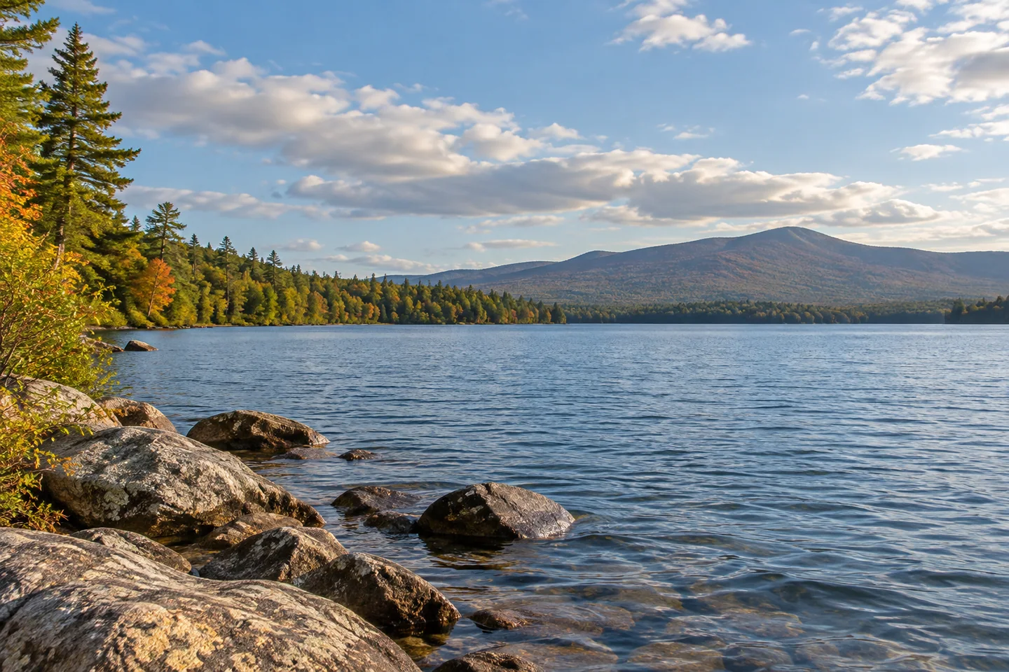
Ron Chase's November 2023 column describes an autumn trip with his son, Adam, beginning at the northern landing. They paddled south with the open summit of Black Mountain's East Peak in view and combined the water journey with an overnight and a hike. His account is particularly valuable for its return leg: a strong following wind built waves and whitecaps near the landing. The same conditions that accelerated their progress demanded attention at the end. Chase enjoyed the adventure, but his experienced party's choices should not become a standard itinerary for another crew. The contrast between colorful shore scenery and a challenging finish is part of his report, not a promise of an easy autumn paddle.
For a water-level composition, keep a stony foreground subordinate to the longer sweep of the lake. A low horizon can emphasize the space overhead; a higher one can draw attention to the water's surface. Make that choice from a position already appropriate to your outing, without moving closer to a shore obstacle simply to improve the frame.
Fun facts
- The state chart records a maximum depth of 225 feet.
- Tunk Lake drains north toward Spring River Lake.
Before you go
- Use the official northern access and prepare an appropriate return plan for changing conditions.
- Leave vegetated banks and shoreline habitat undisturbed.
Visitor perspectives
- Ron Chase enjoyed an autumn paddle and overnight with his son, with Black Mountain scenery along the lake. A strong return wind produced waves and whitecaps near the northern landing.
Capture
- Show a permitted stony shore edge against the longer sweep of open water; retain enough distance to keep equipment out of the landing task.
 Damariscotta Lake
 Sennebec Pond
 Megunticook Lake
Social
Tunk Lake’s surface sits above a much deeper world.
The modern state chart records a 225-foot maximum depth.
Brook trout, lake trout and landlocked salmon appear in the state’s principal-fish list.
The lake drains north toward Spring River Lake.
The outlet is identified as valuable landlocked-salmon habitat.
Ron Chase’s autumn account combines colorful scenery with a windy, wave-filled return.
A shoreline buffer protects more than a pretty background.
Would you begin with the underwater map or the mountain-shaped horizon? #Cre8Travel
Hashtags