 Cre8Travel
CRE8TRAVEL · MAINE PLACES
Damariscotta Lake
Damariscotta Lake: One Waterbody, Many Scales
Discover
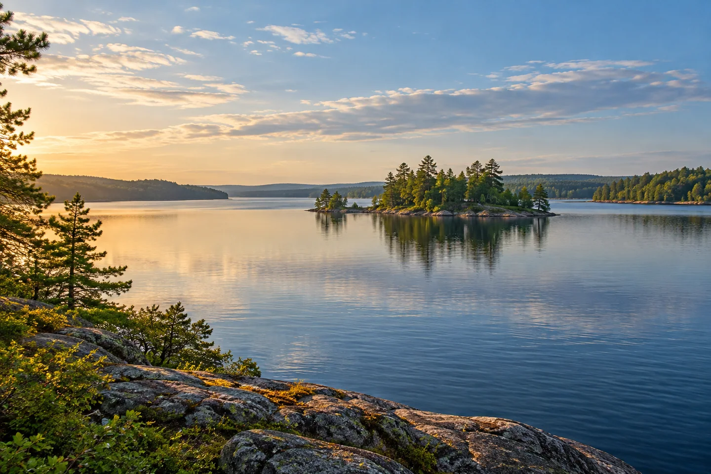
Damariscotta Lake stretches through Jefferson, Nobleboro and Newcastle, offering an outing shaped by bays, islands and a long freshwater shoreline. Midcoast Conservancy's work here grew from the Damariscotta Lake Watershed Association, founded in 1966. Its present mission connects healthy recreation with water protection, education and stewardship. That combination is a useful starting point for exploring beyond the familiar state-park beach: choose a part of the lake to understand, rather than trying to cover the entire waterbody.
The state's modern bathymetric sheet adds an underwater perspective. Its mapped surface area of 4,686 acres helps convey how much water the shoreline encloses. It records a maximum depth of 124 feet and a mean depth of 22 feet, showing why one number cannot describe the entire lake. Its 2024 species information includes lake trout, brown trout, bass, smelt and white perch among the principal fishes. Its recorded shoreline perimeter is 21.4 miles, a reminder that an edge can be much longer and more intricate than a crossing. These details can help an angler ask better questions about habitat, though a biological chart is not a substitute for appropriate navigation information. Study the broad differences before launching, then use current rules and proper boating preparation for the actual outing. A lake that looks continuous from shore contains a much more varied world below.
Mimi Bigelow Steadman's Maine Boats, Homes & Harbors account conveys the changing scale from a boat. Exploring with friends, she moved across broad Great Bay, through a narrower middle reach and into the lower branches, then paused for a picnic and swim. The trip changed her appreciation of the lake's extent. Her article also relays a longtime boater's warning about rocks, a useful counterpoint to the apparent freedom of open water. Treat her itinerary as a personal narrative rather than a promise of suitable landings or clear passage. The broader lesson is appealingly simple: one lake can offer several different kinds of scene without requiring a transfer to another destination.
Michael Perry describes a different outing in his April 2022 canoeing column. Starting from the Route 213 launch, he and his companion explored the narrower southern lake, watching buffleheads, loons and mergansers along the way. Their decisions included whether to extend the paddle as an afternoon breeze became more likely. That moment of discussion is as instructive as the bird list: the day remained enjoyable because the route was a choice, not a commitment to finish a predetermined circuit. Perry's four-hour exploration belongs to his party and conditions. Allow time for pauses and reassessment, so there is room to shorten the outing.
Island wildlife also places boundaries on exploration. Midcoast Conservancy closes the Spectacle Islands to all visitors during loon nesting season. Check its current restriction before considering any landing, even if an older travel account describes a picnic or campsite there. Looking after the water is part of continuing to enjoy it. Let island outlines and changing shore angles enrich the view without turning every attractive patch of land into a place you need to step ashore.
Fun facts
- The watershed association began in 1966.
- The state bathymetric sheet records a 124-foot maximum depth.
Before you go
- Check the conservancy’s current Spectacle Islands nesting restriction before planning any landing.
- Treat published paddle durations as individual experiences, not standard trip times.
Visitor perspectives
- Mimi Bigelow Steadman’s boat outing moved between broad Great Bay, a narrow middle reach and the lower lake, changing her appreciation of its scale. She also relayed a warning about submerged rocks.
- Michael Perry enjoyed spring birds and the southern lake on a four-hour canoe outing. He described deciding whether to extend the route with a possible afternoon breeze in mind.
Capture
- Use a narrow island shape against a wider bay to show the lake’s changing scale, without landing to obtain the view.
 Branch Lake
 Tunk Lake
 Sennebec Pond
Social
Damariscotta Lake reaches Jefferson, Nobleboro and Newcastle.
Its underwater shape varies: mean depth and maximum depth tell different stories.
A boat-based account by Steadman moves from broad water through a narrower middle reach.
Michael Perry’s spring canoe trip focused on the southern lake and its birds.
Perry’s route discussion included the possibility of an afternoon breeze.
Spectacle Islands have a nesting-season closure: check the current guidance.
A biological lake chart should not be your sole navigation source.
Would you explore a small cove carefully or begin with a broad bay? #Cre8Travel
Hashtags