 Cre8Travel
CRE8TRAVEL · MAINE PLACES
Megunticook Lake
Megunticook Lake: Islands within a Living Watershed
Discover
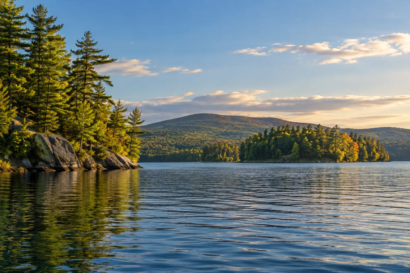
Megunticook Lake gives the Camden area a freshwater landscape of inlets, islands and mountain-framed water. The watershed association places it within a connected system beginning in Searsmont, passing through several ponds and eventually reaching Camden Harbor by the Megunticook River. It identifies public boat launches on Routes 105 and 52 in Camden. Choose an appropriate access point for your intended outing, then consider the shape of the water beyond it. This is a chance to see the lakeshore from a different angle than the familiar forest walks or beach picnic, with the route chosen around the boat rather than a road or footpath.
Local stewardship has a history of its own. The Megunticook Lake Association formed in 1969, and water-clarity monitoring began in 1975. Its later change of name to the Megunticook Watershed Association reflected a recognition that the other ponds, river and surrounding land mattered as much as the main lake. The organization also acquired the lake's two outlet dams in the 1980s and donated them to Camden. Its timeline also dates the courtesy boat-inspection program to 2001, making prevention another part of the continuing stewardship work. Those steps connect the scenic setting with decisions about water management, public care and the wider catchment. A lake view may seem immediate and self-contained, but its condition depends on places and choices beyond the edge of the frame.
Coastal Mountains Land Trust's boat-based guide offers a practical way to look at the protected shore. Its lake preserves include islands as well as woodland, and the guide distinguishes them from the town's Land's End picnic property. Some have no trails, so landing does not automatically produce a walking excursion. More importantly, Echo, Pine and Little Pine Islands close seasonally for nesting loons. Check the current restriction before approaching a landing, and enjoy the view from the water whenever an island is unavailable. Conservation makes these shores interesting to visit while also establishing limits on how they can be used.
A PenobscotPaddles account captures the pleasure of exploring the lake on an autumn afternoon. The paddlers enjoyed islands, inlets and the contrast between the lake and the surrounding hills. They moved along the peninsula and a cottage-lined shore, noting an island protected for nesting. Their day began with frost on the car and later warmed enough for a comfortable paddle. Those details belong to that outing rather than a seasonal guarantee, but they give the account a welcome human scale. One companion eventually needed to return to work: even a memorable lake trip had to fit inside an ordinary day.
For photographs, think in layers rather than collecting a separate picture of every feature. A closer shoreline shape can lead toward a middle-distance island and a more distant slope. If the elements merge into one dark outline, change the framing from your existing permitted position instead of forcing a closer approach. Record the place and the conditions beside the image. That small habit helps keep a pleasing view connected with what actually happened, especially when several bays begin to look similar afterward.
Fun facts
- The original lake association formed in 1969.
- Water-clarity monitoring began in 1975.
Before you go
- Choose the Route 105 or Route 52 public launch to suit your planned water route.
- Check nesting-season restrictions before approaching protected island landings.
Visitor perspectives
- PenobscotPaddles enjoyed an autumn lake outing among islands, inlets and mountain scenery. The day shifted from a frosty start to a warmer afternoon, while work commitments limited the available paddling time.
Capture
- Layer a nearer shore, a middle-distance island and a distant slope when the view allows; a photograph need not require a landing.
 Sennebec Pond
 Coastal Maine Botanical Gardens
 Tunk Lake
Social
Megunticook Lake belongs to a watershed that reaches Camden Harbor.
Public launches on Routes 105 and 52 offer different starting points.
The original lake association formed in 1969.
Its later watershed name recognized the importance of connected ponds, river and land.
The boat-based land-trust guide distinguishes protected islands from trail destinations.
Some islands close seasonally for nesting loons; check current restrictions.
One autumn paddling account found islands, inlets and a day that still had to end in time for work.
What would anchor your lake photograph: an island, the shore or the distant hills? #Cre8Travel
Hashtags