 Cre8Travel
CRE8TRAVEL · MAINE PLACES
Mooselookmeguntic Lake
Mooselookmeguntic: Give the Big Lake Time
Discover
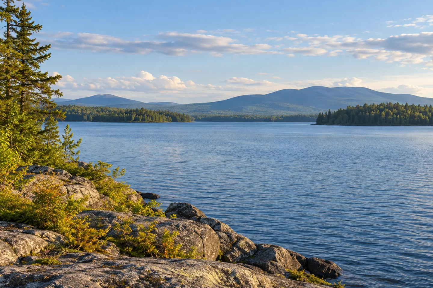
Mooselookmeguntic Lake is a place to think in sections. Its broad water reaches across the Rangeley region in both Franklin and Oxford counties, with enough room for a modest outing to become much more than intended if the map is treated casually. Begin with a particular launch and a realistic piece of shoreline, not an obligation to cross the entire lake. The scale is part of the attraction: distant banks, wooded islands, and open sky can make a short, carefully chosen visit feel expansive.
State boating information identifies established launches at Rangeley and Richardsontown Township. Haines Landing is a familiar approach near Oquossoc, while a separate state facility serves another part of the lake. Choose the access that belongs to your plan, then verify the current route and facilities. A launch is not interchangeable with a campground, and a convenient place to get a boat onto the water does not automatically provide overnight parking, a landing elsewhere, or a return shuttle after a longer trip.
The state biological map adds some perspective below the surface. It records more than sixteen thousand acres of lake and identifies brook trout and landlocked salmon among the principal species. The map is intended for biological and fishing information, rather than navigation. Anglers should pair that habitat background with current regulations and proper navigational preparation. For anyone simply watching the water, those details help explain why the view deserves more than a quick glance: a substantial living system occupies the space beneath it.
An overnight visit has its own arrangements. Stephen Phillips Memorial Preserve manages waterfront tent sites on the mainland, islands, and western shore, describing a rustic experience without electricity or showers. Select and reserve an appropriate site through the operator rather than choosing an apparently empty shore from the boat. Think through what that style of camp requires before deciding it is the right addition to a lake day. The lack of developed facilities can be part of its appeal when expectations match the actual setting.
Ron Chase's 2020 account of traversing the big lakes captures both the scenery and the logistics. He enjoyed the views on Mooselookmeguntic and an overnight at Brandy Point, then continued toward the Richardson Lakes. A mistaken assumption about later camping availability forced an unexpectedly long final day. His report is a useful reminder that an impressive route is assembled from many permissions and decisions. A successful outing on one lake does not guarantee that the next campsite or connection will work as remembered.
Rangeley-area boating guidance emphasizes watching the weather, wearing a flotation device, and sharing your plans. Keep those preparations proportionate to the lake you are actually visiting. For photographs, let a nearby bank or permitted landing anchor the scene, with the distant woods providing scale. You do not need to manufacture a wilderness adventure by attempting a crossing for the camera. A little patience can reveal the lake's changing texture, the shape of an island, and the reasons people return to the same stretch of water rather than trying to finish it.
Fun facts
- Mooselookmeguntic spans parts of Franklin and Oxford counties.
- Its principal fish species include brook trout and landlocked salmon.
- Stephen Phillips Memorial Preserve offers rustic waterfront tent sites on several parts of the lake.
Before you go
- Choose an established launch that matches the lake section you intend to visit.
- Arrange campsite permissions in advance; do not rely on remembered availability from an old trip.
- Wear a flotation device, share your plan, and be ready to adjust to the weather.
Visitor perspectives
- Ron Chase’s August 2020 account enjoys Mooselookmeguntic’s scenery and a stay at Brandy Point. His wider lake traverse also involved a camping-availability mistake later on the Richardson Lakes, making the trip longer than expected.
Capture
- Use a legal landing or nearby bank as foreground to convey the scale of the far shore.
- Photograph from a secure stationary position; do not extend an exposed route simply to improve the angle.
 Aziscohos Lake
 Umbagog Lake
 Hooper Pond Preserve
Social
Mooselookmeguntic rewards a plan built around one manageable section of water.
A big-lake map is a starting point, not a demand to cross the whole thing.
Brook trout and landlocked salmon help explain the lake’s importance beneath the scenery.
Haines Landing and the separate state launch serve different approaches. Match the access to your plan.
Waterfront tent sites require arrangements through the appropriate operator.
Ron Chase enjoyed the lake’s scenery, but his wider trip also showed why campsite assumptions need checking.
Watch the weather, wear a flotation device, and tell someone your plan.
Would you return to a favorite stretch of this lake or explore a different section each time?
Hashtags