 Cre8Travel
CRE8TRAVEL · MAINE PLACES
Aziscohos Lake
Aziscohos Lake: Long Water and a Carefully Planned Camp
Discover
Aziscohos Lake runs through a remote part of western Maine near the New Hampshire border, with wooded shores, islands, and water that can make a canoe feel suddenly small. A visit works best when its scale is taken seriously from the beginning. Choose a realistic section, an established launch, and a clear return or camping arrangement. The attraction is not a race to the far end. It is the chance to spend time in a lake landscape whose long shape keeps changing the relationship between water, hills, and sky.
The lake also holds a history older than its present outline. Northern Forest Canoe Trail explains that Aziscohos was formed by damming the Magalloway River in the early twentieth century. Beneath the reservoir lies the Vail archaeological site, associated with Indigenous encampments dating back roughly thirteen thousand years. Consider that history as context for the water, without treating an archaeological place as a collecting destination. The contemporary lake covers a much older river landscape and human story.
Camping requires deliberate arrangements. Northern Forest Canoe Trail describes privately managed sites that need reservations, while Black Brook Cove distinguishes its main campground, east-shore sites, and boat-access Beaver Island sites. Those choices are different experiences, with different ways of arriving and different facilities. Ask the operator which option suits the equipment and group you actually have. An island campsite does not become available just because it appears empty from the water, and a remote tenting plan should be settled before launching.
For a human view of that experience, the Vermont Paddle Pups account describes several days canoeing here in 2014. The travelers liked the rocky shores, birds, and relatively few other boats, but also encountered wind and a prolonged rainstorm. Their photographs and narrative communicate both pleasure and the work of managing a wet trip. Read the account as a particular holiday, rather than expecting the same wildlife, solitude, or conditions. Its practical balance is more useful than a promise that remote water will always be quiet and easy.
The surrounding landscape is also part of an active conservation story. The Magalloway Conservation Collaborative describes protection of a large connected forest region, including land and islands around the northern lake. Public recreation continues in many areas, but ownerships, gates, camping rules, and vehicle access differ. The collaborative warns of limited cell coverage and demanding road conditions away from the highway. Check the landowner's guidance for the exact approach you intend, carry information that works offline, and avoid assuming that one permission applies to every shore.
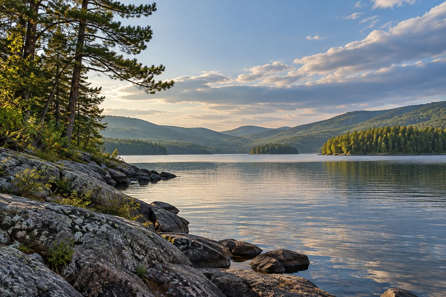
For a first outing, simplicity can be a strength. Arrange the launch with the appropriate operator, keep enough time for changing conditions, and select photographs from secure positions rather than stretching a route for another headland. A line of rocky shore against a distant wooded slope can carry the feeling of the lake without needing a dramatic encounter. Aziscohos offers substantial space and a deep history; the most satisfying plan is one that gives both some attention while leaving the practical parts of the journey comfortably accounted for.
Fun facts
- Aziscohos is a reservoir created by damming the Magalloway River.
- The submerged Vail archaeological site records an Indigenous history much older than the reservoir.
- Black Brook Cove distinguishes road-access camping from boat-access island sites.
Before you go
- Reserve an appropriate campsite before planning an overnight lake trip.
- Confirm the launch and seasonal arrangements with the relevant operator.
- Check road and landowner guidance, and carry offline information where cell coverage is limited.
Visitor perspectives
- The Vermont Paddle Pups account of July 2014 enjoys Aziscohos’s rocky shores, birds, and relatively few boats during a canoe-camping stay. Wind and a long rainstorm also shaped the trip, including time waiting under shelter.
Capture
- From a secure shore or stationary boat, use a rocky edge to lead toward the wooded hills.
- Protect camera equipment for a wet trip; composition is secondary to controlling the boat and choosing a suitable stopping place.
 Panther Pond
 Mooselookmeguntic Lake
 Umbagog Lake
Social
Aziscohos Lake brings a long stretch of western Maine water into a landscape of woods, islands, and hills.
Its present outline was created by damming the Magalloway River.
The Vail archaeological site adds a much older Indigenous history beneath the reservoir.
Remote campsites still need reservations and landowner permission.
Road-access and boat-access camps are different plans. Match the site to your group and equipment.
The Vermont Paddle Pups travelers enjoyed rocky shores and birds while also managing wind and sustained rain.
Limited cell coverage makes offline information useful in the surrounding Magalloway region.
Would an Aziscohos visit be a short paddle for you, or a carefully arranged overnight?
Hashtags