 Cre8Travel
CRE8TRAVEL · MAINE PLACES
Lower Sysladobsis Lake
Lower Sysladobsis: A Long Lake in a Connected System
Discover
Lower Sysladobsis, often called Dobsis Lake, has a public launch at its northern end identified in the Indian Township Tribal Government's 2021 water assessment. Confirm the intended lake and access before planning an outing.
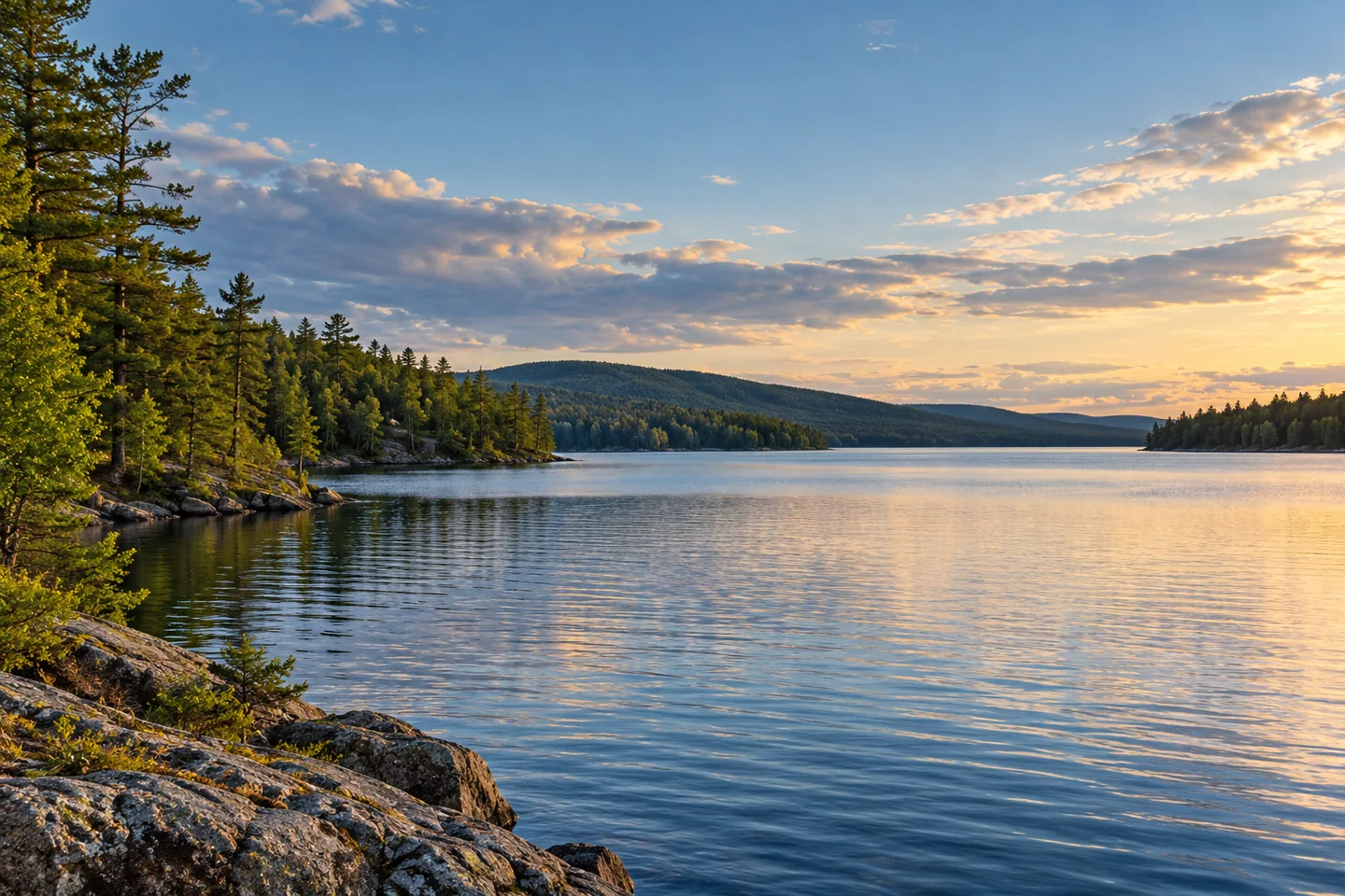
This is the long, narrow Sysladobsis spanning parts of Hancock, Washington and Penobscot counties, rather than the separate Upper Sysladobsis. The state's fisheries report, revised in 1996, describes a generally rocky shore interrupted by sand beaches, with marshier coves toward the upper end. Several points and shoals shape the underwater landscape. The report describes a dam raising the lake level by approximately six feet. Its account of summer habitat is particularly interesting: strong temperature layering could develop in some years and not others, while both warmwater and coldwater fish inhabited the lake. Salmon, whitefish, smallmouth bass, white perch and pickerel formed different parts of the recorded fishery. The report also identified tributaries with smelt spawning runs. Those historical findings add a network of habitat relationships to the visible sequence of wooded points and open reaches.
A 1997 International Joint Commission working-group report describes the outlet dam as part of the managed St. Croix basin. Its account records an earth embankment with a concrete core, a timber gate structure and a fishway. The dam operated in conjunction with West Grand's to control water reaching the western branch of the river. These are dated engineering descriptions, rather than a current inspection or assurance about operating conditions. Their value to a visitor is interpretive: an apparently remote lake also belonged to a wider system of stored water, downstream industrial uses, fisheries and recreation. Keep clear of operating structures rather than trying to inspect those details from a boat.
The shore's future prompted another kind of collective action. Trust for Public Land's account of the 2021 Lakeville forest expansion describes northern lakeshore land that could have become dozens of house lots. Residents and conservation partners instead worked toward protecting a tract linked by the lake to existing conserved forest farther south. The story recalls conversations around a picnic table with lodge owner Steve Norris and other residents before the organizations assembled the acquisition. The acquired forest had undergone heavy harvesting, and the partners described allowing recovery before future sustainable management. Such long-term care connects the view across the water with decisions made well inland. The enduring story is the decision to retain a connected lake landscape rather than considering individual shore parcels in isolation.
Aislinn Sarnacki offers a smaller, more immediate observation in an original 2024 column. While camping at Sysladobsis, she watched five loons diving and preening together; her accompanying photograph places that gathering in late July. The scene is her own encounter, not a promise that a visitor will find the same birds or behavior. Her account explicitly encourages respectful distance. It gives a useful alternative to making wildlife photography an approach exercise: watch the activity already occurring within view and let the birds determine whether they remain visible. A broad frame of the lake can still tell the story when wildlife is distant or absent.
Fun facts
- The lake spans parts of three Maine counties.
- A historical basin study describes its dam working with West Grand’s.
Before you go
- Confirm the northern public entry and intended lake before departure.
- Keep clear of dam structures and leave wildlife ample space.
Visitor perspectives
- Sarnacki recalled watching five loons dive and preen together while camping at Sysladobsis, with her photograph identifying a late-July gathering.
Capture
- Use a wider water-and-shore composition when wildlife is distant; do not approach birds to fill the frame.
 West Grand Lake
 Naramissic Farm Bridgton Historical Society
 John Ford Statue
Social
Lower Sysladobsis is distinct from Upper Sysladobsis.
The long lake crosses three county boundaries.
Historical fisheries work records rocky points, shoals and sand beaches.
Smelt spawning streams connect fish habitat with the watershed.
A 1997 basin study describes coordinated water storage.
Northern lakeshore conservation grew from community concern about development.
A writer’s 2024 camp observation captured a gathering of five loons.
A distant bird can remain part of a wider lake photograph. #Cre8Travel
Hashtags