 Cre8Travel
CRE8TRAVEL · MAINE PLACES
Jo-Mary Lakes
Jo-Mary Lakes: One Name, Different Waters
Discover
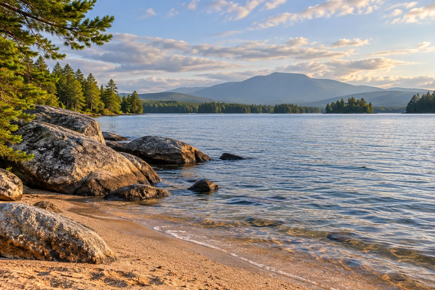
The Jo-Mary lakes share a name, but a good visit begins by noticing their differences. Upper, Middle and Lower Jo-Mary belong to the wooded lake country south of Katahdin, with Turkeytail closely connected to Middle. Taken together, they offer sandy shore, broad water and a useful lesson in how neighboring lakes can behave very differently. Choose a particular lake and a verified approach first. Their names on one map do not establish an effortless through-route between them.
Upper Jo-Mary has a practical visitor base at Jo-Mary Lake Campground, whose current information identifies a boat launch, water access and a long sandy beach. Its reservation information also provides for day use. This makes a lake-focused visit possible without treating a remote canoe expedition as the default. Confirm the appropriate arrangement with the operator before arrival. The campground describes primitive campsites without individual water or electrical connections, while also listing shared facilities; primitive here does not mean every visitor must supply an expedition camp.
An older state survey gives Upper Jo-Mary a distinctive shoreline character: a mixture of sand and rock, wooded surroundings and islands. Its 2002 revision also describes a large balanced rock near the northeastern outlet. That is an interesting feature to recognize on a reliable map, rather than a reason to attempt an unplanned crossing or scramble onto rocks. A close view from an authorized shore can convey the lake's textures without requiring every named feature to become a destination.
Middle Jo-Mary and Turkeytail have a different fisheries history. The state's 1959 survey treats them together because narrow thoroughfares connect waters at the same level. It characterizes them as shallow, relatively warm lakes, contrasting them with the deeper coldwater environment of Upper Jo-Mary. Those historical observations help explain why a shared name does not imply an identical habitat. They do not establish current fishing rules or conditions, which require their own contemporary check.
Lower Jo-Mary adds another setting. Its historical state survey describes sandy beaches alternating with rocky and gravelly shore, with views toward Katahdin. The same document explains its water connections with neighboring lakes, including an old driving-dam passage. That network is part of the lake's story, but a connection shown in a survey is not a guarantee that a loaded canoe can pass easily at today's water level. Keep the chosen outing independent of an unverified transfer.
A detailed October 2020 Canoetripping.net report by Brasenia illustrates that distinction. Low water defeated the writer's intended brook connection between Middle and Lower Jo-Mary, requiring a different approach. Wind later complicated the return. The account also records rewarding shore exploration, so the lesson is not to reduce the place to a hazard checklist. It is to give a beautiful lake enough time and flexibility, without copying another paddler's exceptional decisions as a standard route.
For a first visit, select the shoreline experience that fits the group's actual interests: a managed beach-and-water base at Upper Jo-Mary, or a separately researched canoe plan elsewhere in the group. Photograph sand, water and the wooded horizon from a secure position, letting actual weather determine whether a mountain appears. The Jo-Mary lakes reward an informed choice rather than a hurried attempt to join every blue shape into one continuous adventure.
Fun facts
- Middle Jo-Mary and Turkeytail are connected by narrow thoroughfares.
- A historical Upper Jo-Mary survey notes a balanced rock near its northeastern outlet.
- Upper Jo-Mary’s campground identifies day use and a boat launch.
Before you go
- Choose Upper, Middle or Lower Jo-Mary before planning the approach.
- Confirm day use or camping directly with the Upper Jo-Mary operator.
- Do not assume connecting brooks allow a continuous paddle at every water level.
- Use current maps and a route suited to the group, with time for changes.
Visitor perspectives
- Brasenia’s October 2020 solo report describes a failed low-water brook connection between Middle and Lower Jo-Mary, followed by rewarding shore exploration and a windier return.
Capture
- Use the meeting of sand, rocks and water for a shoreline composition.
- Treat a mountain view as weather-dependent and photograph from a secure permitted position.
 Lobster Lake
 Coastal Maine Botanical Gardens
 Flagstaff Lake
Social
The Jo-Mary name belongs to neighboring lakes with different physical characters.
Choose a lake and an actual approach before drawing a route between them.
Upper Jo-Mary offers a managed base with a sandy beach and boat launch.
A 2002 survey revision notes a balanced rock near Upper Jo-Mary’s outlet.
Middle Jo-Mary and Turkeytail share narrow water connections and a historical fisheries unit.
A mapped brook is not a promise of easy passage at every water level.
Sand, rocks, forest and water can fill a photograph even when a distant mountain stays in cloud.
Would you choose a managed shoreline day or a separately planned canoe trip?
Hashtags