 Cre8Travel
CRE8TRAVEL · MAINE PLACES
First Davis Pond
First and Second Davis Ponds: Connected Water near Guilford
Discover
First and Second Davis ponds make a connected water destination in the Guilford and Willimantic area. The state fisheries survey treats the two basins as one managed body of water, joined by a narrow thoroughfare. First Davis is the deeper basin, with a recorded maximum depth of 54 feet, compared with 33 feet in Second Davis. Those contrasting proportions offer a useful starting point for understanding a place whose two names belong to one connected system.
The survey identifies a small public access on First Davis near Route 150 and a separate carry-in approach to Second Davis.
For a present-day visit, establish which entry you intend to use and check the current arrangements before traveling. A compact access can demand more planning than a large lakefront facility. Keep your proposed outing within the part of the water you can comfortably explore and return from.
Stan’s original August 2025 visit provides a recent description of the First Davis approach. He reached a concrete launch off Davis Pond Road but emphasized the very limited parking and turning space between neighboring private properties. His canoe made the arrival simpler than it would have been with a trailer. Treat the neighboring land respectfully, keep the launch usable and choose an arrival plan that works within the available public space.
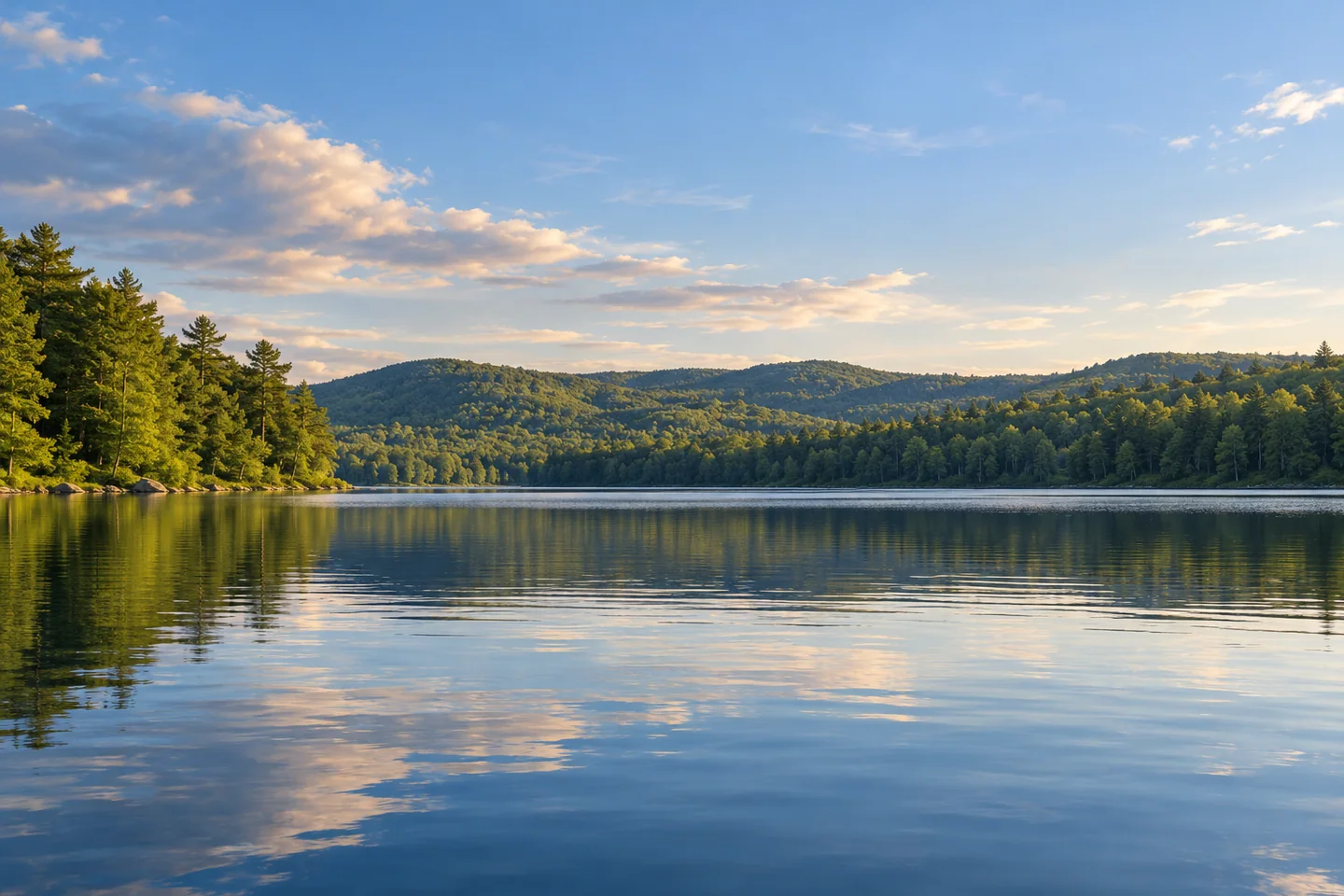
Once afloat, he enjoyed a calm early morning with wooded hills along the eastern horizon. Fishing began with perch and a bass, followed later by the brook trout he had hoped to catch. After several hours of paddling he was ready to return and stretch his legs. His experience combines an attractive view with the ordinary physical demands of an outing, without suggesting that the same fishing results or weather await the next visitor.
The older fisheries account explains why habitat deserves attention here. Although both basins contain cold water, the deepest areas can lack sufficient dissolved oxygen. The report describes a history of introduced smelt and salmon stocking, followed by the addition of splake in 1992. These historical management choices reflect the difficulty of supporting coldwater fish in a mixed fish community, rather than a simple equation between greater depth and better habitat.
The pond also belongs to Guilford’s settlement story. A historical narrative by Stub Schultz and Carrie Fellows, presented with Guilford Historical Society material, identifies the Davis Pond outlet as one of three local waterpower settings. Settlements grew around that outlet, Salmon Stream and the Piscataquis River. North Guilford and Guilford Center remained more agricultural as the village became the community’s business center.
That local account describes an economy shaped first by waterways and later by electricity and the railroad. Reading it before a visit changes the significance of the outlet: the water helped determine where people established work and homes. The present pond can therefore be appreciated as both habitat and part of a settled landscape. Its connections extend beyond the narrow passage into Second Davis, reaching into the history of the surrounding community.
Give the visit a clear, modest purpose, whether that is observing the hills from a canoe or understanding the connected basins. A return with enough time to land and load without crowding others is a satisfying conclusion. The small scale of the approach makes consideration for the next visitor particularly valuable.
Fun facts
- The two basins are connected by a narrow thoroughfare.
Before you go
- Plan around the limited public launch and turning space.
Visitor perspectives
- Stan describes a compact public launch, calm morning views and a canoe fishing trip that eventually yielded a brook trout.
Capture
- Frame the wooded eastern hills from a settled position on the water.
 Spencer Pond
 Branns Mill Pond
 Shirley Pond
Social
First and Second Davis are managed together.
An outlet helped shape the settlement of North Guilford.
Stan’s 2025 canoe outing began at a compact launch.
Cold water and adequate oxygen are separate habitat needs.
The historical survey dates splake stocking to 1992.
Leave landing space for the next visitor.
Choose an outing with an unhurried return.
A place can hold both ecological and community history.
Hashtags