 Cre8Travel
CRE8TRAVEL · MAINE PLACES
Alamoosook Lake
Alamoosook Lake: Islands, Shallow Water and a Changing Wind
Discover
Alamoosook Lake in Orland offers a freshwater outing with a very different character from the nearby saltwater coast. The U.S. Fish and Wildlife Service identifies public boat access and picnic areas at Craig Brook National Fish Hatchery. It also gives a specific warning: wind can increase sharply across the lake on summer afternoons, creating whitecaps and making the return difficult for canoes and kayaks. Let that warning shape the scale of the trip. A suitable launch does not make every crossing suitable, and a pleasant-looking departure should leave room for conditions to change before you return.
The lake's underwater shape helps explain its ecology. A state fisheries survey, revised in 1979, describes a broad, relatively shallow waterbody, with only a small proportion deeper than 22 feet. Its recorded maximum depth was 28 feet. The biologists emphasized warmwater habitat and identified smallmouth bass and white perch as the principal fishery. This is historical scientific context, rather than a current catch forecast. It gives the visible water a useful third dimension: the open surface is spread across a shallow basin, not the deep, cold profile of some other Maine lakes. The same report links the lake with sea-run alewives traveling upstream to spawning habitat.
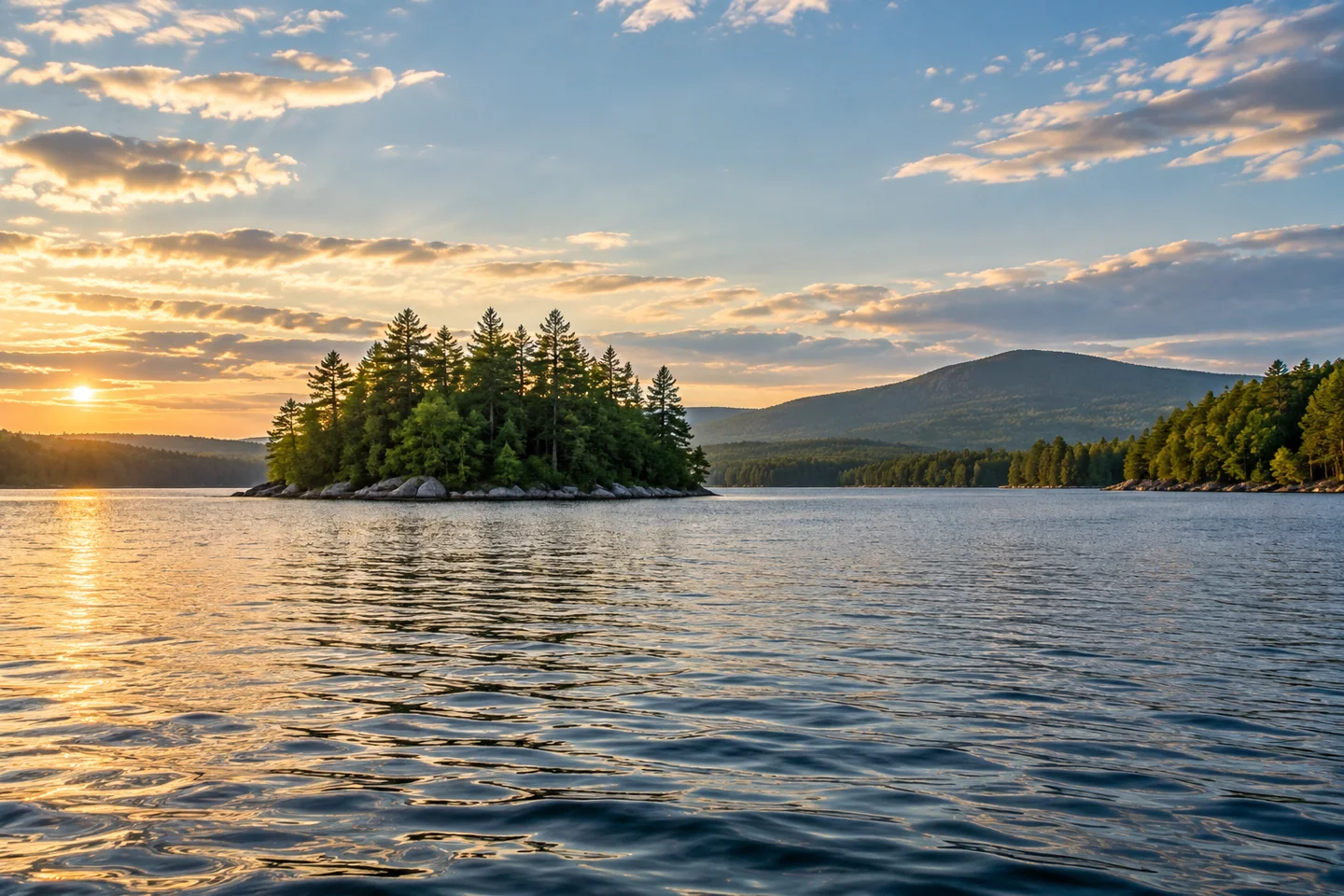
On the water, a PenobscotPaddles account offers a closer sense of the shore. During an afternoon visit, the paddlers explored among the northern islands, noticed granite boulders and looked toward Great Pond Mountain. They continued into Dead River but found water too low for another intended side exploration. On the return, wind had brought some chop. Their narrative combines scenic enthusiasm with the practical limits of a particular day. Use those observations as a reason to look carefully and keep options flexible; they do not establish present water levels, island landing rights or a route to copy without checking.
The Alamoosook Lake Association provides another perspective on what keeps this landscape usable. Its work combines community life with conservation, including reducing polluted runoff, monitoring invasive plants and checking water quality. The association describes measurements of phosphorus, clarity and dissolved oxygen. Those are different ways of asking how the lake is functioning, beyond whether the surface looks attractive from a boat. Its plant-identification and inspection efforts also show why careful boat handling has consequences beyond one outing. Cooperate with the current inspection arrangements and seek guidance before moving equipment between waters. Enjoying the lake and caring about its condition belong in the same plan.
The water also belongs to a connected system. The engineering manual for Alamoosook Dam describes the Narramissic River flowing from the lake toward Orland Village Dam, with downstream water levels influenced by that second structure. This is not a simple, unobstructed corridor to the sea. The useful visitor lesson is to distinguish a lake outing from a through-river journey, and to research either on its own terms. For photographs, the northern island shapes described by the paddlers offer an interesting contrast with the broader open water. Keep that visual curiosity within a route that leaves you a comfortable return.
Fun facts
- A historical state survey recorded a maximum depth of 28 feet.
- The lake association monitors clarity, phosphorus and dissolved oxygen.
Before you go
- Plan around the Fish and Wildlife Service’s warning about stronger afternoon wind.
- Cooperate with current boat-inspection arrangements and check equipment before changing waters.
Visitor perspectives
- PenobscotPaddles enjoyed exploring northern islands and granite shores. Low water limited a side exploration, and the return brought wind and chop. This is one historical afternoon trip.
Capture
- From an appropriate position, use an island silhouette to divide a broad lake composition; make the route decision before the photograph.
 Beauchamp Point and Rockport Shore Preserves
 Branch Lake
 Damariscotta Lake
Social
Alamoosook Lake offers freshwater boating access in Orland.
A historical state survey describes a largely shallow basin.
Warmwater habitat gives this lake an ecological character of its own.
PenobscotPaddles noticed granite shorelines and northern islands during an afternoon outing.
Their return also brought wind and chop: a useful reminder to keep the plan flexible.
Local monitoring measures more than how pretty the surface looks.
The Narramissic links the lake with a downstream dam system.
Would you begin by studying the islands or learning what lies beneath the surface? #Cre8Travel
Hashtags