 Cre8Travel
CRE8TRAVEL · NEW YORK PLACES
Tioughnioga Wildlife Management Area
Tioughnioga Wildlife Management Area: A Closer Look
Discover
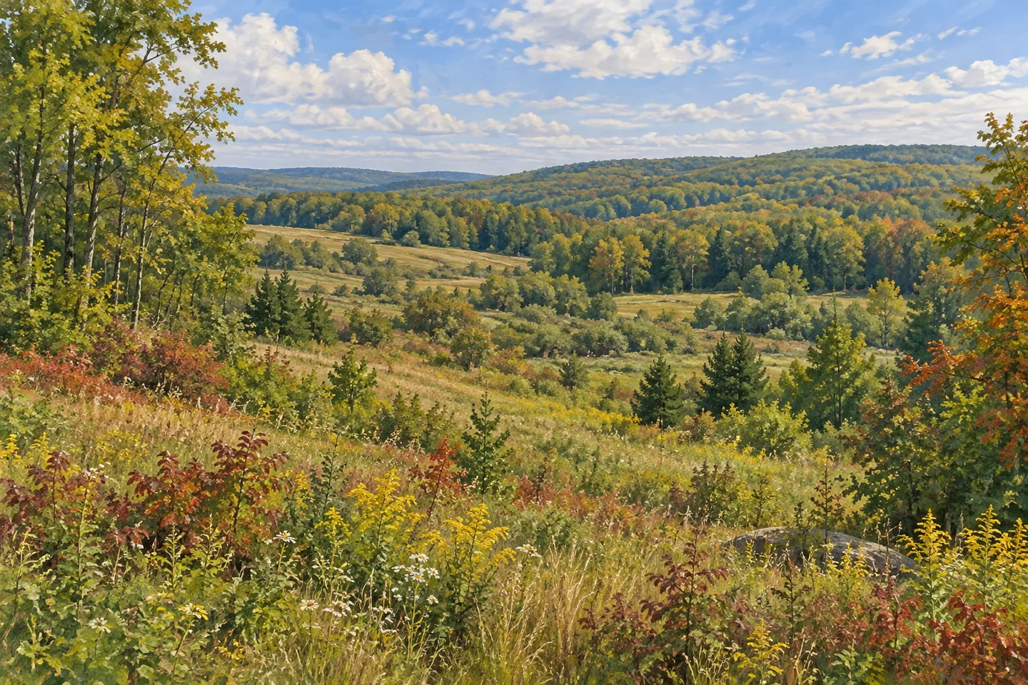
Tioughnioga Wildlife Management Area occupies a divide with a much larger geography behind it. On one side, drainage belongs to the St. Lawrence River system; on the other, to the Susquehanna. Across its 3,744 acres in southwestern Madison County, hills and valleys rise between about 1,500 and 2,100 feet. That rolling setting gives a visit a starting point beyond a list of possible wildlife: the land itself stands between two river systems.
The area lies between New Woodstock and Erieville, about six miles southeast of Cazenovia, across Nelson, Georgetown and Cazenovia. It belongs to the Appalachian Highlands physiographic region. Those location details help place the WMA without turning its broad acreage into an itinerary. Choose an approach from the property map and current access information, letting the landscape you can actually reach shape the outing rather than assuming a long connected trail circuit.
Before 1935, the land was used for dairy farming. Poor soils, harsh weather and difficult economic conditions led to much of it being purchased by the United States Department of Agriculture, with transfer to New York following later. That history matters because today's wildlife landscape did not begin as one untouched expanse. Former agricultural use and later management both belong to the story of what visitors see now.
The New York State Department of Environmental Conservation (DEC) manages Tioughnioga for wildlife, habitat and wildlife-dependent recreation. Maintaining a variety of cover is a principal concern, with mowing and sales of wood products among the management methods. Those practical interventions can be considered alongside the larger land-use history. Habitat management is work directed toward goals, not a reason to claim that every species flourishes or every scene stays unchanged.
DEC identifies white-tailed deer and songbirds among resident wildlife. Use its bird and vertebrate checklists as references for actual observations, without turning them into a list of encounters promised during a walk. Even a quiet outing can focus on the changes between different kinds of cover and the shape of the rolling ground. A landscape can reveal something about habitat before an animal enters the frame.
The WMA has separate habitat and public-access planning documents. The habitat plan identifies target species and goals, while the access plan considers recreation and visitor features. That distinction is useful when reading about potential improvements: proposals are not necessarily facilities already available on arrival. Access approaches are associated with Damon Road and Dugway Road from the Route 80 and Route 13 side. Match the chosen location to the current map before setting out.
Follow posted conditions and Leave No Trace guidance, and include DEC's tick precautions in preparations. For photographs, look for a composition that relates ground shape to the cover actually visible from an appropriate position. No summit panorama, invented marsh boardwalk or close animal approach is needed. Tioughnioga's combination of drainage divide, former dairy land and active habitat work gives this part of Madison County a particular story, one that can guide observation at the scale of the route you choose.
Fun facts
- Tioughnioga WMA covers 3,744 acres in southwestern Madison County.
- It lies on the divide between St. Lawrence and Susquehanna drainage systems.
- Elevations range from about 1,500 to 2,100 feet in the Appalachian Highlands.
- The land was used for dairy farming before 1935 and was later transferred to New York after federal acquisition.
- Habitat management includes maintaining diverse cover through mowing and sales of wood products.
Before you go
- Plan from the current WMA map rather than assuming a long connected trail.
- Match Damon Road or Dugway Road access to the chosen approach.
- Use DEC bird and vertebrate checklists without expecting guaranteed sightings.
- Treat management proposals as proposals rather than existing visitor facilities.
- Follow posted rules, Leave No Trace guidance and DEC tick precautions.
Capture
- Relate the rolling ground to the different cover visible from your appropriate route.
- A habitat-focused composition can stand on its own without an animal present.
- Avoid assuming a summit panorama; work with actual foreground and background available at your position.
 Muller Hill State Forest
 Boehme Legacy Forest
 California Road State Forest
Social
Tioughnioga WMA covers 3,744 acres between New Woodstock and Erieville in Madison County. #Cre8Travel
Tioughnioga lies on a divide separating St. Lawrence River drainage from Susquehanna River drainage. #Cre8Travel
The WMA's rolling Appalachian Highlands terrain ranges from about 1,500 to 2,100 feet. #Cre8Travel
Dairy farming preceded Tioughnioga's public-land chapter. Its habitat story includes earlier agricultural use. #Cre8Travel
Mowing and wood-product sales are among Tioughnioga's methods for maintaining diverse wildlife cover. #Cre8Travel
DEC records deer and songbirds at Tioughnioga; habitat interest does not depend on a guaranteed sighting. #Cre8Travel
Separate habitat and access plans describe different aspects of Tioughnioga WMA management. #Cre8Travel
At Tioughnioga, how would knowing about the drainage divide change the way you look at the hills? #Cre8Travel
Hashtags