 Cre8Travel
CRE8TRAVEL · NEW YORK PLACES
Taconic Ridge State Forest
Taconic Ridge State Forest: Woodland Connections Across a Border Landscape
Discover
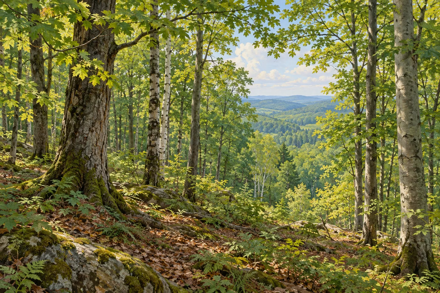
Taconic Ridge State Forest occupies a wooded border landscape in eastern Rensselaer County, where trails connect public land with carefully defined routes across neighboring properties. The Taconic Crest Trail is a central feature, drawing a line through terrain near New York, Massachusetts and Vermont. A visit can focus on a selected woodland section rather than the full ridge. The forest's history of land protection adds another way to understand the ground beneath the walk.
The state forest developed through reforestation areas established in the 1990s, with adjoining easements helping connect recreational routes. That arrangement gives the landscape a distinctive pattern. Public forest, private holdings and designated access lines work together to support a longer walking corridor. On a local outing, the map helps explain both where the route goes and how the surrounding pieces of land relate to one another.
Different road approaches serve different sections. Route 346 provides a northern starting area, while Prosser Hollow Road gives another approach east of Route 22. At Petersburg Pass, Route 2 provides access toward both the north and south. Greene Hollow Road supplies an additional starting area farther along the ridge. Choose one approach and a defined return plan, considering the actual terrain and distance instead of treating these separate starting points as parts of a single short walk.
The northern hardwood setting offers a close observation theme. DEC's autumn hiking guide describes sugar maple, birch, red maple and beech along the Taconic Crest route. Their different leaf shapes and branching forms make the woodland interesting beyond the main seasonal display. Look at how trees frame the route, how openings reveal a longer view, and how the ground rises and falls as the walk follows the ridge landscape.
Conservation continued well after the original reforestation areas were established. In December 2022, DEC announced the protection of 1,300 acres of forest and grassland in the town of Berlin. The addition was intended for Taconic Ridge State Forest, connecting it with Berlin State Forest and linking more than 12,000 acres of state forests in the combined network. The significance lies in the connection: protecting a parcel can strengthen the relationship between larger areas of woodland.
The acquired land includes forested steep slopes, a tributary of the Little Hoosic River and 80 acres of grassland habitat. Those details show that the conservation story reaches beyond a walking corridor. Woodland and open habitat, water and slope all contribute to the landscape's value. DEC describes management for several purposes, including watershed protection, wildlife habitat, sustainable timber production and recreation. The ridge can therefore be read as both an outdoor destination and a working conservation landscape.
Before travelling, use the current official maps and access notices to select the intended section. Public rights on adjacent conservation easements are limited to designated marked trails, making route discipline part of a well-planned outing. The broader conservation network includes separate forests and properties with their own boundaries. Give one chosen woodland walk time, noticing the trees and changes in ground along the way. Taconic Ridge rewards that focused approach, with a trail connection and a history of protecting connected land adding depth to the same visit.
Fun facts
- The Taconic Crest Trail is a central route through Taconic Ridge State Forest.
- The forest includes reforestation areas established in the 1990s.
- DEC announced a 1,300-acre forest-and-grassland addition in December 2022.
- That acquisition included a Little Hoosic River tributary and 80 acres of grassland.
Before you go
- Choose one road approach and a defined route with the current official maps.
- Follow designated marked trails where public access crosses conservation easements.
- Check current notices and match the actual terrain and distance to the outing.
Capture
- Use woodland layers and changes in ground to give a composition depth from the selected route.
- Look closely at the different forms of maple, birch and beech where identifiable.
- Compare a close woodland frame with a wider view of the rising ground, keeping both compositions on the selected route.
 Ridge Conservation Area (Pine Barrens)
 Crocheron Park
 Wilcox Lake Wild Forest
Social
Taconic Ridge State Forest combines woodland trails with a history of connected-land conservation. #Cre8Travel
The Taconic Crest Trail supplies a central walking corridor.
Several road approaches serve different sections of the forest.
Northern hardwoods add interest through tree form and seasonal color.
A 2022 acquisition protected 1,300 acres of forest and grassland.
The parcel linked Taconic Ridge and Berlin state forests.
Choose one mapped outing and follow designated easement routes.
Would the woodland details or the conservation connections guide your visit?
Hashtags